Busy start to the day already with severe storms and a wake low
Unfortunately, more storms are possible later this evening.
Threats
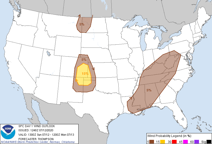
SPC has the entire area under a 5% chance of seeing severe winds within 25 miles of a point.

Busy start to the day already with severe storms and a wake low
Unfortunately, more storms are possible later this evening.
SPC has the entire area under a 5% chance of seeing severe winds within 25 miles of a point.
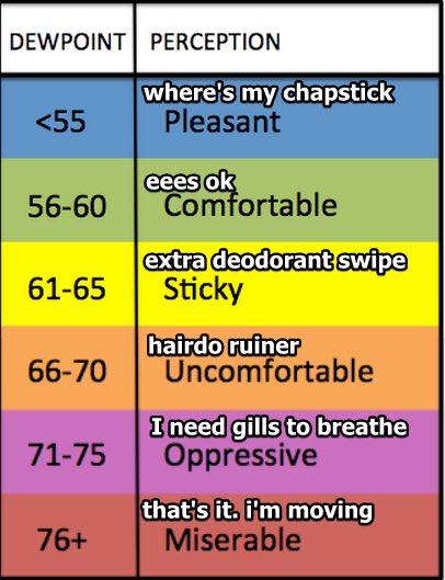
Warm Saturday with lower dew points: mid to upper 60s instead of 70s
SPC has our area in a 5% risk for seeing severe gusts within 25 miles of your location.
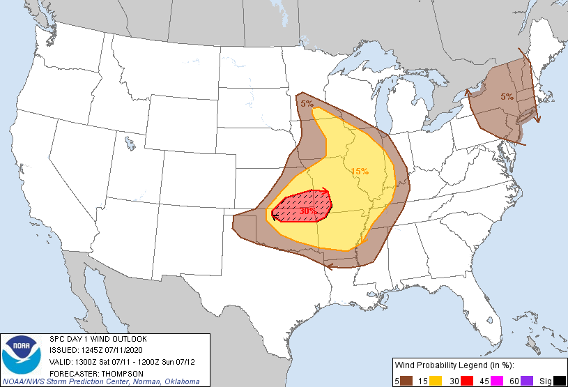
Note: the above outlook is valid until 7AM Sunday.
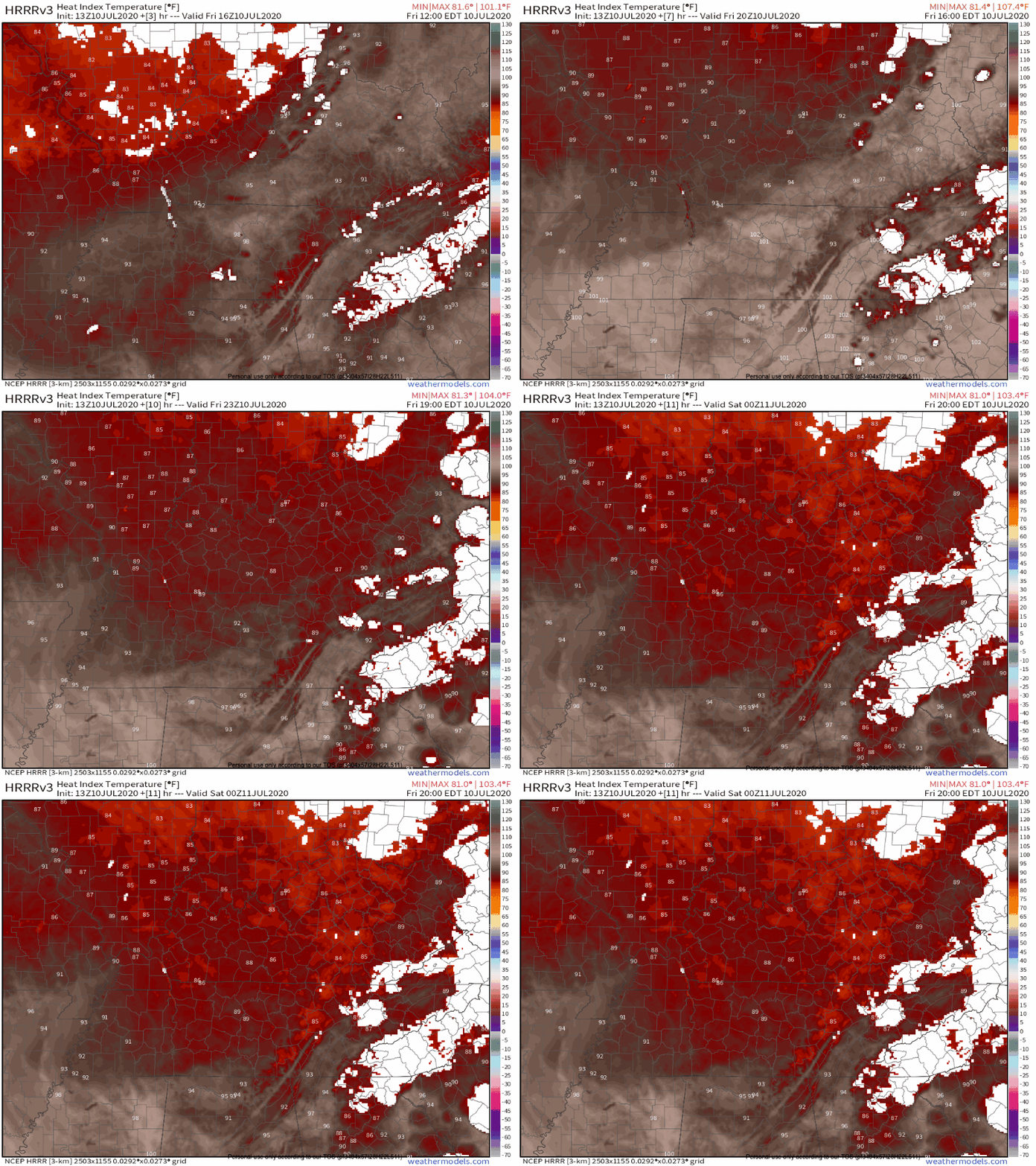
Lower Rain Chances. Tradeoff: Hotter Temperatures.
The heat index was over 100º today.
The winds were around 10-15mph. Earlier this evening it was just enough wind to make it feel a couple degrees cooler. Temporarily at least.
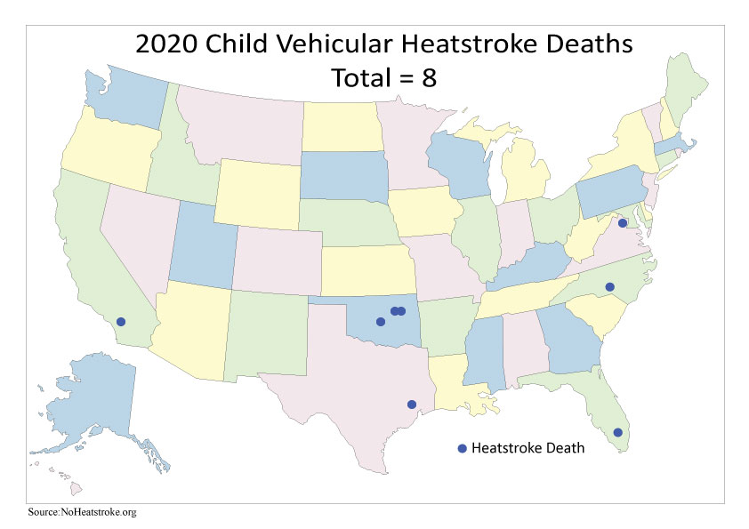
The youngest victim was 10 months old.
There have been over 800 deaths from vehicular heatstroke since 1998, and over half of those (54%) have been from kids under the age of 2.
It gets really hot really fast in your car, even if you leave the windows cracked. Before you get out, make sure to double check your backseat!
Low 90s with low 70s dewpoints won’t change anytime soon. Heat index will run into the upper 90s each day.
This morning we are looking at sunny skies with a few clouds. But as we develop into the afternoon, a few small rain showers, and thunderstorms are possible.
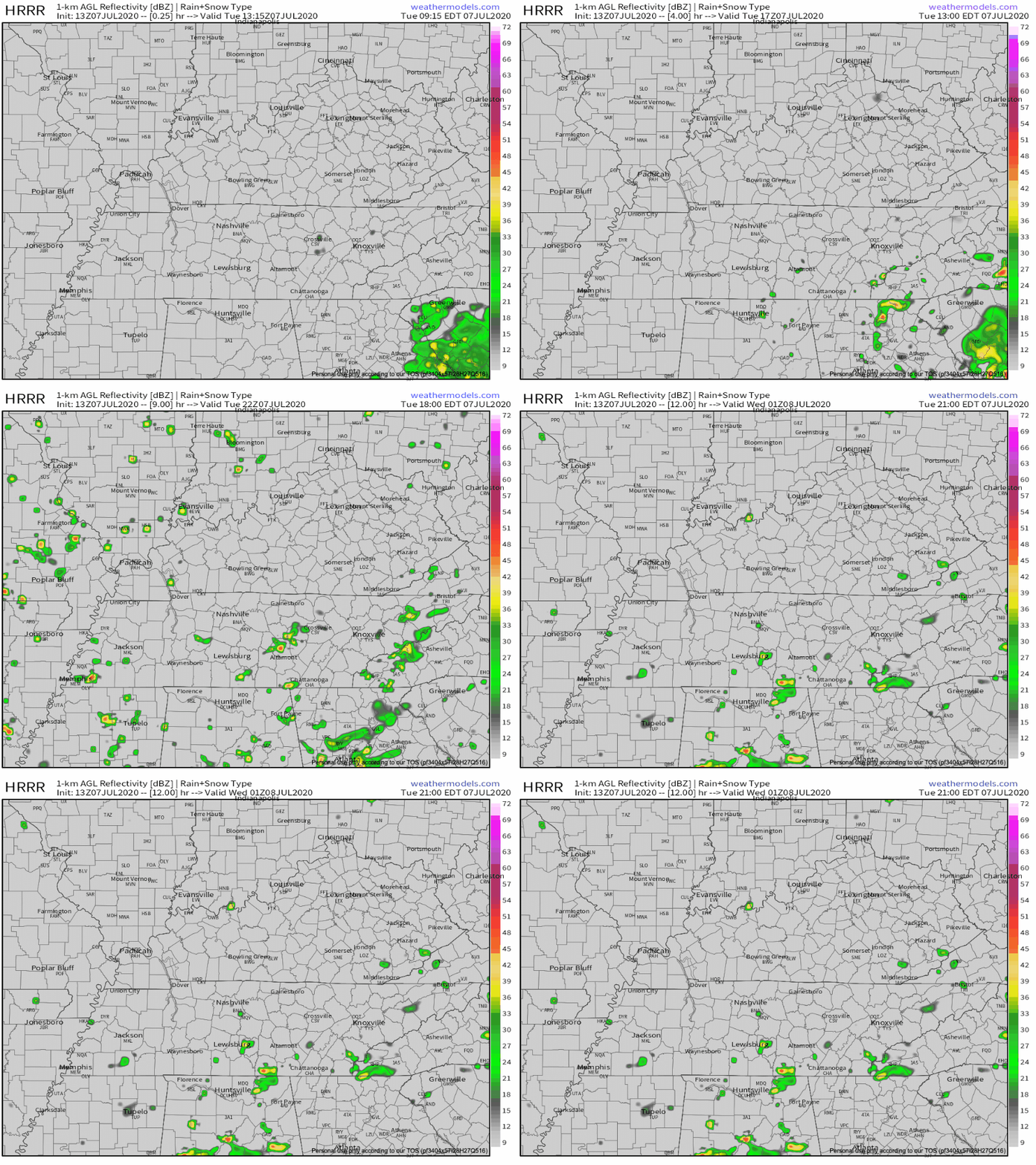
Yet another warm and humid day for us with a chance of scattered showers and thunderstorms developing in the early afternoon.
While severe weather is unlikely, any storm may throw a tantrum and necessitate a brief warning. But, the most likely scenario is that storms will produce some gusty winds, lightning and heavy rainfall…general summer-time thunderstorms.
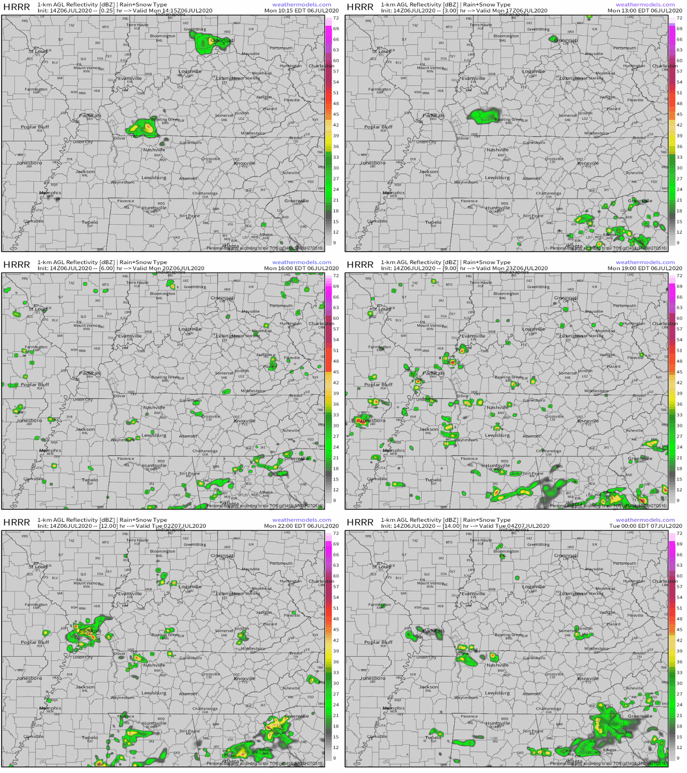
Looking to be another hot and muggy day. Dew points will reach as high as 72°, which will help the heat index climb up to 96°.
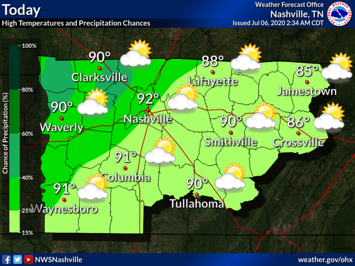
Those high dew point values don’t only help the heat index: they also help to fuel those scattered showers and storms we’ve been seeing.
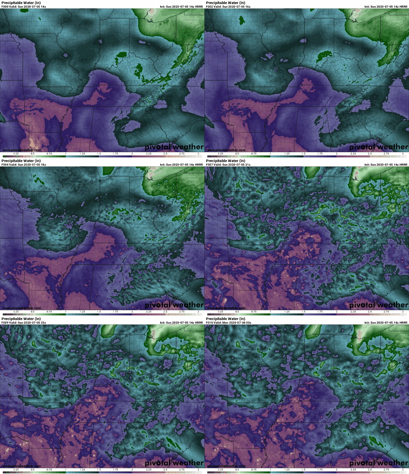
Storms are Likely Today, Maybe in Your Backyard
Storms should start forming once we hit 91°, which we’ll do shortly after lunch.
Storm Timing
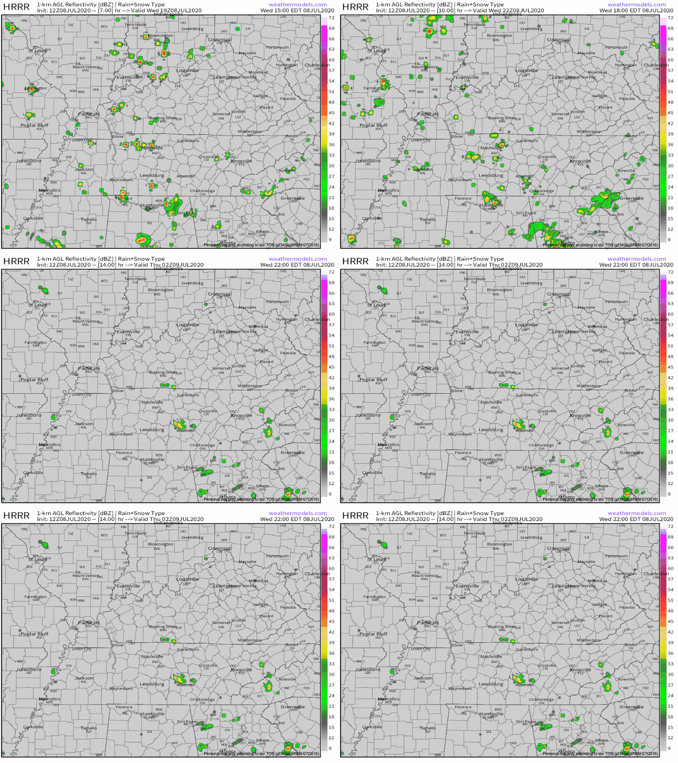
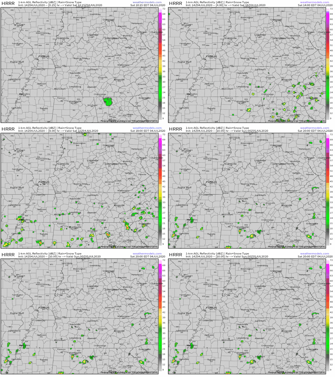
The HRRR model predicts rain and storms bubbling up in Middle Tennessee starting around 2 PM. This should continue through the afternoon into the early evening. Storms should start to fizzle out around sunset and completely clear the area by midnight tonight. Here is where the HRRR predicts the storms’ general whereabouts this afternoon:

On behalf of us here at NashSevereWX, we want to wish you a safe and happy Holiday Weekend!
A gorgeous 4th of July is in store for us today, with temperatures in the mid 90s and NO RAIN!
Humid, humid, and more humid weather for Independence Day.
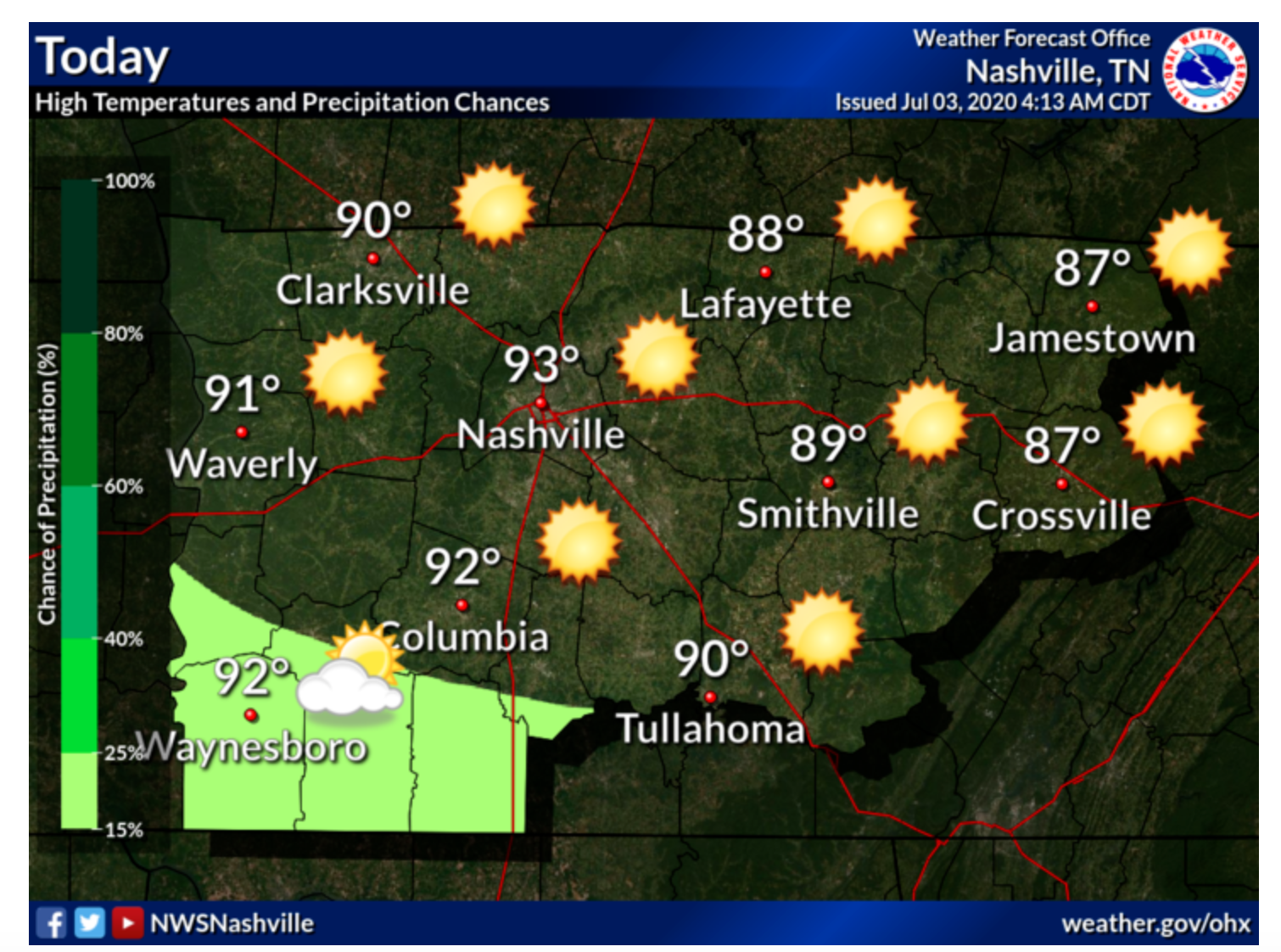
Independence Day Eve (Today)
Right now we are looking at mostly sunny skies which will continue throughout the rest of the day with temperatures continuing to rise into the low 90s.
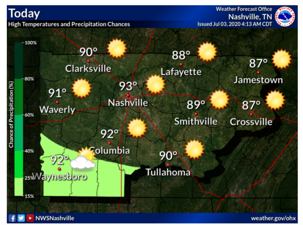
A thunderstorm is possible in south western Middle Tennessee as the graphic shows, but the Nashville area is in the clear.
You must be logged in to post a comment.