
Oh, no, Sir. Festivus is all too real.
George Costanza
Wind
37 MPH was the top reported hourly BNA wind gust as of 6 PM. Gusts 40-45 MPH are possible until midnight. A Wind Advisory remains in effect until then. Winds will blow from the south.

Oh, no, Sir. Festivus is all too real.
George Costanza
37 MPH was the top reported hourly BNA wind gust as of 6 PM. Gusts 40-45 MPH are possible until midnight. A Wind Advisory remains in effect until then. Winds will blow from the south.
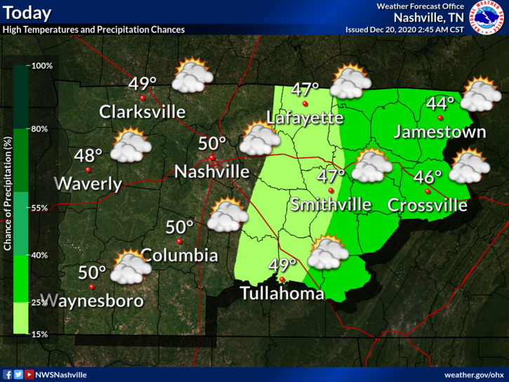
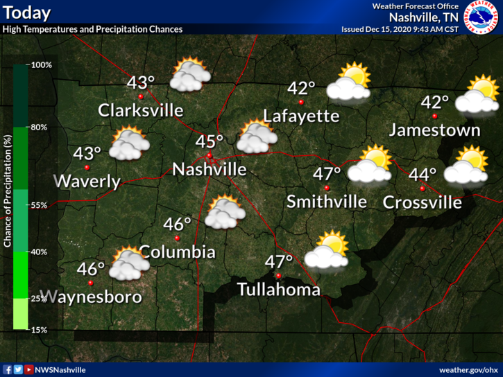
Some rain and gusty winds are in store for us today into tonight as a cold front moves eastward across Tennessee.
Any outdoor holiday decorations that aren’t secured down could end up in the neighbor’s yard with wind gusts to 35 mph.

Nothing much to talk about today: clear skies, plenty of sunshine, and high temps near 55°.
Clouds will begin to move in overnight.
Wake up to around 38°. Afternoon highs in the lower 60°s .
Through the afternoon, a shower or two could roll into your neighborhood ahead of the main line. Golfers should expect wind gusts to 28 MPH. Protect feeble inflatable Santas.
The first official day of winter began this morning at 4:02 AM, meaning today marks the least amount of daylight of the year (and the longest amount of darkness of the year.)

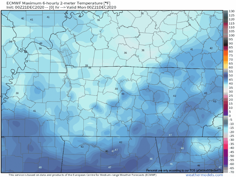
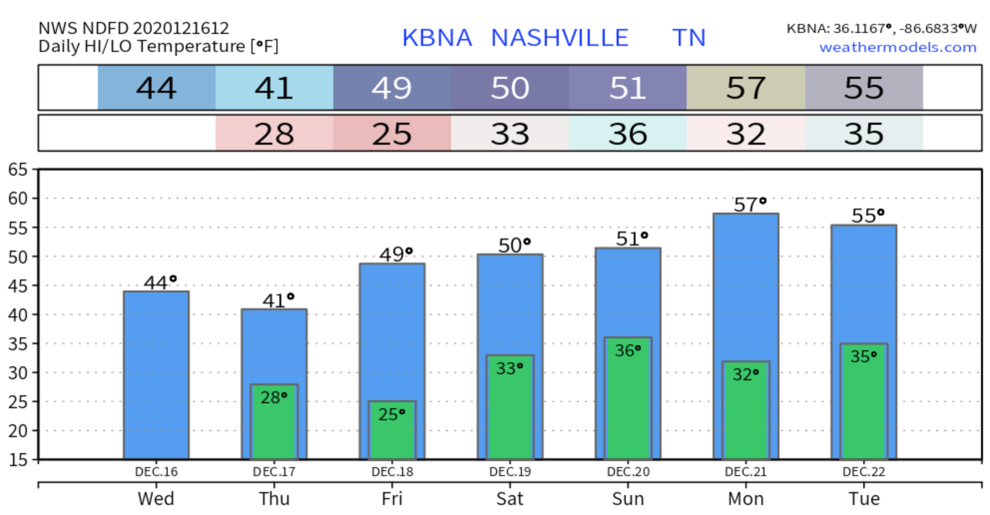
Winter temps will wait until Christmas Day.

Overnight rain has moved out and we are left socked in with clouds. Good news is that we do start the warming trend today. Should top out around 50 today.
And it’s only going to get warmer from here…
Everyone’s favorite–Saturday rain! Fortunately, today won’t be a washout. High temperatures will reach 47º. Our overnight temperatures will stay relatively mild due to the rain.
Clouds will increase throughout the day, culminating in rain tonight.
Chilly start to the morning with heavy frost and freezing fog in some areas.
We will surpass yesterday’s high of 40 for what that’s worth.
At least we’ll get plenty of sunshine
Another chilly night ahead. Near freezing with areas away from the city dipping back into the 20s.
It’s chilly out this morning. Wind chills are near 29°.
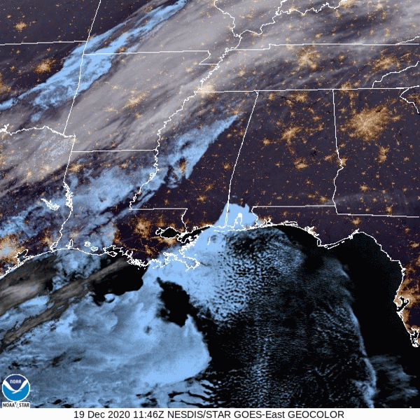
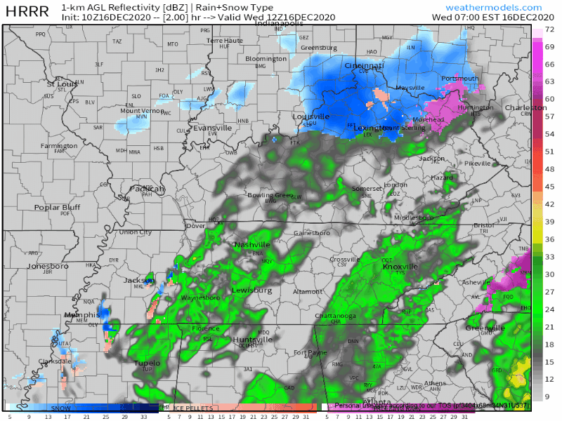
Some clouds are still lingering this morning, as shown in the satellite imagery below. They will clear out through the late morning and afternoon hours, giving way to sunny skies.
It’s Hump Day!
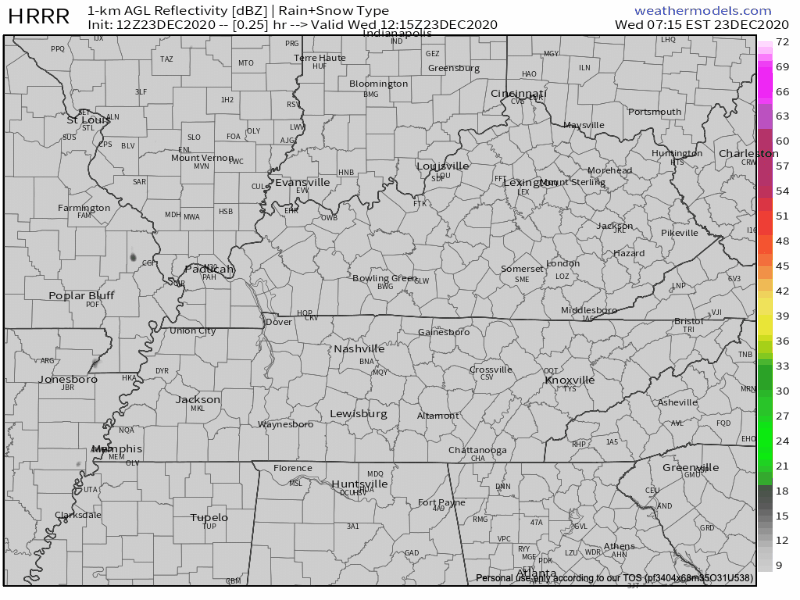
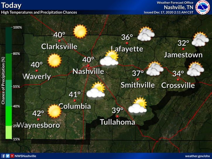
Light rain continues across the region this morning with temperatures in the low 40’s.
This system should be moving out around lunchtime/noon.
Those temperatures aren’t going to warm up very much as the day goes on with only a high of 44.
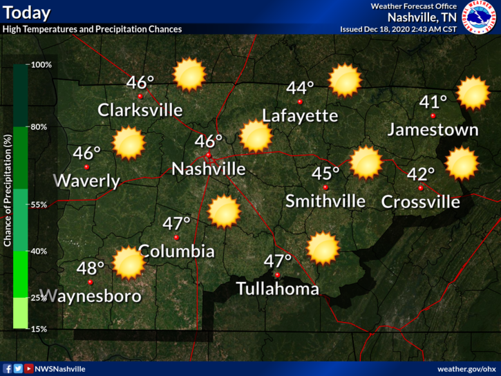
Bundle up! A cold day awaits. Luckily, we will be sunny today, so that will help our high temperatures reach a ~balmy~ 45º.
Clouds are clearing a bit this morning, but they will build back up this afternoon ahead of our next precipitation event.
You must be logged in to post a comment.