Chilly Start to April
The temperatures this morning are no April Fool’s joke!
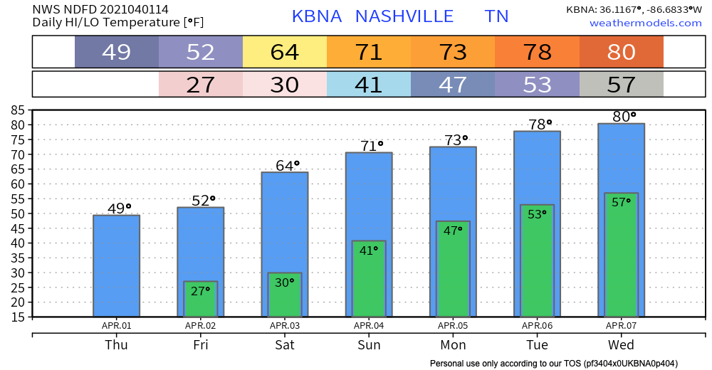
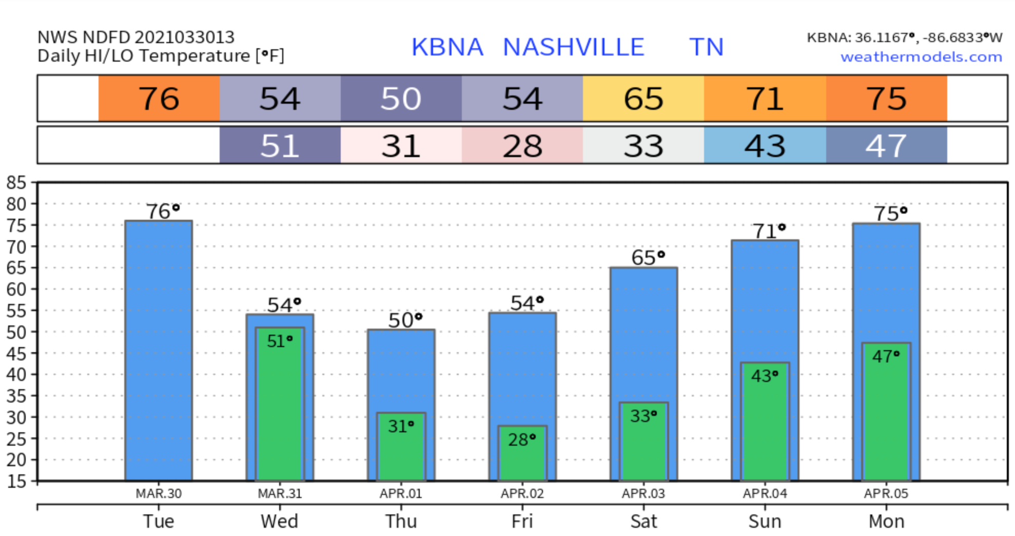
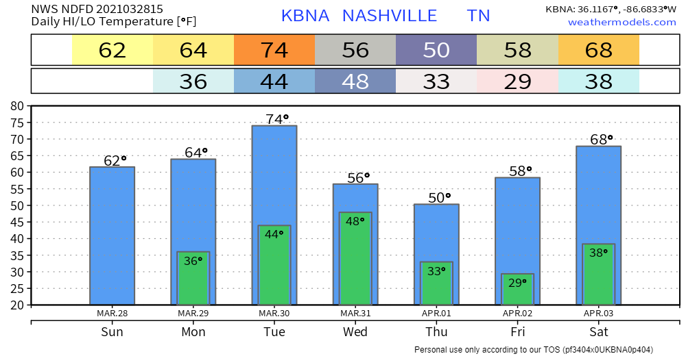
High temperatures will have to stretch to hit 50º by this afternoon. The climatological high for this time of year is around 65º, so we’re far below normal.

The temperatures this morning are no April Fool’s joke!
High temperatures will have to stretch to hit 50º by this afternoon. The climatological high for this time of year is around 65º, so we’re far below normal.

Even though the rain has departed, flooding still remains a concern, especially if you live near the Harpeth River in Bellevue. If you come across a road with water over it, please do not attempt to cross is. It’s difficult to judge how deep the water is and it doesn’t take much to cause big problems.
Rivers levels are plateauing, and will recede. But tonight along comes another line of rain with a few thunderstorms. Our water management system has anticipated the incoming rain and is working to keep river levels steady.

Rain will enter Middle Tennessee late Tuesday night.
The HRRR model thinks the first drops will fall around 7 PM Tuesday night. Then a break in the rain. Then the heaviest rain arrives Wednesday, probably after midnight Tuesday night through sunrise Wednesday morning. The HRRR model (right now, at least, see below) thinks that heaviest rain goes just southeast of Davidson and Williamson Counties:
Look out for patchy frost this morning–your reminder that in Nashville, we can never really be sure what season it is. We will warm up this afternoon thanks to plenty of sunshine!

Tomorrow will look similar with even warmer temperatures.
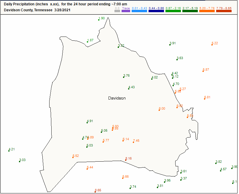
24 hour rain fall totals from various observers in Nashville:
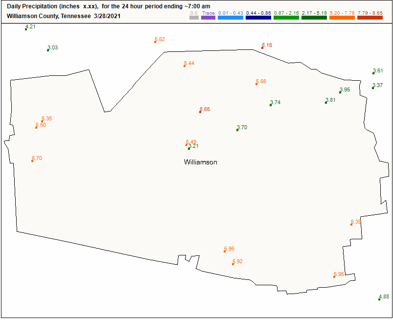
Williamson County:
The rainfall was historic:
Editor’s Note: We lost 4 people in this flood, at least that’s how many we know about as of noon Sunday. Each immeasurably valuable. The Mayor held a noon press conference and promised thorough investigation to understand the circumstances of each person having lost their life due to flash flooding. Investigations improve future messaging. But right now I do not want to reduce the lives of each of these four people into a lesson we expect to be taught later. Nothing is more important than a life. When we lose one it seems to me the community should mourn the person and surround his and her loved ones with love, kindness, and support, regardless of circumstances. Same is true for those who woke up with water in their home, businesses, and cars. Donate, give, love.
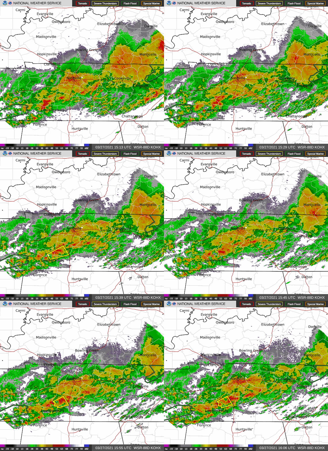
Storms this morning packed a punch with gusty winds, heavy rainfall, and hail.
Current radar shows sub-severe rain over the area. Unfortunately, this will only exacerbate the flooding concerns.
HRRR Model below shows off and on showers this afternoon before perhaps a more substantial line of storms rolls through overnight.
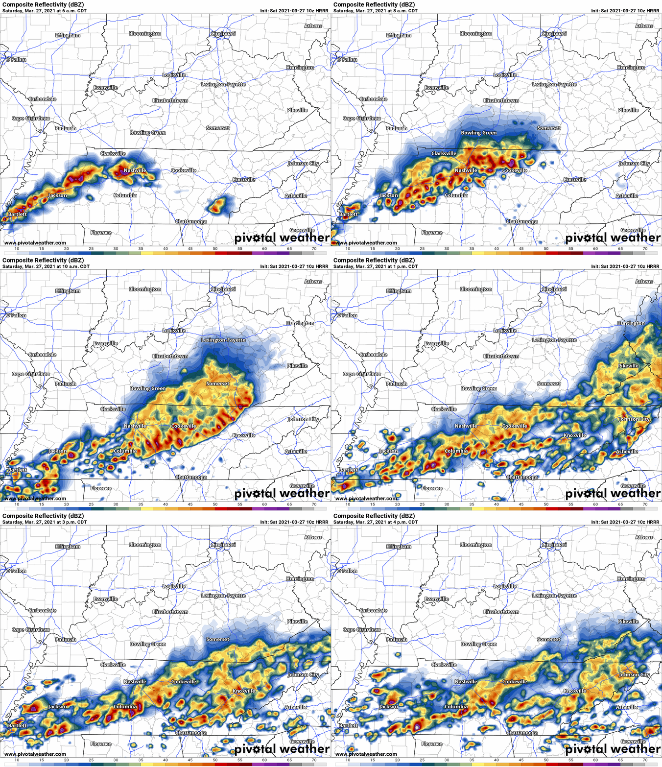
As I write this Andrew is on YouTube Live covering two Severe Thunderstorm Warnings. Will is on the tweeter, tweeting about them. These are hail storms. Lightning frequent and intense. Severe straight line winds are possible but there is no reason for early morning tornado concerns.
Nashville. Williamson County. Saturday morning. A weary community awakes.
A warm front arrives. Behind it, a waterlogged atmosphere.
HRRR Model
7 AM, rain begins. Will Co first. First rain drops south of I-40. Soon the tattered rain curtain covers both counties.
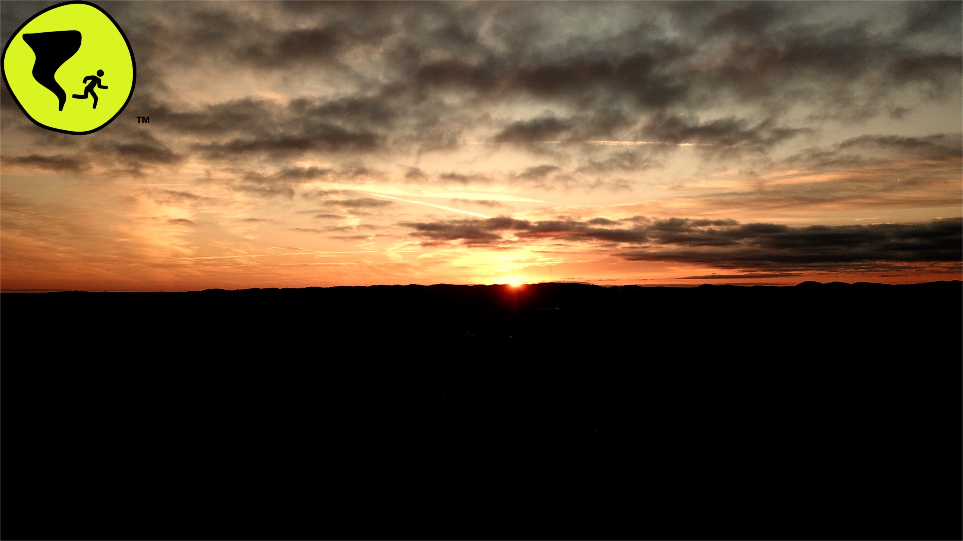
Check out today’s sunrise over the hills surrounding Grassland in Williamson county.
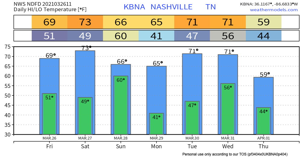
After last night’s severe weather, we dry out for most of today followed by decreasing clouds throughout the morning. We’ll be topping out near the upper 60s for our high temperature and the lower 50s for our low overnight tonight.
You must be logged in to post a comment.