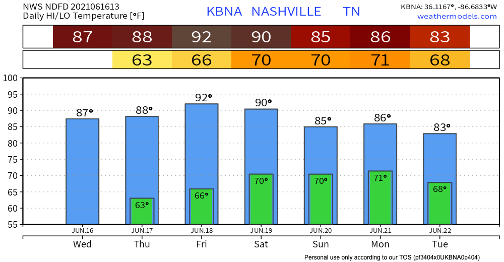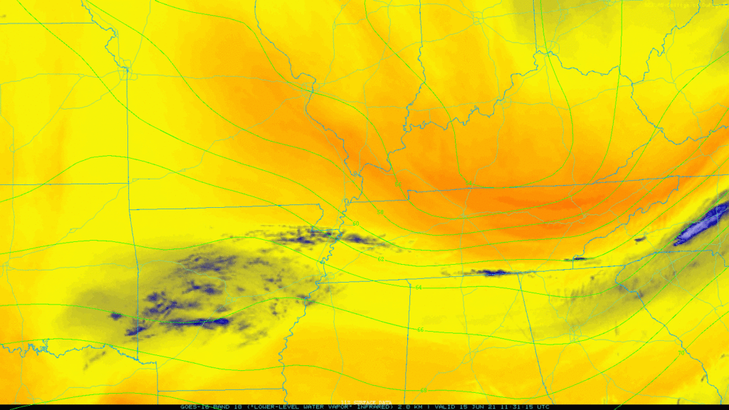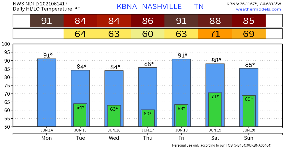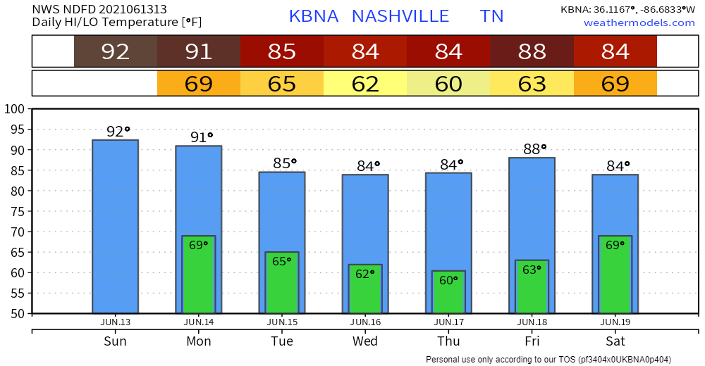
Morning rain has moved east. Clouds remain as another round of storms is expected to develop, mostly east of us. HRRR model below thinks it will be mostly a Plateau issue.

We should be finished with any showers by 2pm.

Morning rain has moved east. Clouds remain as another round of storms is expected to develop, mostly east of us. HRRR model below thinks it will be mostly a Plateau issue.

We should be finished with any showers by 2pm.
Wednesday should remain warm and dry until this evening. Rain will move into Middle Tennessee tonight.
Timing
The HRRR shows rain approaching both counties just before midnight. Rain should last through the overnight hours and clear by the morning.
Perfect spring weather persists Tuesday.
Most of the day Wednesday should be dry. The bulk of the activity will come during the overnight hours Wednesday Night -early Thursday Morning
HRRR Model shows a weakening line of showers moving entering our western communities around midnight Wednesday night, with most of the precip ending before sunrise Thursday.
Nothing much to talk about today and Tuesday – plenty of sun and warmer temps.

We could see a couple showers Wednesday afternoon, but the main event will come through late Wednesday night into early Thursday morning.

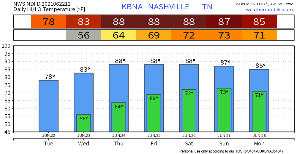
Sunshine and a warmup through the mid-week.
Our next chance of showers and thunderstorms arrives Wednesday night and continues Thursday.
The approaching storm system presents some severe risk for Arkansas and West Tennessee. Severe is unlikely for us. The system appears to weaken a bit and become just a rain event with low-powered thunderstorms by the time it gets here. ETA most likely very late Wednesday into Thursday morning. Timing remains iffy, though, because hi-res models are not yet in range.
Was this the last freezing morning of the szn?
Place your bets. We say “probably” because it’s difficult for the atmosphere to get freezing air this far south, this time of the year, but not impossible. For now, we see no chance of a freezing morning for the next 7-10 days.
Happy spr-winter, the weird in-between season that only Nashville experiences.
(Side note: When you write about the weather, you also have the ability to create fake seasons.)
We will be warmer than yesterday, but “warm” is a relative term. Our high temperature is expected to reach about 55º. The sun will be out shining all day!
The temperatures this morning are no April Fool’s joke!
High temperatures will have to stretch to hit 50º by this afternoon. The climatological high for this time of year is around 65º, so we’re far below normal.
Even though the rain has departed, flooding still remains a concern, especially if you live near the Harpeth River in Bellevue. If you come across a road with water over it, please do not attempt to cross is. It’s difficult to judge how deep the water is and it doesn’t take much to cause big problems.

Rivers levels are plateauing, and will recede. But tonight along comes another line of rain with a few thunderstorms. Our water management system has anticipated the incoming rain and is working to keep river levels steady.
You must be logged in to post a comment.