5º: the low temperature on this day in 1960
2.9 inches: snow that fell on this day in 2015
1º: the departure from normal (36º) of our low temperature this morning (37º)
80º: the high temperature on this day in 1910
5º: the low temperature on this day in 1960
2.9 inches: snow that fell on this day in 2015
1º: the departure from normal (36º) of our low temperature this morning (37º)
80º: the high temperature on this day in 1910

Editor’s Note: On this day in 1917, Nashville received 7 1/2 inches of snow. Give yourself about 30 seconds to immerse yourself in that scene, then proceed with reading this awesome forecast.
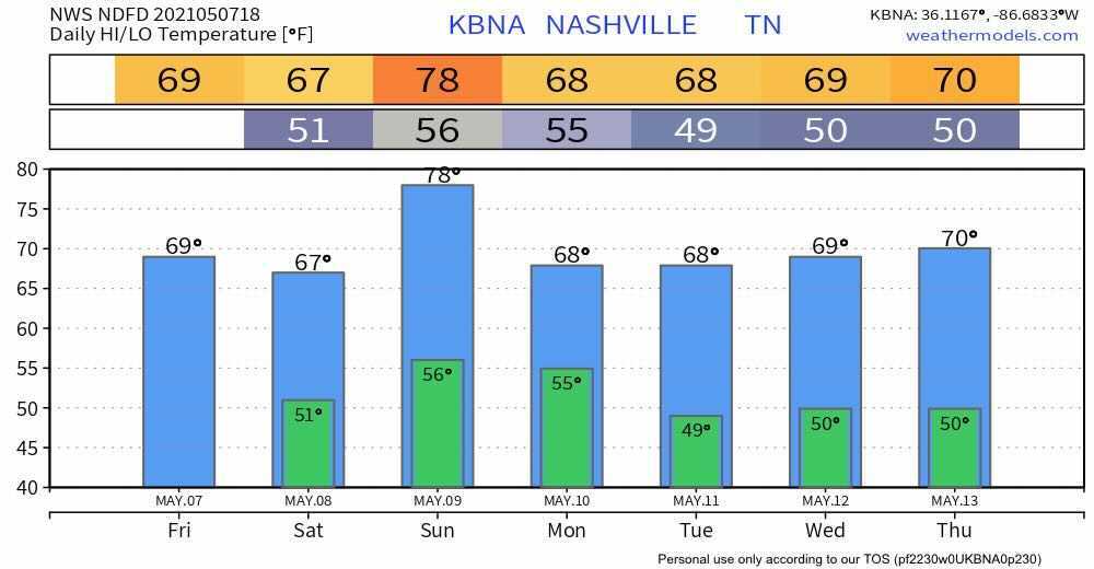
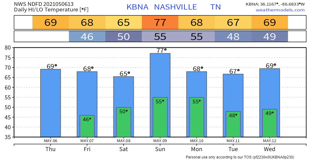
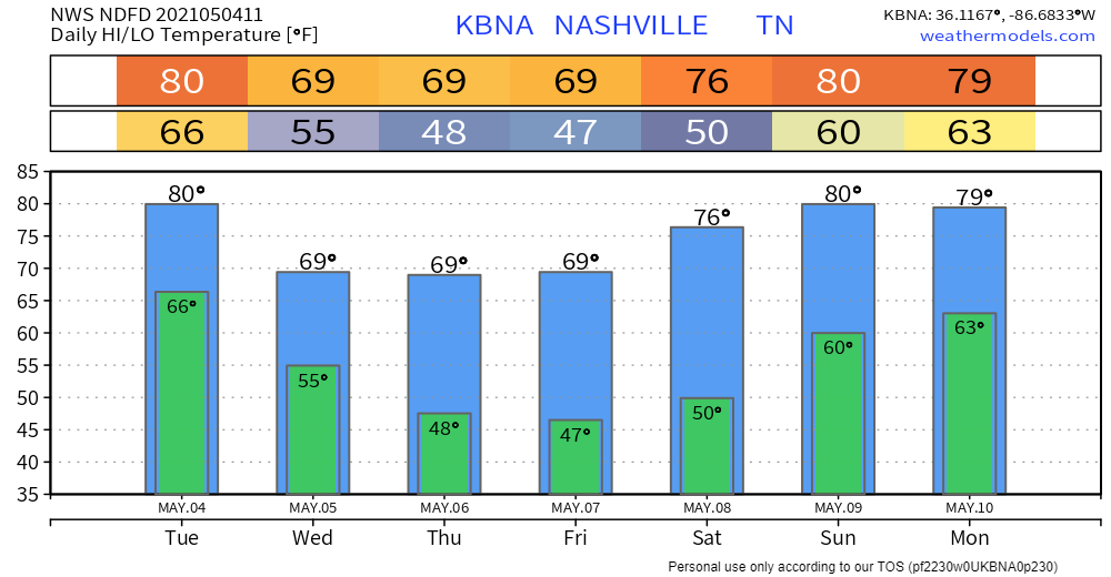
Warming up nicely out of the 40’s today with lots of sunshine.
One year ago, many of us were beginning to understand the magnitude of what had happened. We had watched the horrific scene of a strong tornado moving through our city live on our screens hours before, but this wasn’t your average tornado video off YouTube. It was our city, our home, our friends, our neighbors.
The supercell appeared on radar a year ago tonight. By 12:33 AM Tuesday March 3, 2020, that [expletive deleted] was here. You know what happened.
I was behind screens watching radar, data, internal chat, typing furiously in surreal horror. Since then I’ve watched and read everything I could find about that tornado. I’ve been back through the radar data. I’ve reviewed the meteorology. I’ve reviewed every tweet I sent and every frame of video footage I could find. I’ve looked at, and walked in, stood in and looked up through, your damage. Many, many times. Trying to process it, to understand it, to be better. I’ve even written a retrospective.

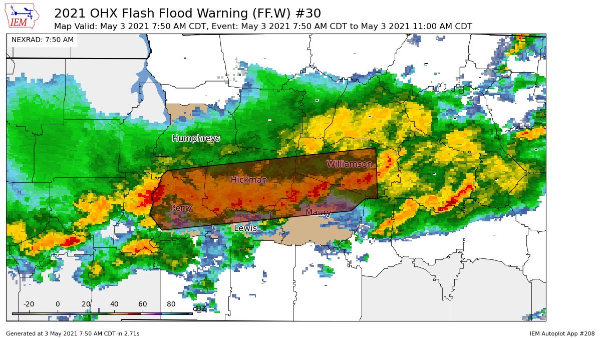
Nearly 4-5 inches of rainfall fell from last Friday to this morning in Nashville. Bit less in Will Co.

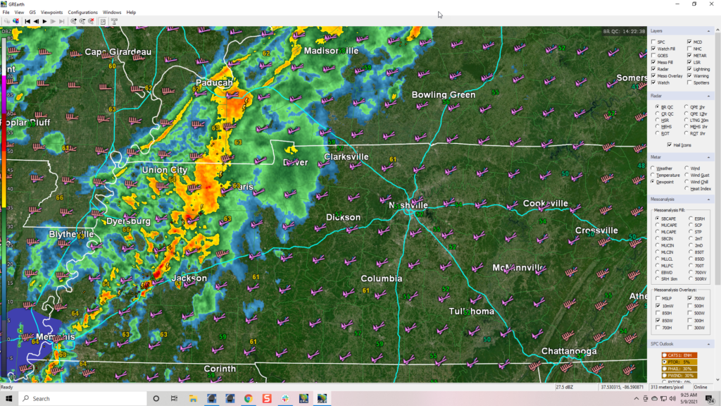
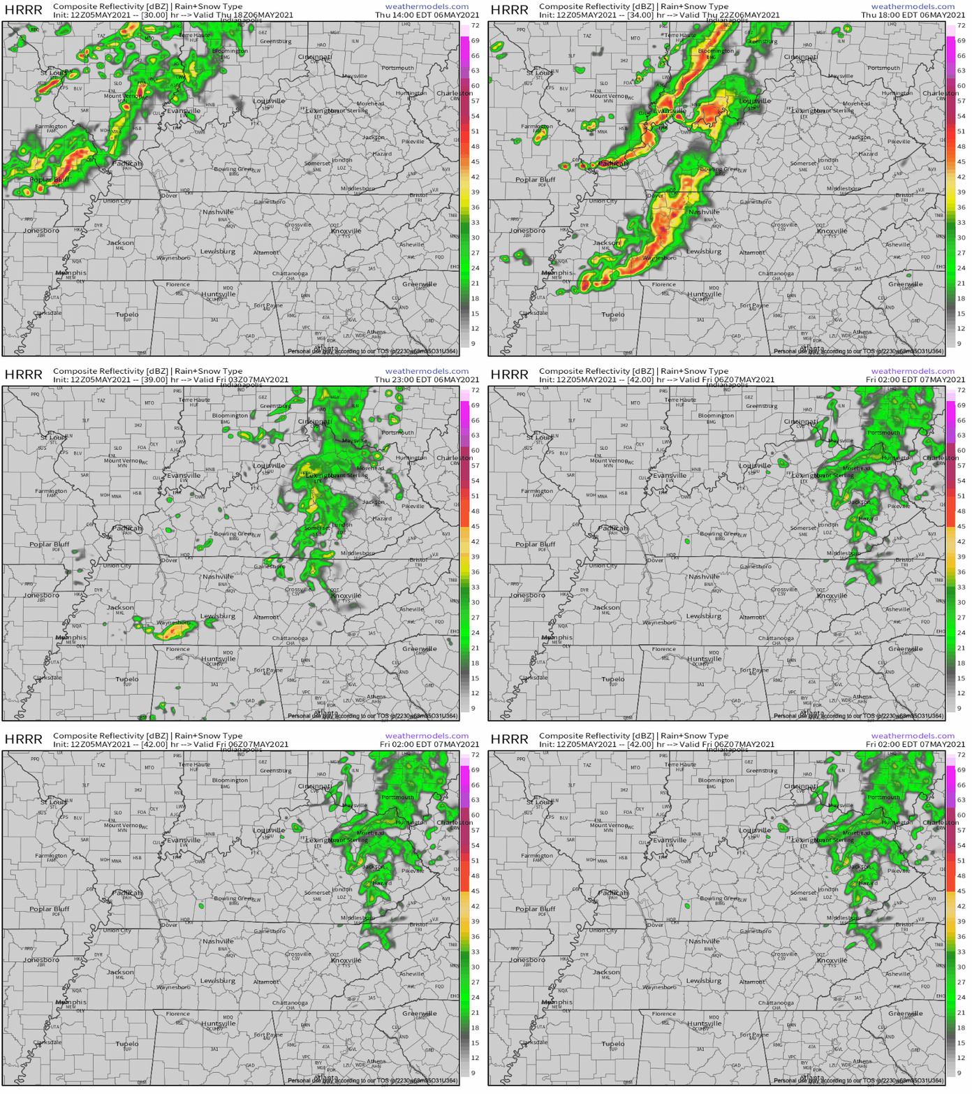
All rain today will be well south of us:

Rivers and creeks will take time to drain. Levels will slowly go down.
By the time the storm line got to us tonight, low level winds were running parallel to storm motion. Add an inversion aloft with a heavily saturated column. The trio wrecked our low-probability tornado chances.

Strong to severe storms are possible today and tonight.

Tornadoes are possible in Middle Tennessee, including Davidson & Williamson Counties of course. That’s the area we cover.
Around lunchtime we see our atmosphere begin gathering tornadomaking ingredients.
The Storm Prediction Center in Norman, OK has given us a Slight Risk for Sunday afternoon, but we don’t expect widespread severe weather.

As mentioned above, spc put us in a slight risk for Sunday. The main concerns are flooding, and a non-zero chance of brief Tornados, damaging wind, and small hail. This isn’t some widespread severe weather event, but it has us interested enough to write a special blog to discuss it. So let’s dig in.

10z HRRR Reflectivity Loop
Above, the HRRR model is running through Sunday night. A storm complex riding a cool front comes our way Sunday afternoon. Exact timing is still a little unsteady, but we think it will be Sunday evening for the “main event”.
We know it will bring us lots of rain.

The above graphic is showing a forecasted amount of multiple inches, and that has triggered a flood watch through Monday morning. Creeks, rivers, drainage ditches will remain full and may exceed flood guidance, triggering flood warnings tomorrow night. An isolated 4″ of rain for some us is not out of the question. Flash flooding will be of most concern in areas that receive a lot of rain yesterday. Creek and river levels can be checked here… NashSevereWX Flood Resources

A flood advisory will like remain in effect through 6pm Wednesday.
It’s low. But it’s not zero and the greater threat exists if there isn’t a cloud deck in place tomorrow afternoon. The setup Sunday is going to be influenced by storm fuel (heat + instability).
Here’s what the NWS said in their Saturday afternoon AFD…
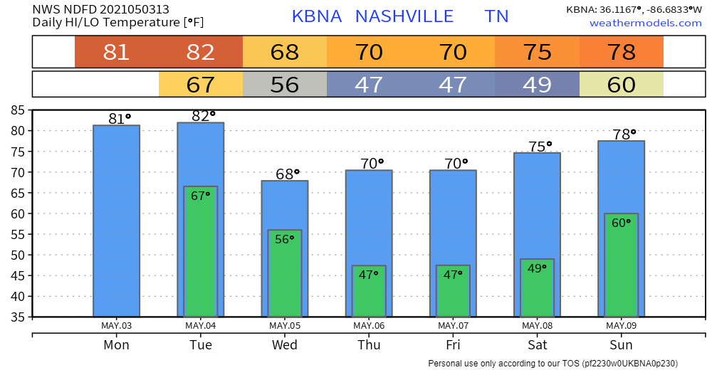
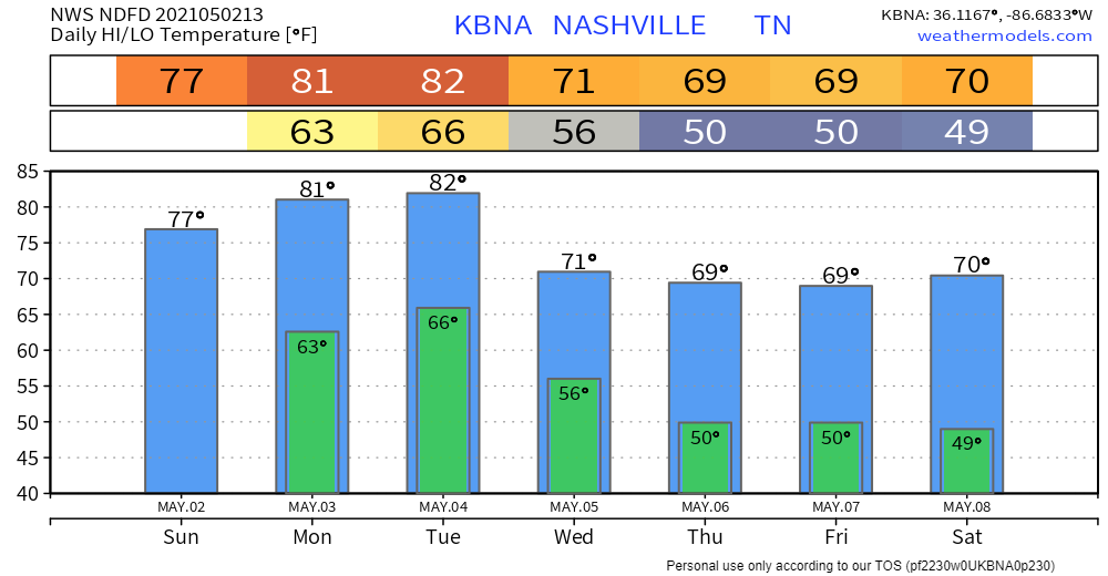
Afternoon high temps on Sunday expected to sore into mid 70s south with a good amount of instability and favorable lapses rates for strong to severe convection development, especially if rainfall does not move into this portion of mid state region until late afternoon hours allowing for increased atmospheric instability due to enhanced diurnal heating influences.

Heavy localized rainfall and thunderstorms remain for the majority of the afternoon into tonight. The producer for this lineup is caused by a developing warm front moving northward over the area.

Mostly spotty showers and passing light rain will prevail from now until the late afternoon. The heaviest of rain does not appear to move over Nashville until around 8 PM tonight.
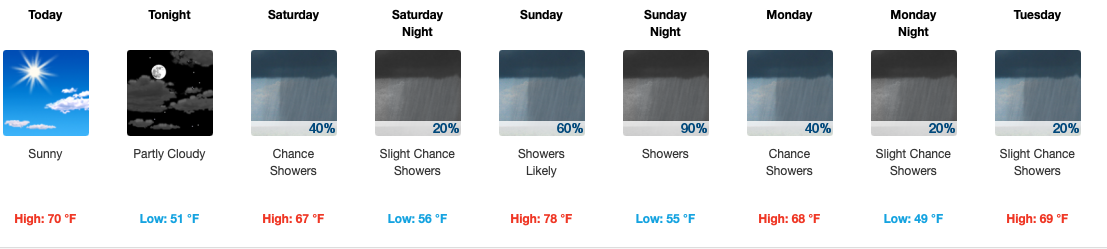
Rain will continue off and on today through Monday. The greatest possibility for flooding will arrive Sunday night through Monday. Severe weather threats remain minimal. If you have outdoor stuff you NEED to do, Saturday afternoon is your best shot.
You must be logged in to post a comment.