
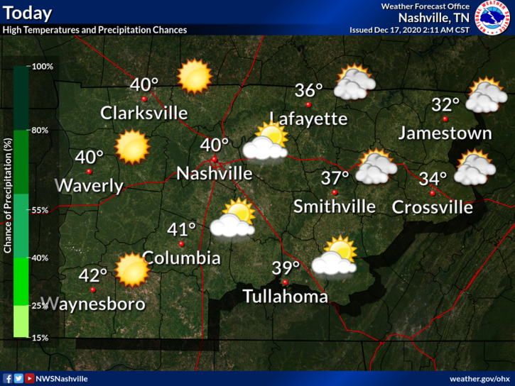
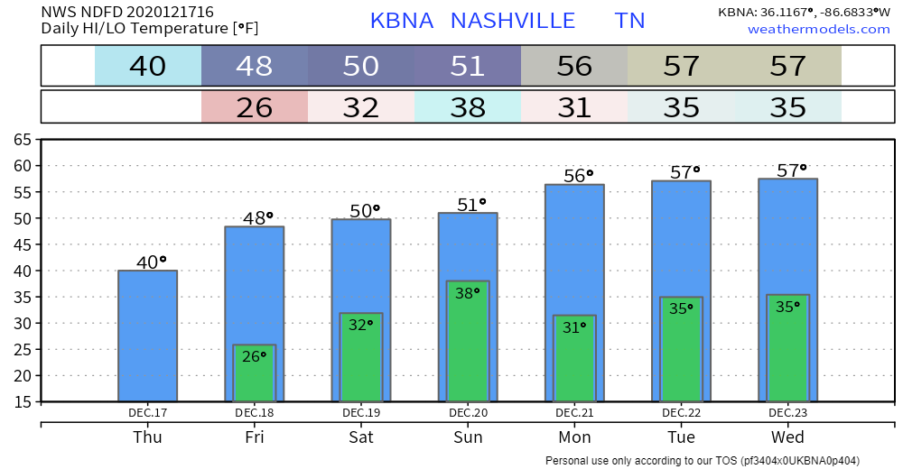
It’s chilly out this morning. Wind chills are near 29°.
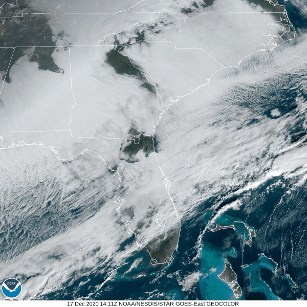
Some clouds are still lingering this morning, as shown in the satellite imagery below. They will clear out through the late morning and afternoon hours, giving way to sunny skies.
High temps will be near 40°.
Clear conditions will continue overnight, lows around 26°.
Sunny Skies Friday
We’ll see more of the sun on Friday.
Temps will be slightly higher, coming in at around 48°.
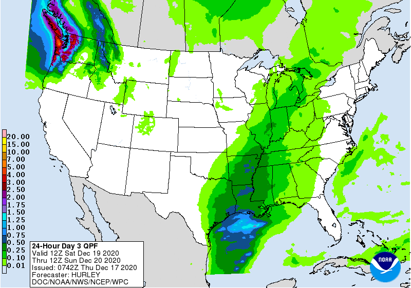
Rain Late Saturday Night
According to the Euro model, we could begin seeing rain at around 8 pm, maybe a bit earlier.
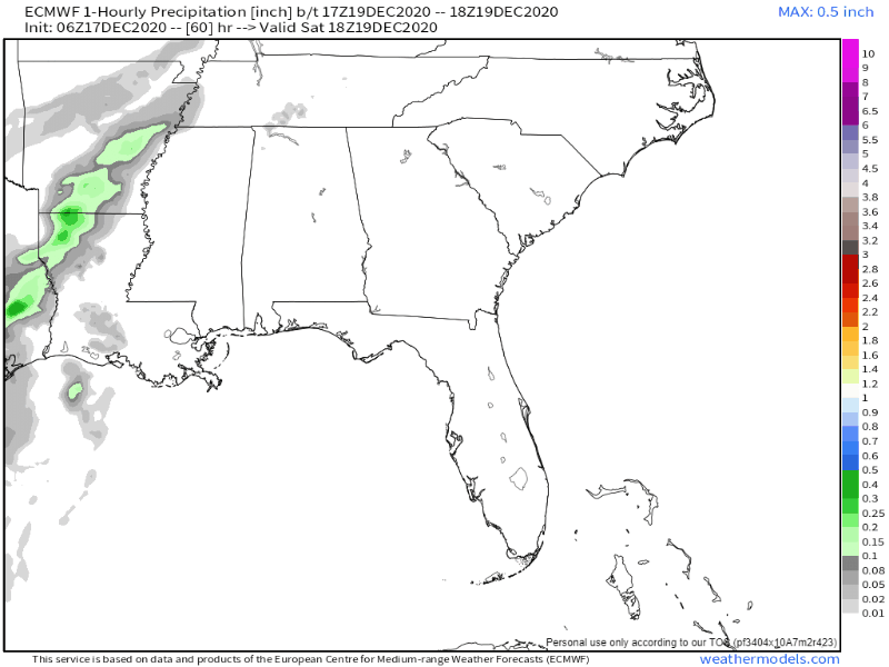
It will hang around through the overnight hours and should be out of the area before 6 am Sunday.
This doesn’t look to be a washout event: anywhere from a tenth to a quarter of an inch of rain is possible.
Looking Ahead
The system moving through Saturday night isn’t expected to bring any cold air with it.
We’ll be seeing some sunshine from Sunday into Tuesday with high temps in the mid to upper 50s.
Our next chance at seeing some rain comes Wednesday. Here’s what the National Weather Service has to say about that system coming through:
00Z guidance continues trend of showing a powerful cold front sweeping through most of the eastern half of the country from late Wednesday into Christmas Eve. This system will likely bring us another round of rain, and depending on how quickly the cold air arrives behind the front, a wintry mix could occur before precip shuts off.
NWS Area Forecast Discussion
This event is almost a week out, so take any forecast with a grain of salt. This is something to keep an eye on in the coming days.

Categories: Forecast Blogs (Legacy)
You must be logged in to post a comment.