Category: Featured Blog

It’s Getting Hot in Here + Possible Rain Tuesday

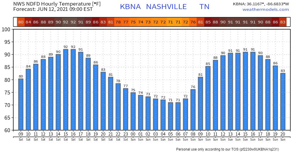
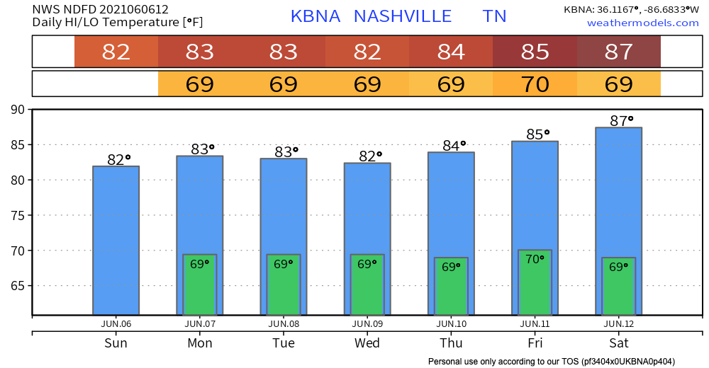
It’s a calm start to the week with not much to worry today. Music to your ears right?! Cloudy skies today won’t produce any rain for your Monday just some heat!

Maybe Rain Tuesday??

There is rain potential on Tuesday but nothing detrimental to your day. The rain might start to trickle in some Tuesday morning but if there are some drizzles, it would be more so during the mid to late afternoon. Clouds stay tomorrow with increased wind speeds up to 10 mph. Overall, Tuesday’s weather is nothing that keeping an umbrella in your car won’t fix! Not enough rain for a rainout. No lightning or other worries. read more

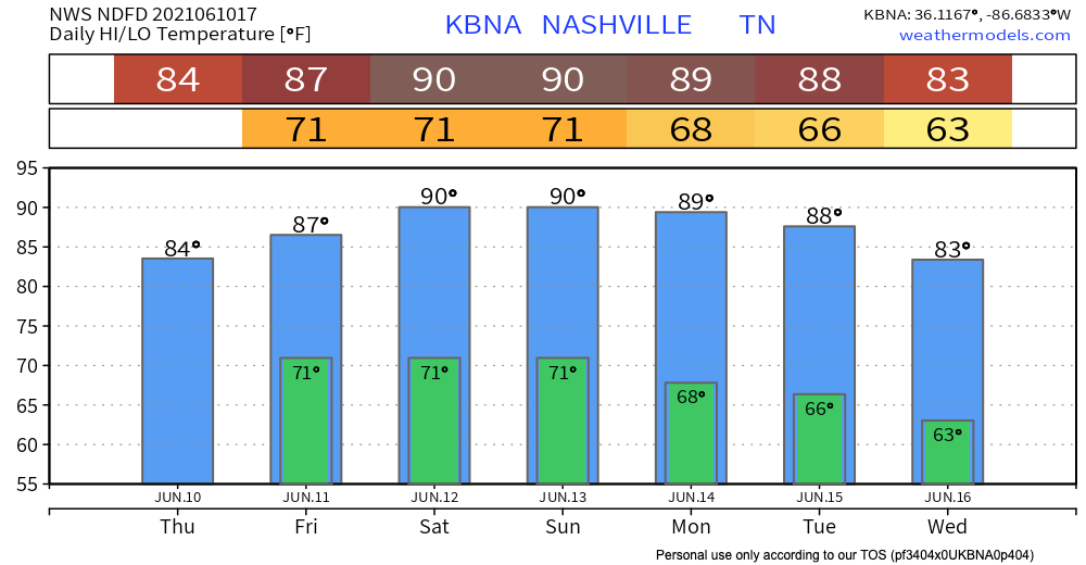
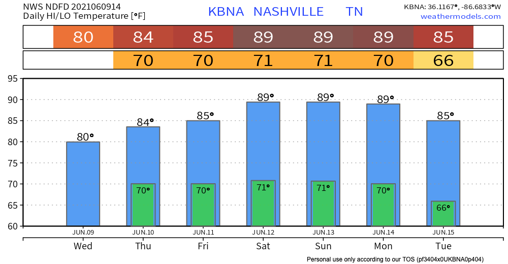
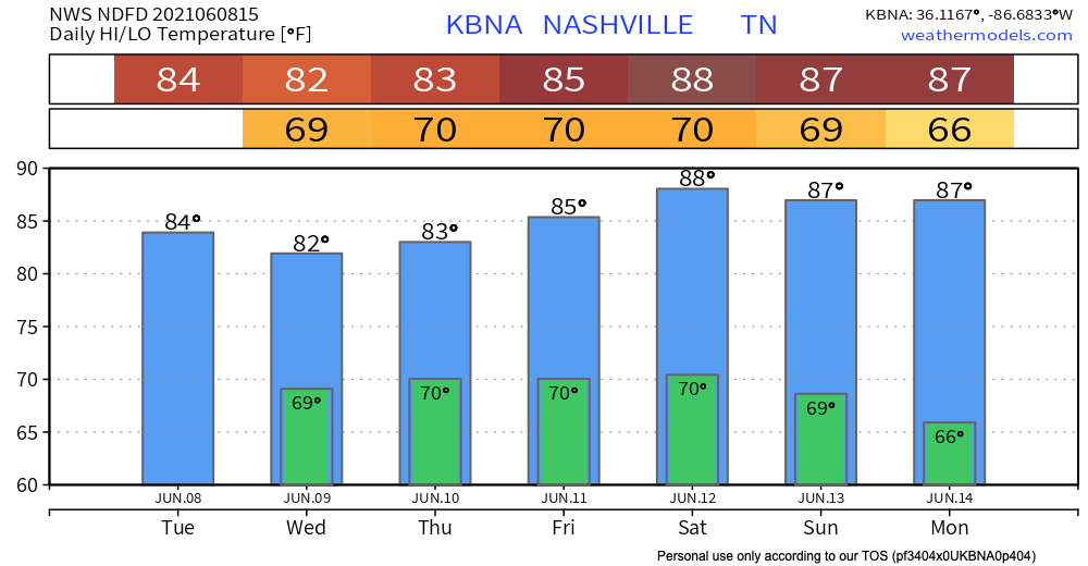
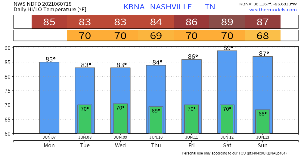
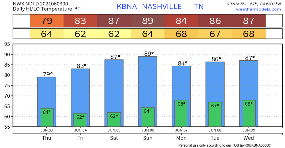
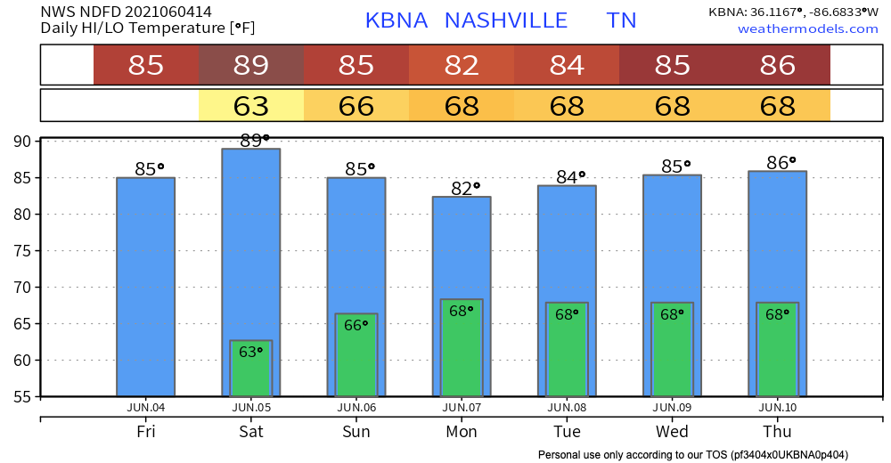
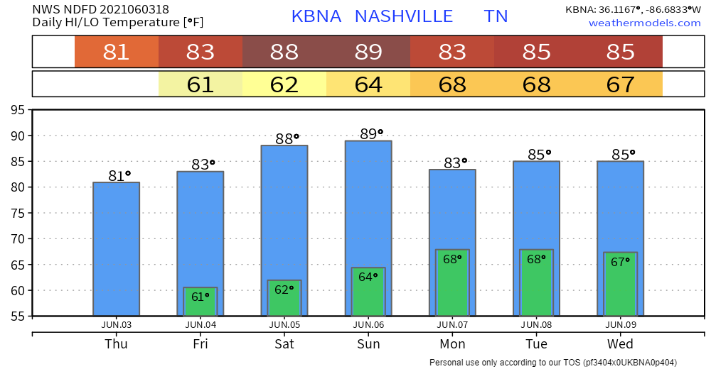
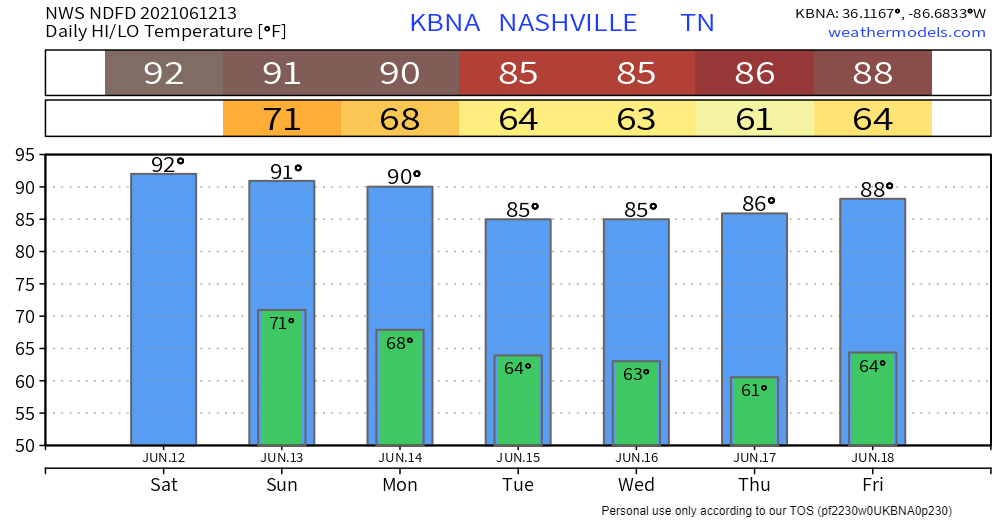
Getting Hot.

No hazards ahead. Except for heat.

i'll take it tv land GIF by YoungerTV

Rain this morning moved out. We’re good today. And Monday looks quiet.

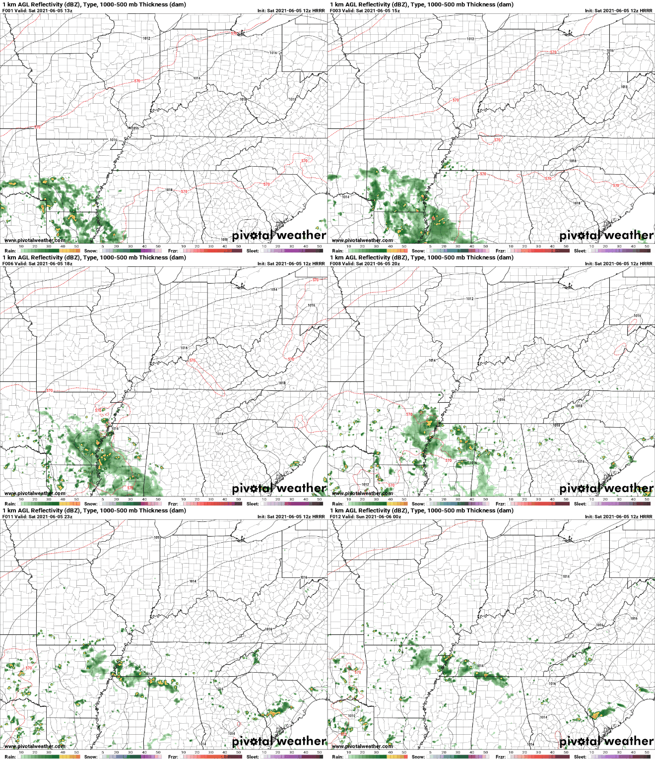
Looks like next best rain chance is Tuesday. The HRRR (below) has Tuesday morning rain:

The GFS also has not-enough-for-a-rainout rain Tuesday: read more

Meh.

Satellite in the sky. We bathe in sun.

I can’t find anything meaningful in the models through the weekend. The Euro tosses a sad, lonely, ineffective shower at us Sunday morning but that looks like nothing. Next week a few systems approach from the west but are battling rain-eroding high pressure as they work east. So while next week looks maybe wet, it’s all too uncertain to comment further. Meh. read more

The Will Co Shamnado Promotion, You May Be Eligible For Federal Flood Assistance, Expect Rain Tonight.

NWS-Nashville promoted Sunday night’s near Page High School Shamnado to Tornado, an EF-0 of very little power.

Shamnadoes are more frequent than we think. Shamnadoes are most dangerous when they intersect us when we are most vulnerable, such as “during trapeze practice.” Severe Thunderstorm straight line winds are as damaging, many times more damaging, but a shamnado can tip or damage an unanchored mobile home, or send your vehicle’s wheels off the ground. read more