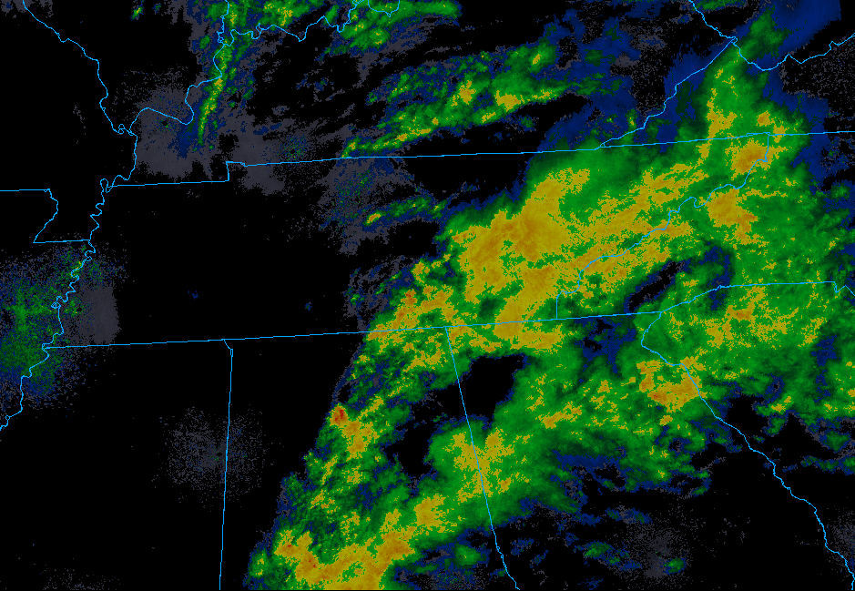
Record-Breaking Heat has Returned this Weekend
You know how it’s the last weekend of September? Well, it feels like the second weekend of July.
Editor’s Note:

Highs today will approach the mid 90°s with dewpoints in the mid 60°s.

You know how it’s the last weekend of September? Well, it feels like the second weekend of July.
Editor’s Note:

Highs today will approach the mid 90°s with dewpoints in the mid 60°s.


There are plenty of chances this week for some high temperature records to be broken with all forecasted highs in the mid 90s. Minimal rain chances through the week, not really any relief in sight. A strong upper level ridge boosts our temperatures mid week up to near 96°, making it feel like a July afternoon. The all-time record high for October, 94°, has a good chance of being snapped later on this week.
Good news: At the time of this post, we have rain moving into the area. It isn’t a lot, but it’s something.
For radar updates, check out our Twitter page @NashSevereWx. Or, go to nashvillesevereweather.com/realtime.
Tonight's rain fizzling, Thursday morning rain amounts vary dramatically by weather model, after that hot the rest of the month. Deeets ⏬ https://t.co/lfehyETKnH
— NashSevereWx (@NashSevereWx) September 25, 2019
Humidity left. Dew points in the mid 40°s — fall quality! — but temps remain above normal for late September with mid/upper 80°s.
Wednesday will be nice.
Showers arrive maybe Wednesday night but probably Thursday morning as another cold front moves into the region.
At least it’s something?
These aren’t pop up storms, instead a weak cold front is moving through today, setting off this rain.
NWS-Nashville predicts less than .25″, with most areas receiving less than .10″. Your backyard could see more, some could see less; either way it’s not a lot. This will do little to cut into our monthly deficit.
Fires can spread quickly this afternoon.
Dewpoints are likely to drop into the mid 50s later today, and with winds speeds picking up and pretty dry ground conditions, marginal fire danger is likely this afternoon. •NWS-Nashville
At the time of writing this the temperature is 89º, but it sure doesn’t feel like with a 52º dew point. A steady 10mph breeze doesn’t hurt anything either. All in all, if you’re tailgating, back yard tailgating, or outside for Pilgrimage, things are pretty comfortable. That being said, take some sunscreen.

We’ve got great weather to end the workweek today for Middle Tennessee.

Cooler than the past few days, but more importantly, lower dewpoints! We’ll be up to 89° today, but the dewpoints are actually going to be our friend today and stay in the 50s!
It’s still kinda humid and dry, though we will have a slight drop in high temps.

These above-average high temperatures keep pushing us closer to breaking a record:
“Still looks to reach the 90s for much of the area, with Nashville now at the #2 most 90 degree days ever in a year and inching ever closer to the all time record set in 1954.” @NWS-Nashville
You must be logged in to post a comment.