
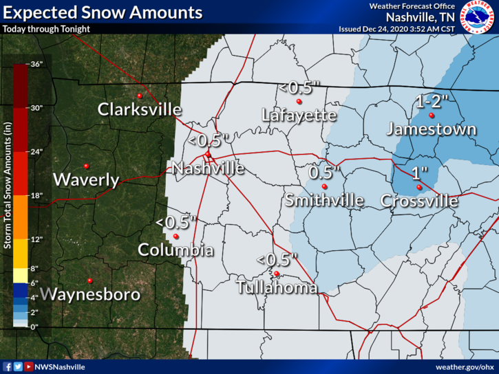
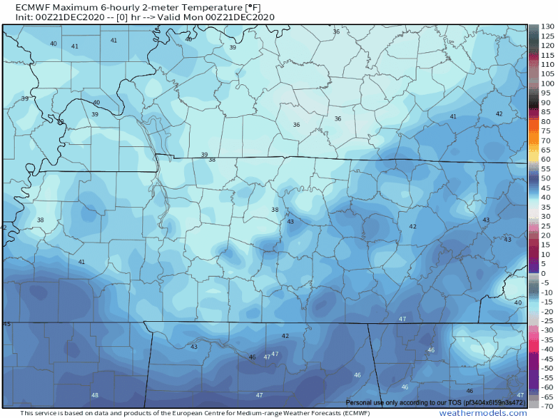
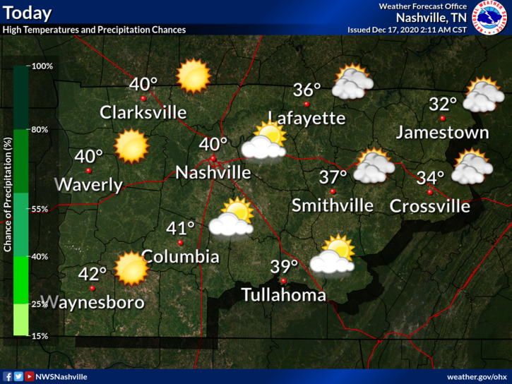
Flurries Possible This Afternoon
What’s on everybody’s mind, perhaps more than what’s under the Christmas tree.
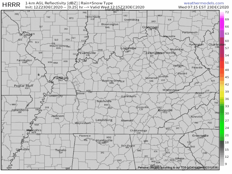
Model soundings for this afternoon show a very shallow layer of moisture. There is enough lift in the atmosphere to squeeze out a few flakes for us. Our best chances of seeing the white stuff will be after about 3pm.


You must be logged in to post a comment.