

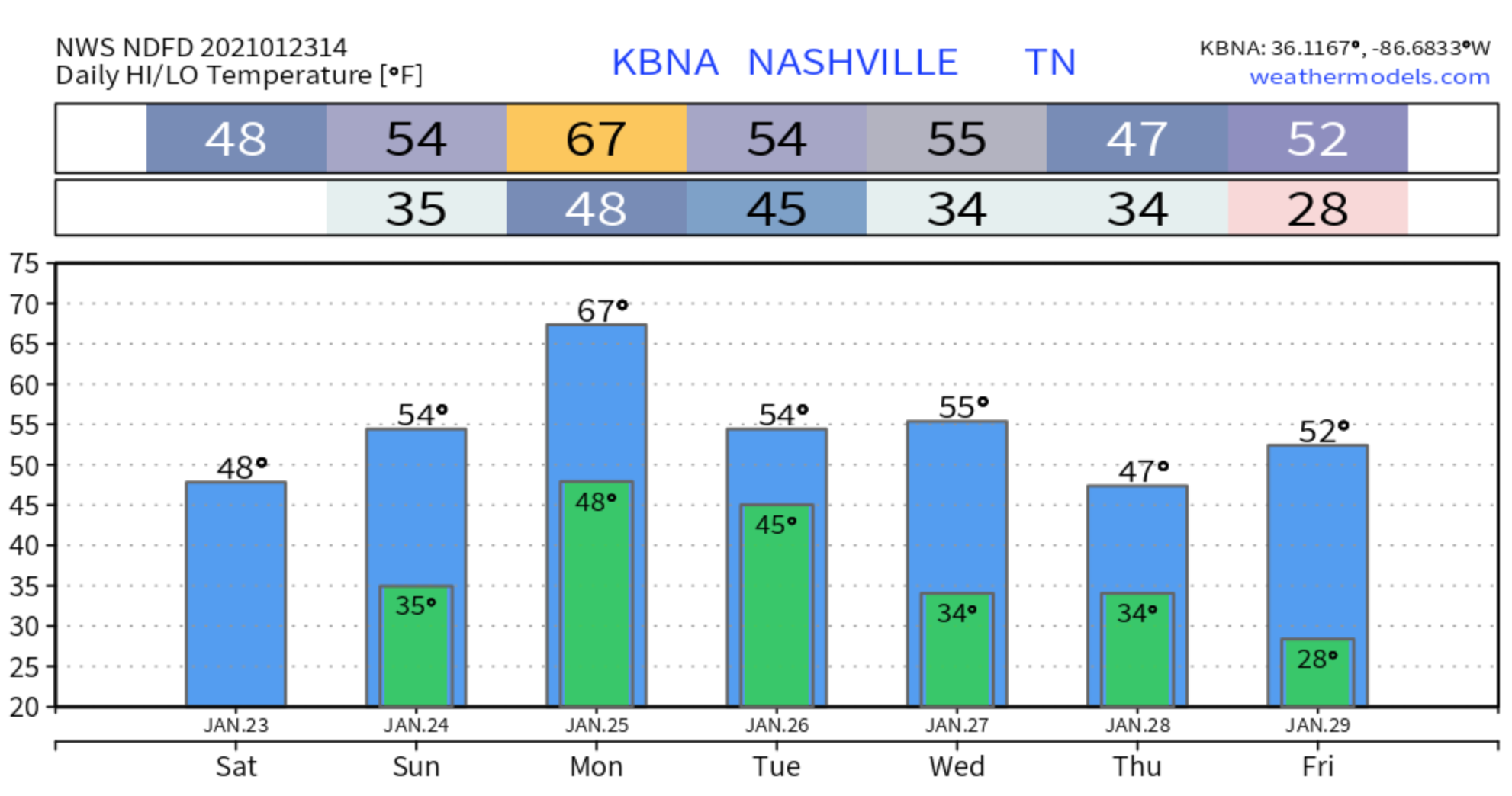
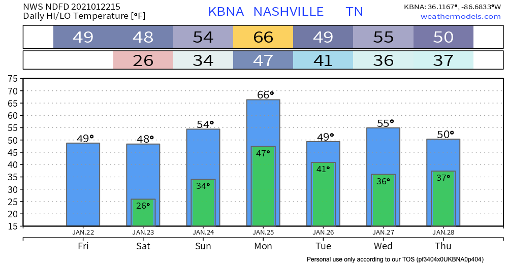
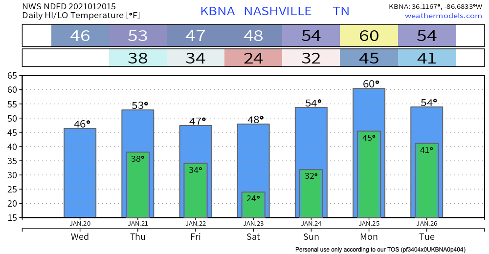
The U.S. West Coast is getting mudslides and epic snowfalls. It’s supercold in the northeast.
Here, not so much.
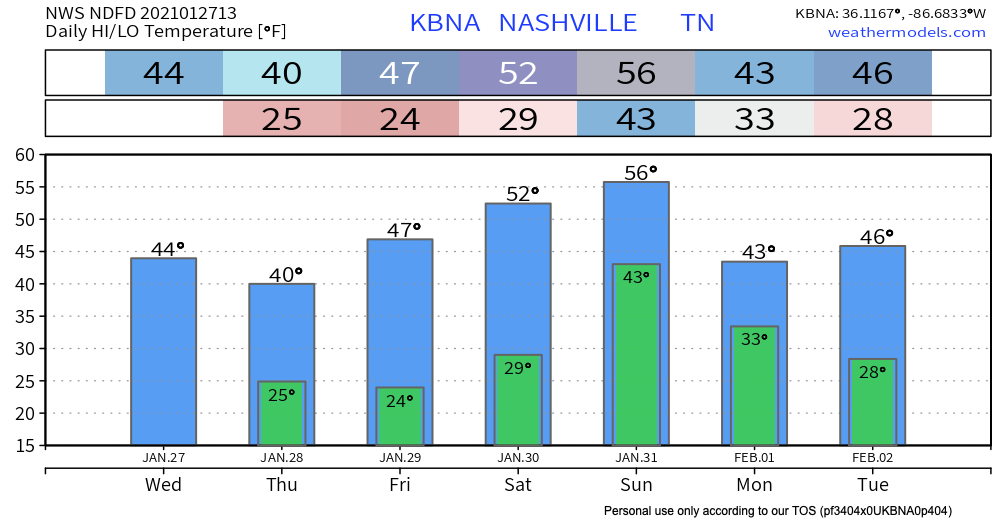
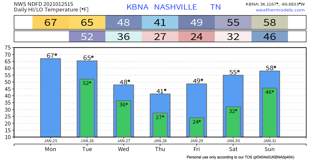
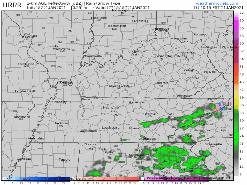
Saturday Afternoon Rain?
Models disagree about Saturday afternoon. Most think a rain wave will pass by but dry air will gobble it up the drops before they reach the ground.


You must be logged in to post a comment.