
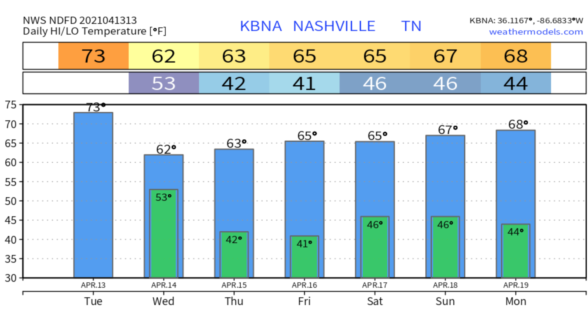
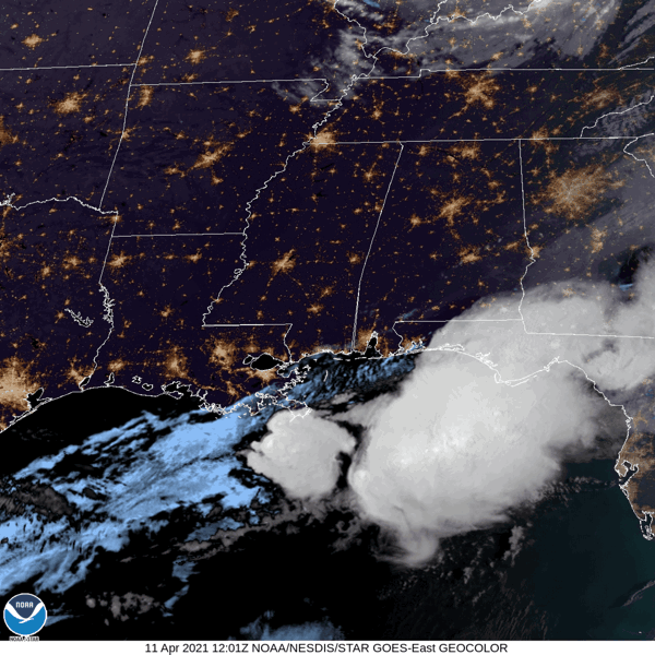
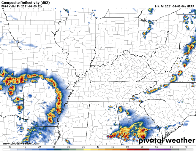
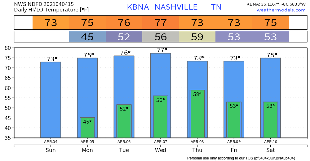
A few light showers are possible in our area today, mainly before 3pm. A few more may sprinkle in tonight.
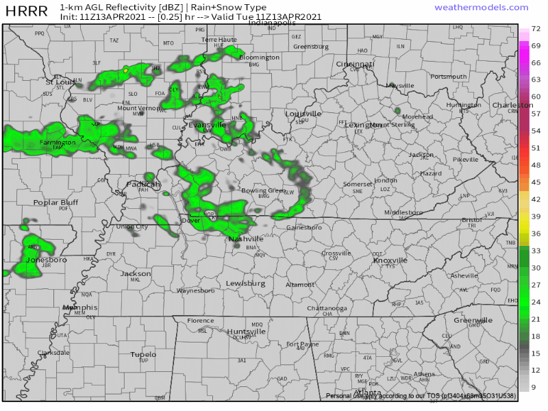
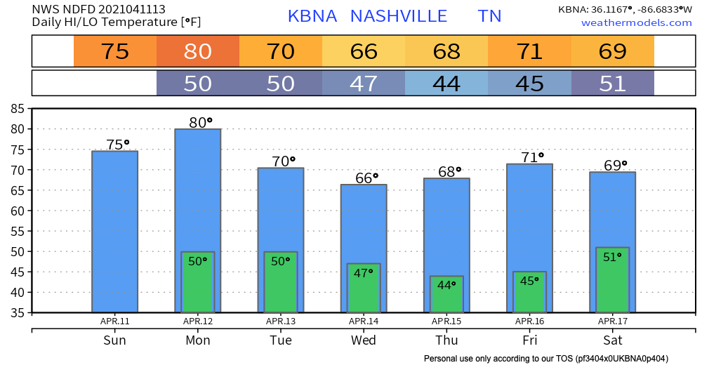
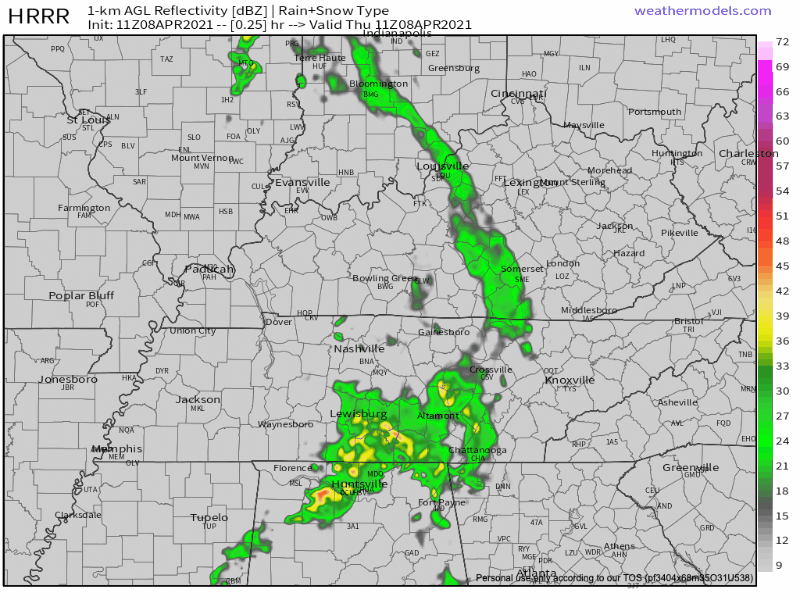
A weak cold front will move through the region today and tomorrow brining more scattered showers Wednesday. ETA mid-day, around lunchtime. Looks really light:


You must be logged in to post a comment.