
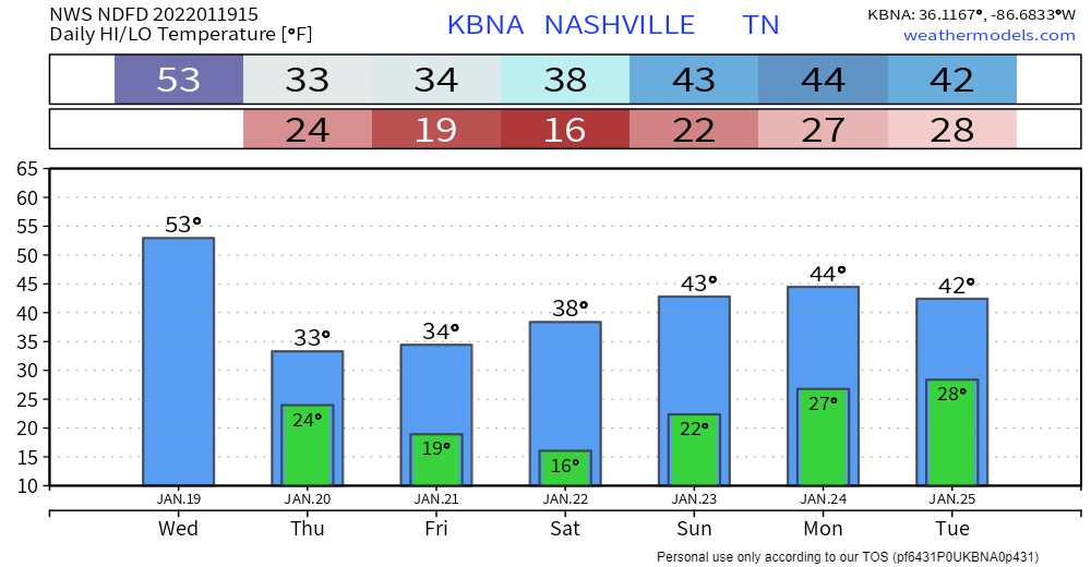
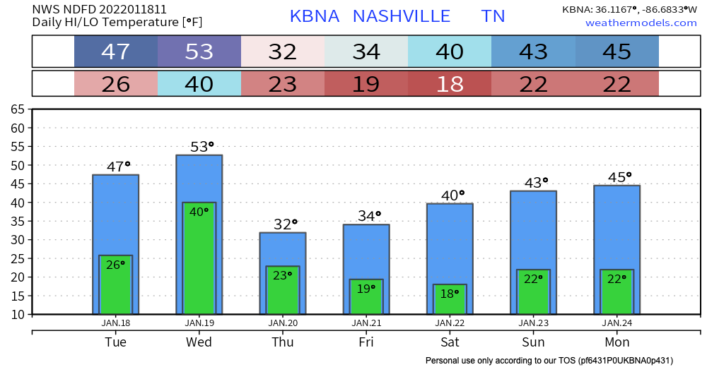
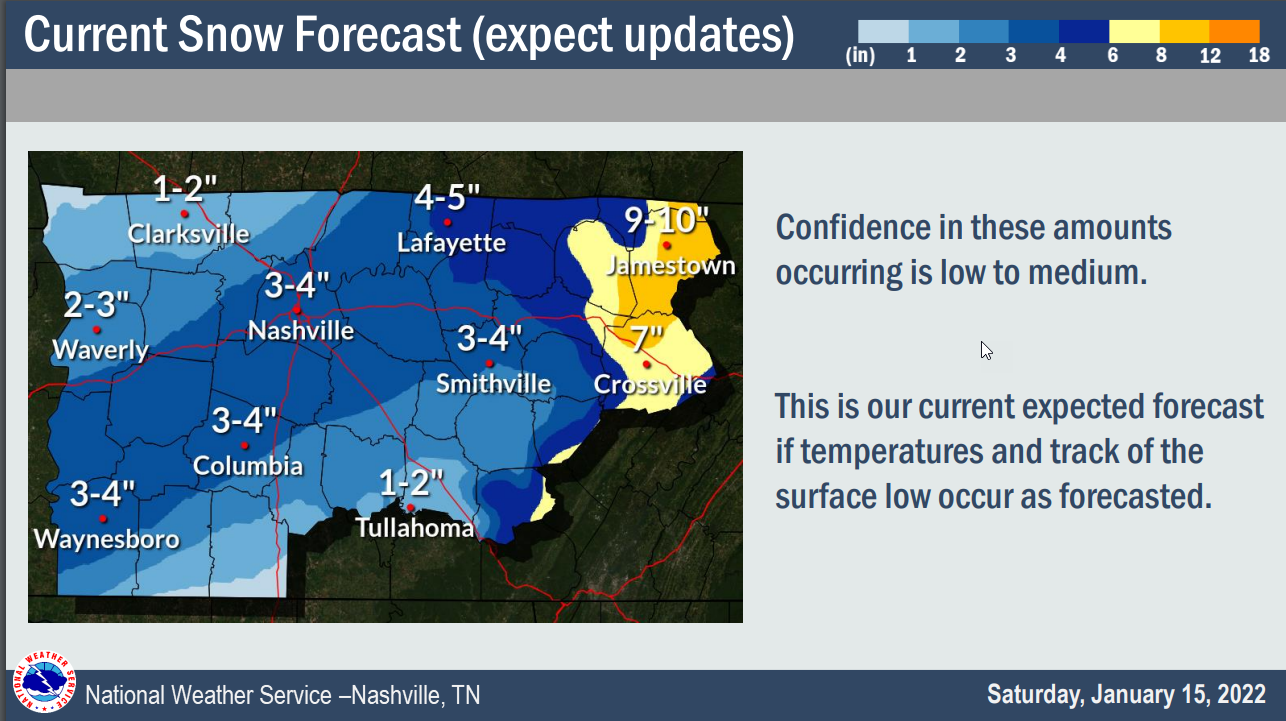
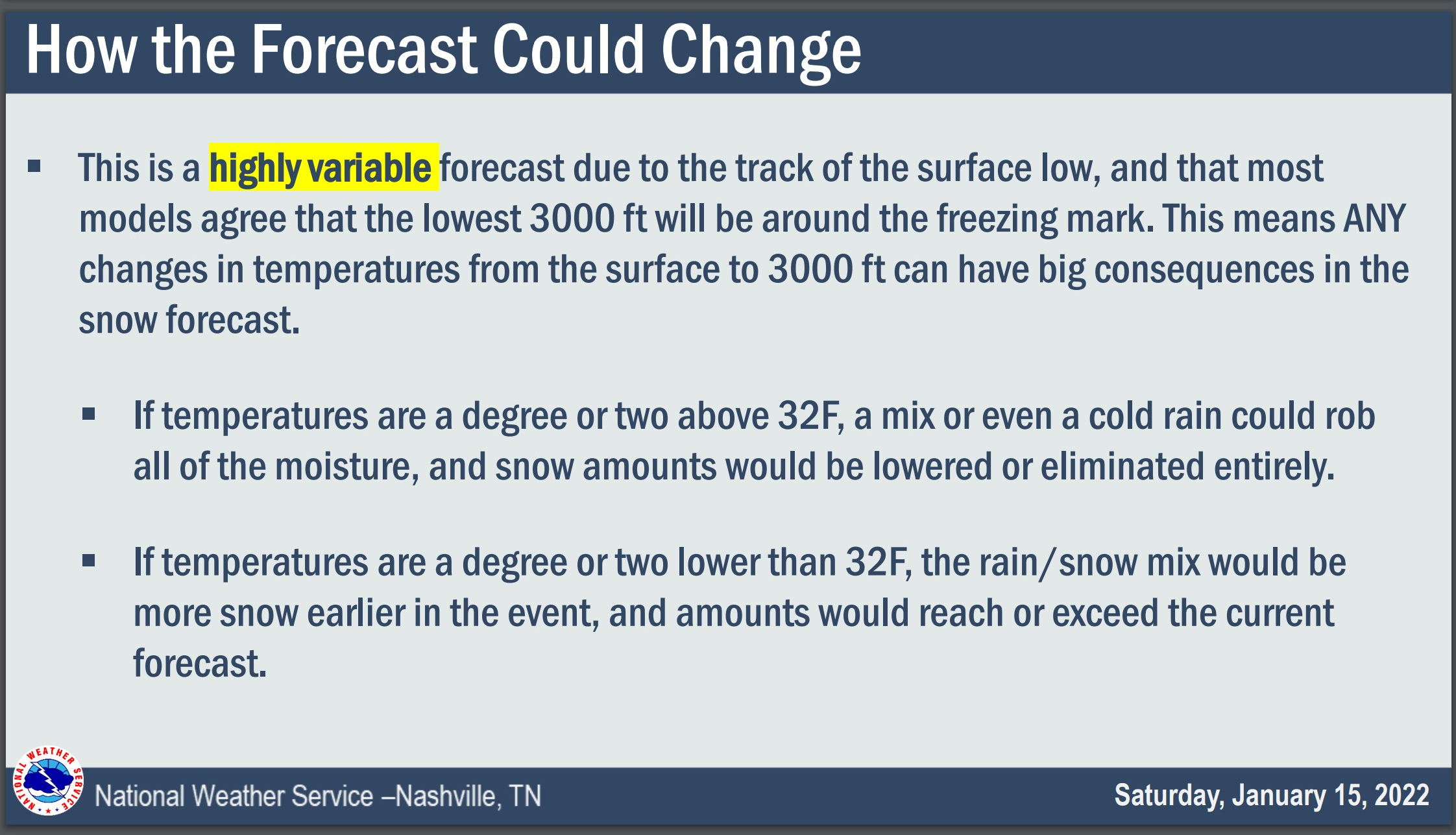
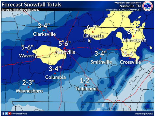
All the wintry stuff is well east of us by the time you are reading this. Now we are just left with the cold.
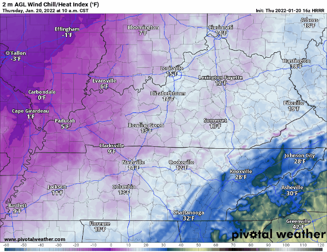
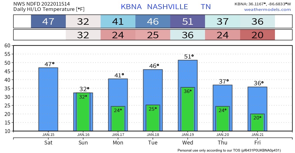
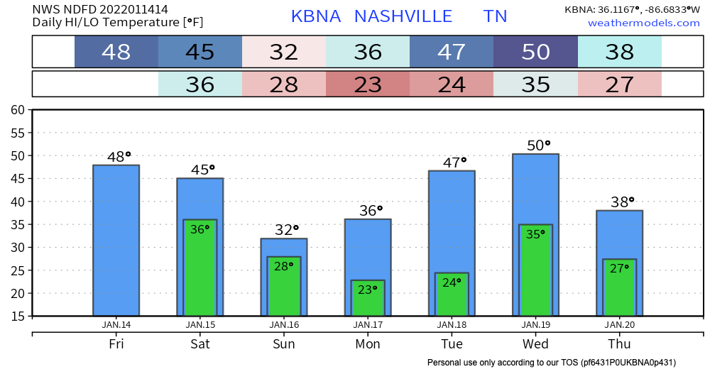
It is COLD out. The high temp today is expected to get up to freezing. If you take wind chill into account it’ll feel like it’s in the teens. The extremely blue and purple image below better illustrates this.


You must be logged in to post a comment.