

Temps get up to the mid 30’s today. Melting will be slow. Expect a refreeze tonight as temps dive into the low 20’s. This may continue dangerous road conditions into the morning commute tomorrow, especially in elevated areas and on secondary/neighborhood roads. Highs tomorrow in the upper 40’s will bring significant melting.
Next Weather-Maker: Wednesday
Rain arrives early Wednesday morning and continues throughout the day.
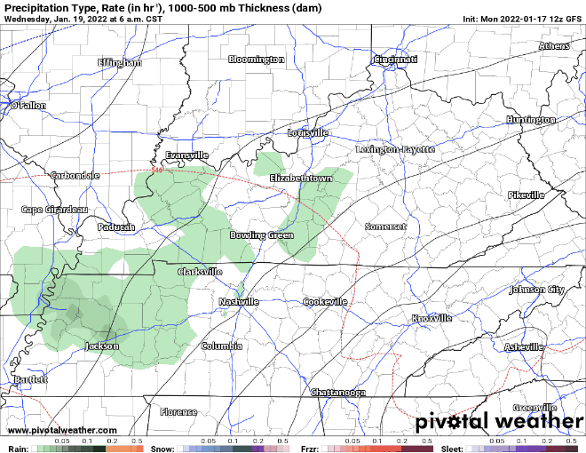
Winter precip could be on the backside of this system. The GFS model below shows wintry precip around dinner time.
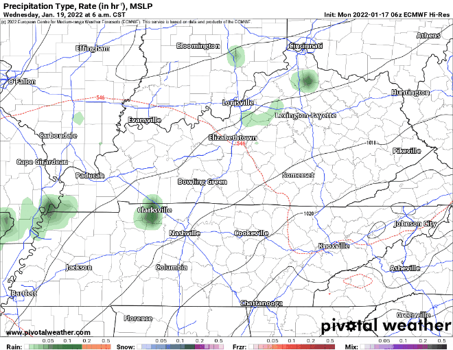
Euro model below shows precipitation continuing throughout the day with a wintry mix coming in around 9pm.
High res models are not yet quite in range so expect forecast revisions. This does not look anywhere close to as strong as the the last three snow producing storms. Travel disruptions are, we suppose, possible, but nothing that’s a big deal for now. This is more traditional “cold air chasing the precip” setup that often disappoints snow fans.
Models agree that this system should be out of our hair by midnight Wednesday night. Thursday temps don’t get above freezing, so anything frozen will have staying power Thursday morning.
Rest of the week, including the Bengals @ Titans game Saturday 3:30 PM, for now looks clear and cold.
Quick References:
Weather changes constantly.
Follow @NashSevereWx on Twitter for any changes to this forecast.
Live coverage during tornado and severe thunderstorm warnings:
Look good.
Support the mission.
We are 100% community supported. No ads. No subscription fees. Keep it free for everyone.
Categories: Forecast Blogs (Legacy)
You must be logged in to post a comment.