
Previously mentioned showers coming in from Kentucky look weak. If they do make it here this afternoon, they would just be some very light showers. No need to alter any plans. No severe weather worries with these. HRRR model gives its’ take below.

Previously mentioned showers coming in from Kentucky look weak. If they do make it here this afternoon, they would just be some very light showers. No need to alter any plans. No severe weather worries with these. HRRR model gives its’ take below.

Below I posted the MaybeWrong HRRR model. It thinks light showers descend from KY beginning midnight tonight and hit or miss sprinkle you until around Saturday afternoon. Would not alter plans. Rainfall unevenly spread and very light. No storm concerns.

Rain and Storm chances return Sunday afternoon. Until then, sticky-uncomfortable humidity (dewpoints in the 60°s) with typical mid-July temps:
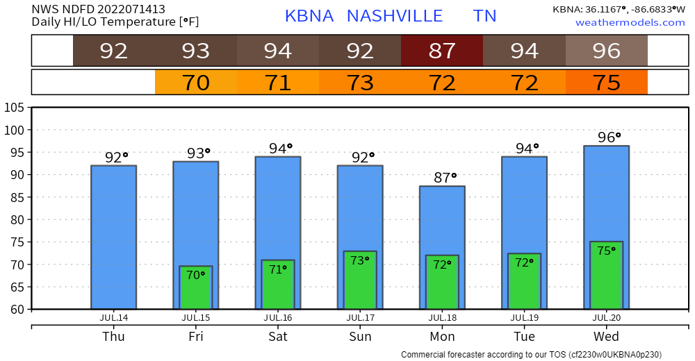
Humidity jumps up Sunday afternoon when The Wattery will resume. Place your bets on getting an isolated, scattered shower or thunderstorm overhead each afternoon Sunday through at least Weds. Lightning the hazard, not concerned about tornadoes.
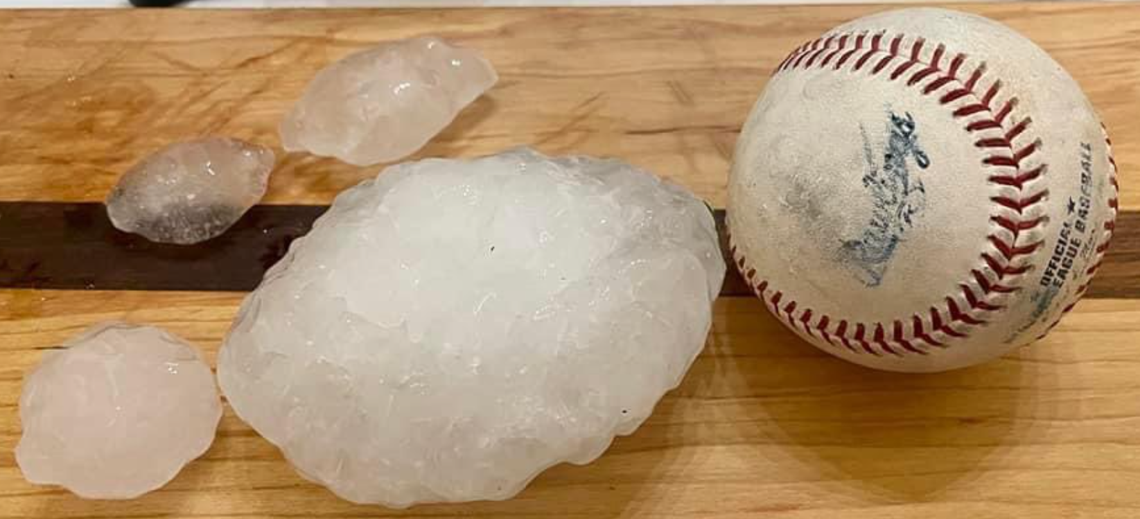
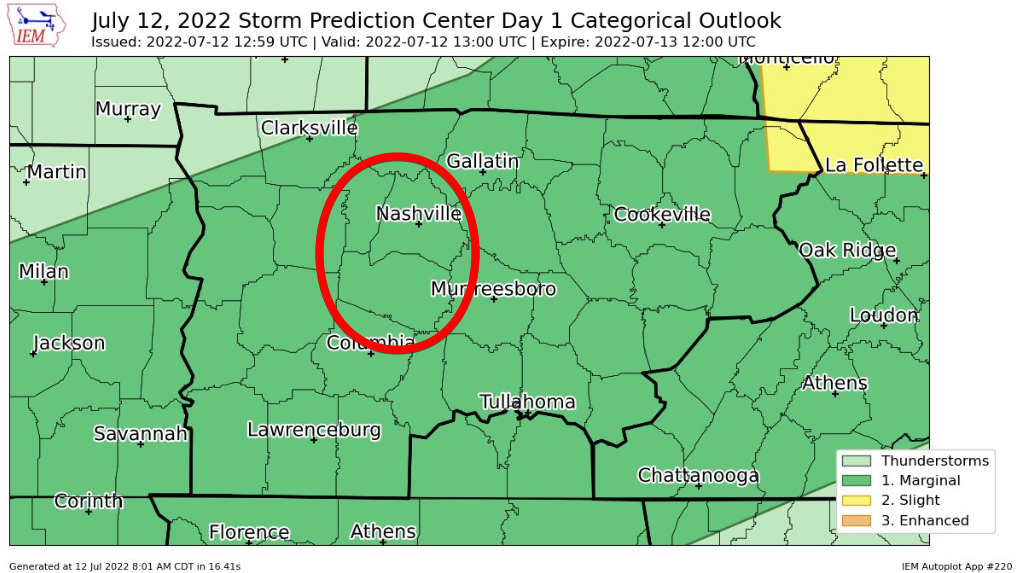
Yesterday’s forecast had wins (HRRR timing on Will Co storms, damaging straight line wind threat) and losses (SPC did not mention hail yet Will Co saw 1″ hail then that storm blew into Marshall Co and dropped 4″ hail on Chapel Hill).
Before storms today, it will be hot. 94° for the high, paired with dewpoints in the low 70’s, giving us a heat index to 101°. Not as bad as last week, but still not comfortable.
Your day throughout the afternoon should be dry.
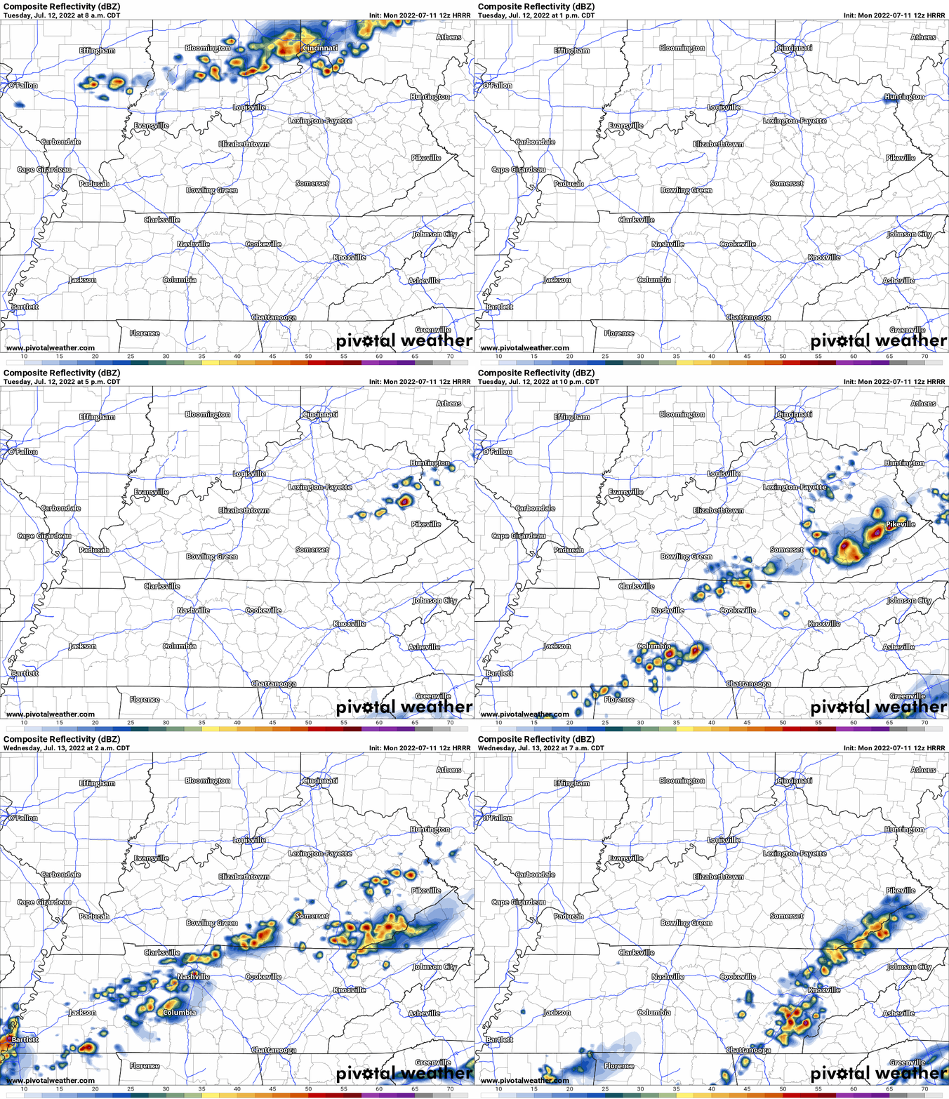
HRRR model thinks a line of rain and thunderstorms will swing out of KY Tuesday (tomorrow) afternoon but fizzle before they arrive here.
Then — right around sundown Tuesday — it thinks storms redevelop and roll off and on until wee hours Weds.

Storms and showers east and south today, I think we stay dry. Humidity also dropping, ending the streak of sweat, in hopelessness and rage, 70° dewpoints delivering oppressive humidity. Dewps today “only” sticky/uncomfortable, mid to upper 60°s, yay? It’s not football weather but at least it snapped a 120 hour 70°+ dewpoint streakdepicted in blue below, a message straight to your soul:
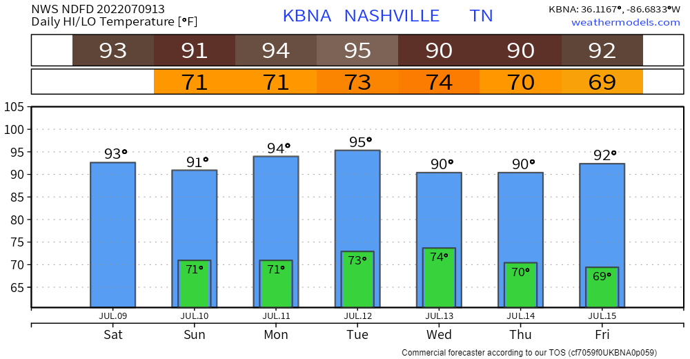
No more upper 90’s, but it will still be in the low 90’s with dewpoints in the mid 70’s, will equal heat index nearing 105°. Better? Yes. Noticeable? Eh.
Looks like we won’t be able to shake the 90’s for a while. Just like all the fashion trends that are still around.
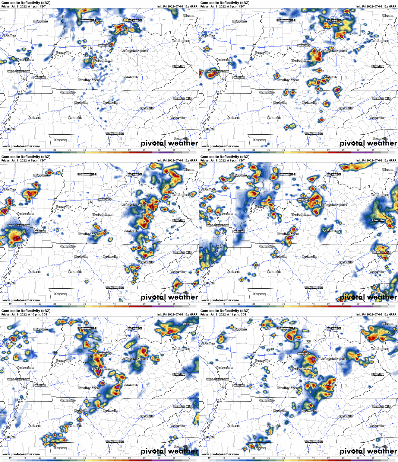
Most of us have struck luck with the Wattery the past two days, bailing us out from the heat index getting to excessive territory. We just need one more day of that.
If not, temps will surge up into the upper 90’s, dewpoints in the mid 70’s = heat index pushing 110°, reason for the Excessive Heat Warning for today.
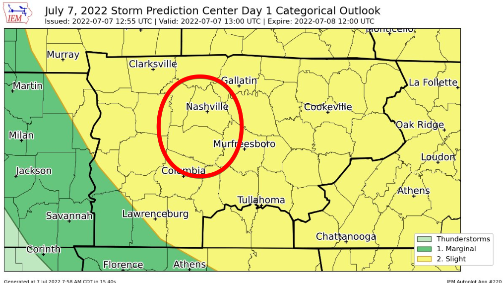
On one edge of the blade, you have super hot, uncomfortable temperature + dewpoint combo, but there is no severe weather. On the other edge, you get kinda hot, but then a shower/storm comes and cools you down. Maybe not the easiest choice. Good thing Mother Nature decides for you.
You must be logged in to post a comment.