THE GOOD NEWS
→ Humidity way down for CMA Fest.
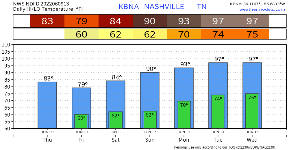
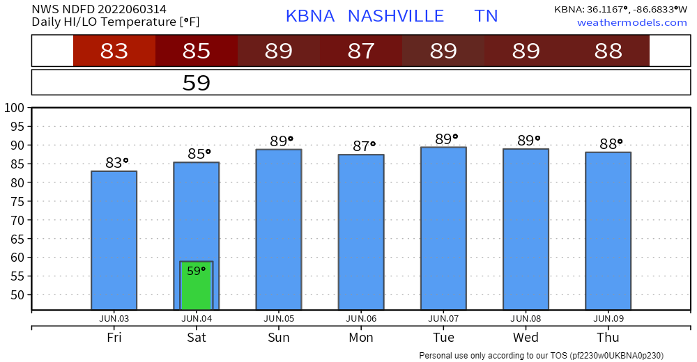
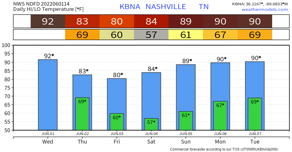
→ Temps cooler than most CMA Fest weekends, the only gripe is Sunday:
→ Only rain in the forecast is maybe Friday with a few light showers in the morning and afternoon possible, HRRR model below:

THE GOOD NEWS
→ Humidity way down for CMA Fest.
→ Temps cooler than most CMA Fest weekends, the only gripe is Sunday:
→ Only rain in the forecast is maybe Friday with a few light showers in the morning and afternoon possible, HRRR model below:
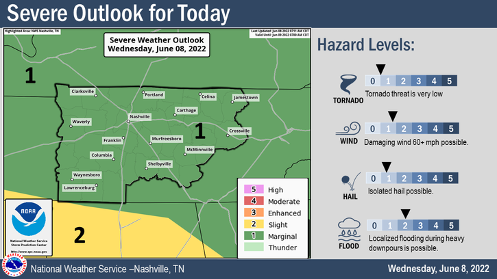
Today looks to be the last day of our three day streak of being outlooked for severe weather. Today is another 5% chance of damaging straight-line winds, hail, and flash flooding within 25 miles. On the bright side, we are yet again not outlooked for any tornado threat.

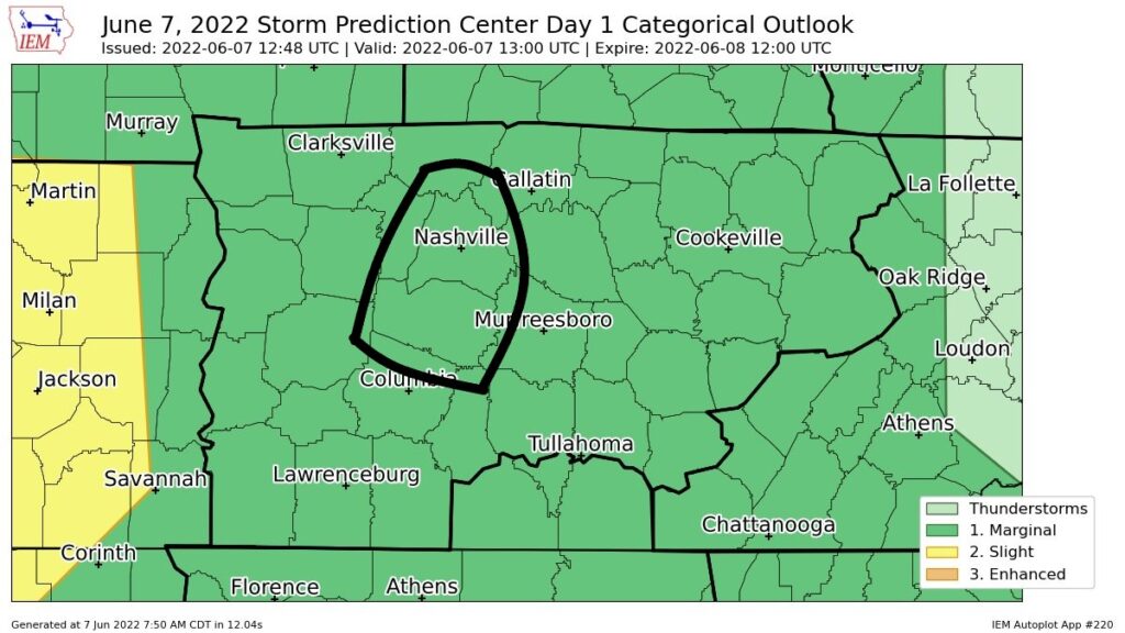
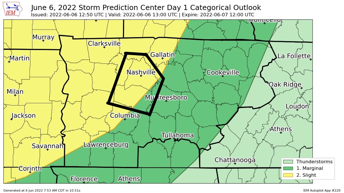
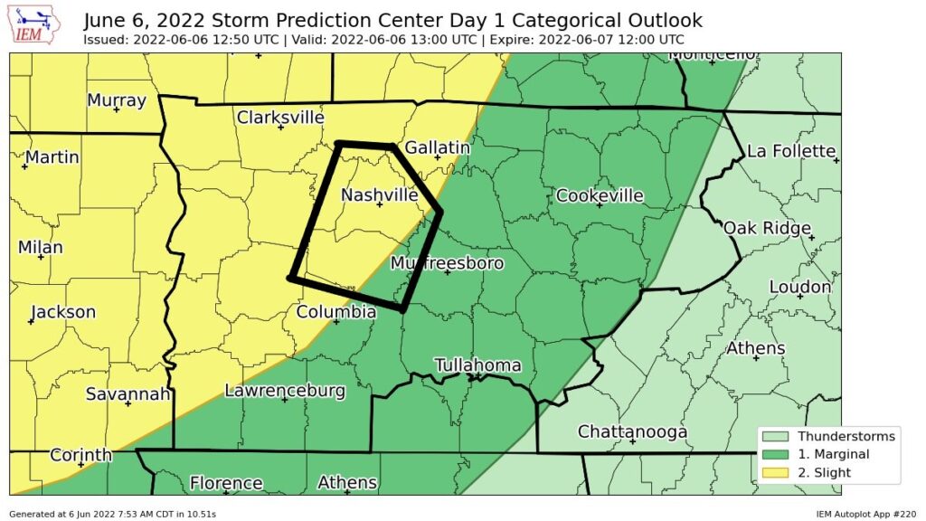
Rain has moved out from last night. SPC has outlooked us again today, 5% chance for damaging winds, hail, and flash flooding. We are not outlooked for a tornado threat, thanks to very little shear.
HRRR model (below) still shows a rough ETA of 5 – 6PM, still may not be exactly right.
The Storm Prediction Center maintained the 2% chance of a tornado within 25 miles for today. There is a 15% chance of a damaging straight-line winds, 5% chance of hail and flash flooding.
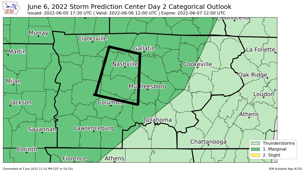
We’re still looking at the possibility of two rounds of severe weather.
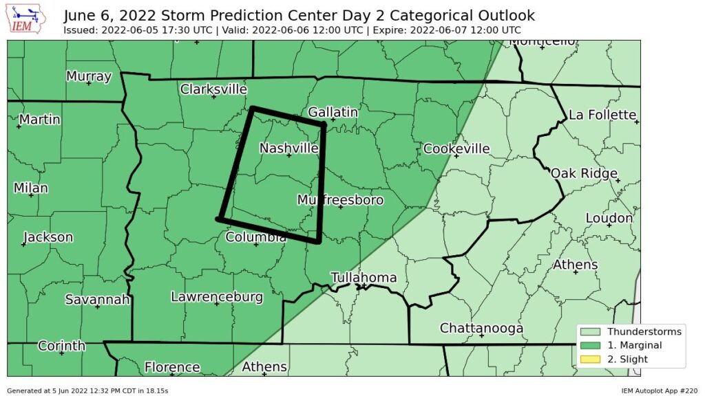
After the lunchtime update from the Storm Prediction Center, we are now outlooked for Monday (tomorrow). Specifically, a 5% chance of a damaging wind event and a 2% chance of a tornado within 25 miles.
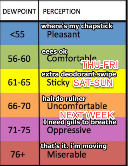
If you like the heat, lower than seasonal dew points, and lots of sun, then buddy, today is your day.
I have a close friend named Fulton, we love to fish together, although we don’t do it often enough. If there was ever a day to go fishing with a friend of yours, then buddy, today is your day. Here’s a limit of walleye from Minnesota we caught in 2016.
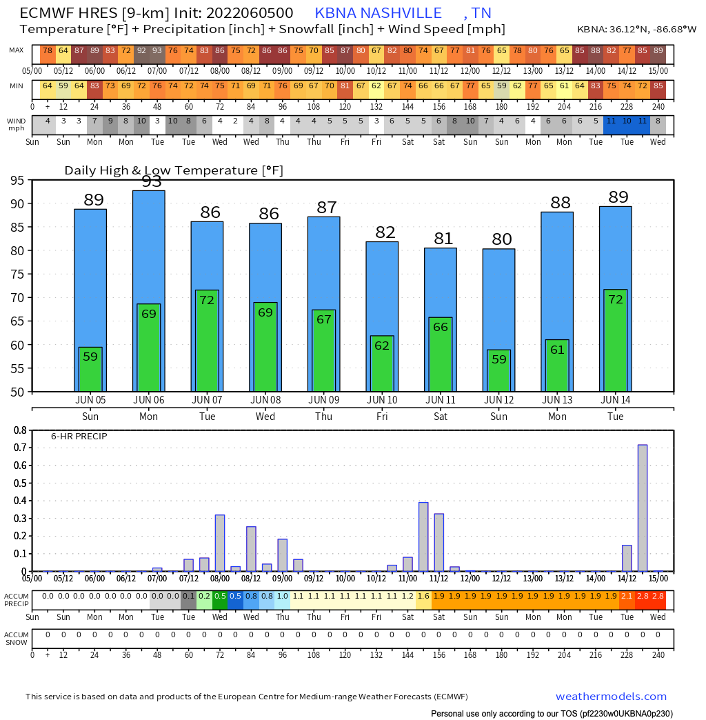
Below normal temps and humidity this weekend. Today will be the nicer of the two days.
I still doubt it’ll rain tomorrow afternoon. HRRR shows very little activity. What little is has is meh. But, we can’t totally rule it out. This is the 12z HRRR model:

Temps drop today and rise only a bit tomorrow. Both below seasonal norms. No rain either day. Comfortable humidity.
→Sunday things start unsettling. Dewpoints and temps start to rise at the surface while winds aloft shift and allow subtle little disturbances to pass overhead. This combo creates random rain and thunderstorm chances for mid-late afternoon through early evening. Rain at your location Sunday is unlikely but cannot be ruled out.

Lightningstorms crossed Davidson & Williamson Co last night (morning?, it was 3 AM to 430 AM). A Dense Dog Advisory was issued (this is a running joke from a tweet typo on 3/30/13, click here for context). Storms didn’t water all yards. They were no big deal other than dogs and startled kids crowding beds (if you were chosen by Thor, LMK).
Today is the first day of meteorological summer. Whether you choose to think it is the first day of summer, or tend to side with the sun, moon, and stars, and wait until June 21 is entirely up to you. Maybe summer is just a mindset.
You must be logged in to post a comment.