
Rain and a few nonsevere lightning storms should be around Middle Tennessee today. Most models think so, not all of ’em. None agree on exactly where so let’s all cross our arms and look at the models disapprovingly. Models don’t care tho, they show:

Rain and a few nonsevere lightning storms should be around Middle Tennessee today. Most models think so, not all of ’em. None agree on exactly where so let’s all cross our arms and look at the models disapprovingly. Models don’t care tho, they show:
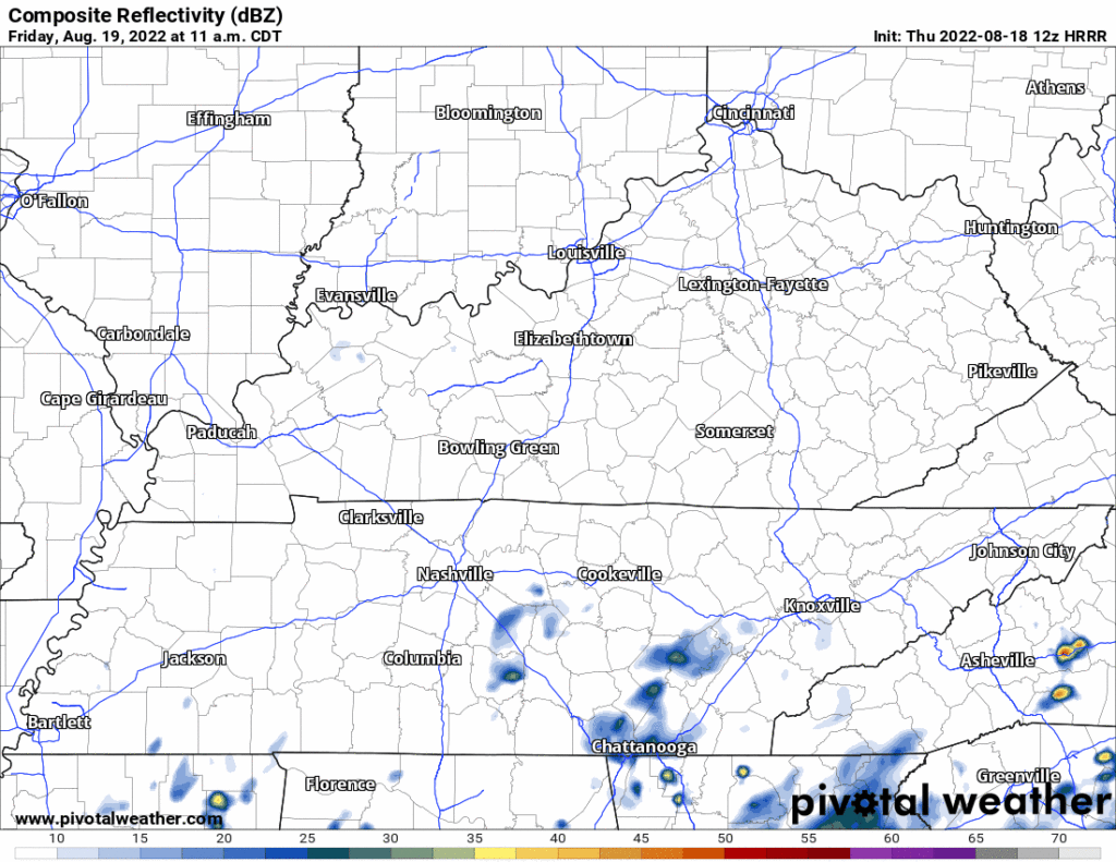
Rain is not expected today. The HRRR has a few showers widely scattered around Middle Tennessee late tonight. Nothing consequential.
More humidity starting Thursday and lasting through the weekend (at least). The Wattery may choose you with a downpour or lightningstorm, so for most of you reading this you likely won’t see anything. Typical August weather, you need to be prepared for an afternoon or early evening downpour or ⚡.

First can I please say this was harsh. There are now weather vacancies in Hungary.
All the rain is south of us today. It may flood today in northern Louisiana into west central Mississippi so if you’ve got fam down there heads up.

Boring, “normal” week ahead.

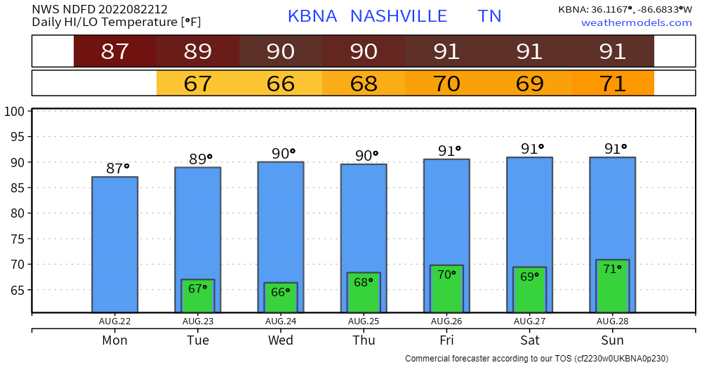
Temps normal for late August.
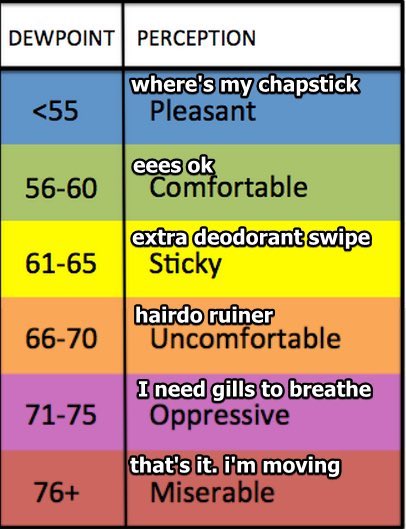
Humidity kinda low for late August, dewpoints in the low 60s.
It probably won’t rain here Weds afternoon and Thursday, but rain then is possible. Rain this week is expected to slide south of us through Mississippi-Alabama-Georgia with some flooding risk down there. Models think there’s a 10% probability some of that rain will sneak north and splash us Weds, with around a 30% to 40% probability Thursday (see below).

The million dollar question – “will it rain again today?” We’ve already used all our lifelines, so we are in a tough position. Good thing we have help from models.
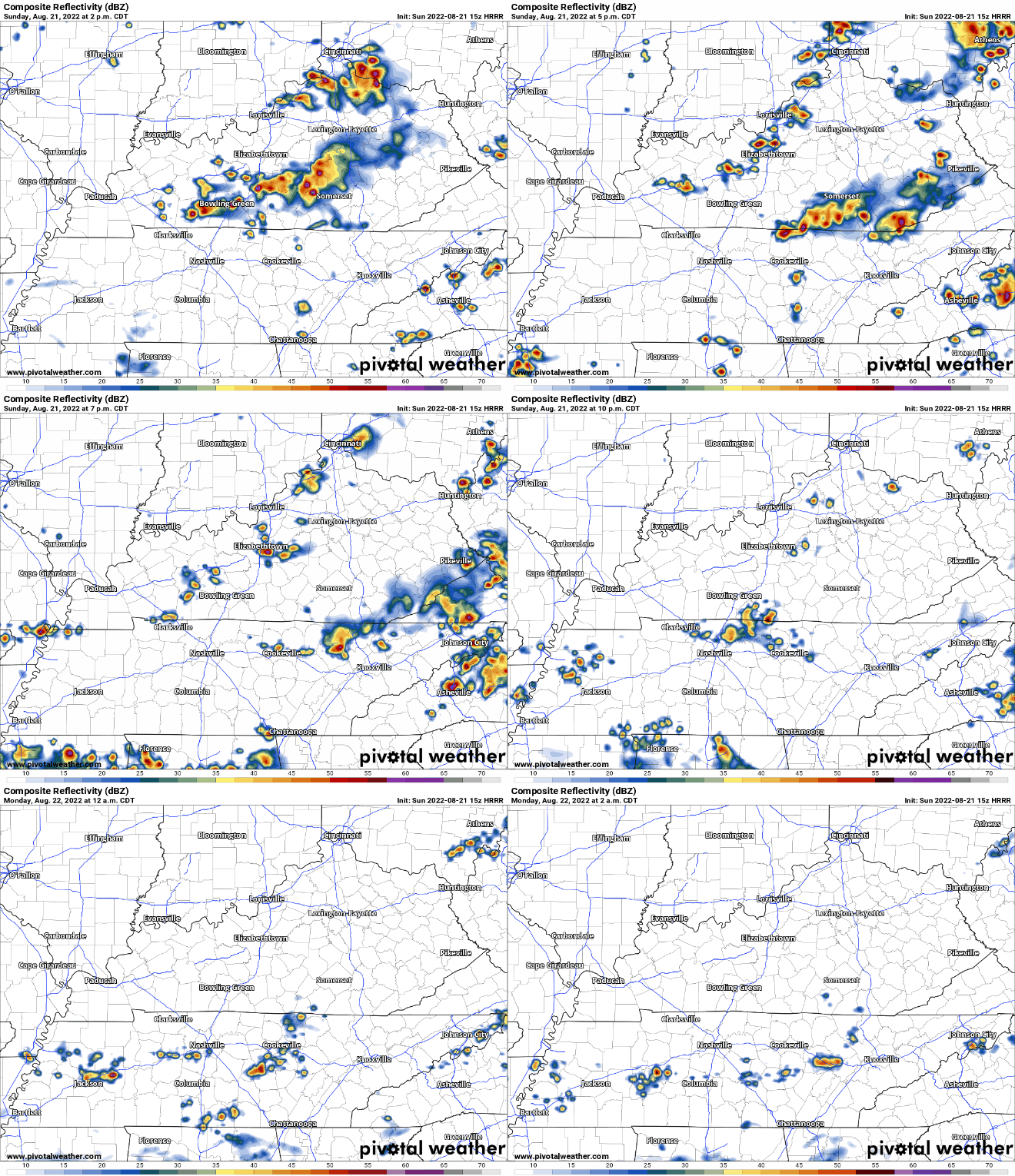
HRRR model (above) is leaning towards very few showers/lightningstorms. It wants to think the line coming in from Kentucky falls apart before it can affect the soccer game.

Ongoing showers/lightningstorms will continue through the afternoon/evening, clearing out (hopefully, no pinky promises) for nighttime activities – including good ole’ Titans preseason. Things could very well change, we’ll be posting all the updates on Twitter. Below is what the HRRR model thinks will happen. A good amount of these storms will contain lightning, which is sorta (very) dangerous – when thunder roars, go indoors.

Remember when we were all SMHing over the 90° days? We were looking at August coming with the dread and Oh Noes? Well…
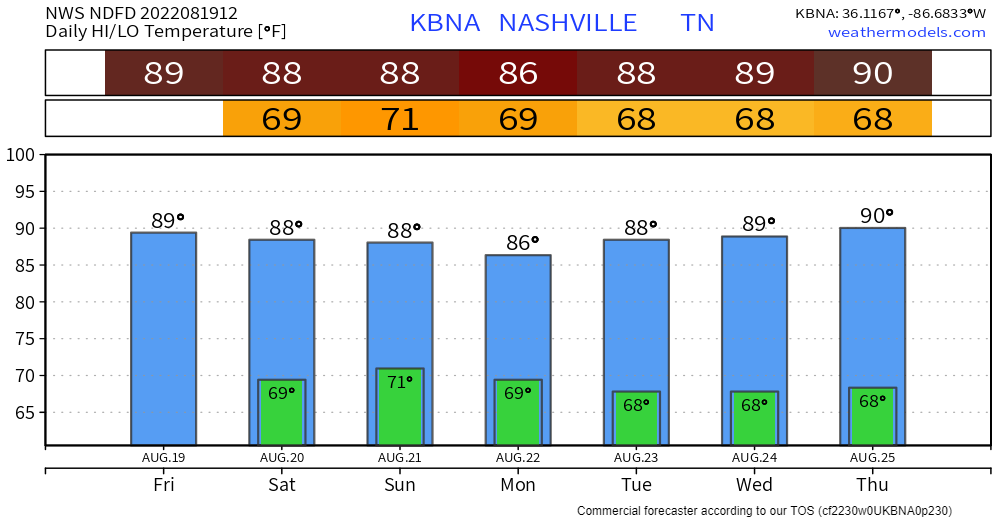
Just one 90°.
Humidity up to uncomfortable levels is teaming with Other Atmospherey Things You Don’t Care About to create a weekend full of so-so rain/lightning chances.

89° is the mid/late August average high.
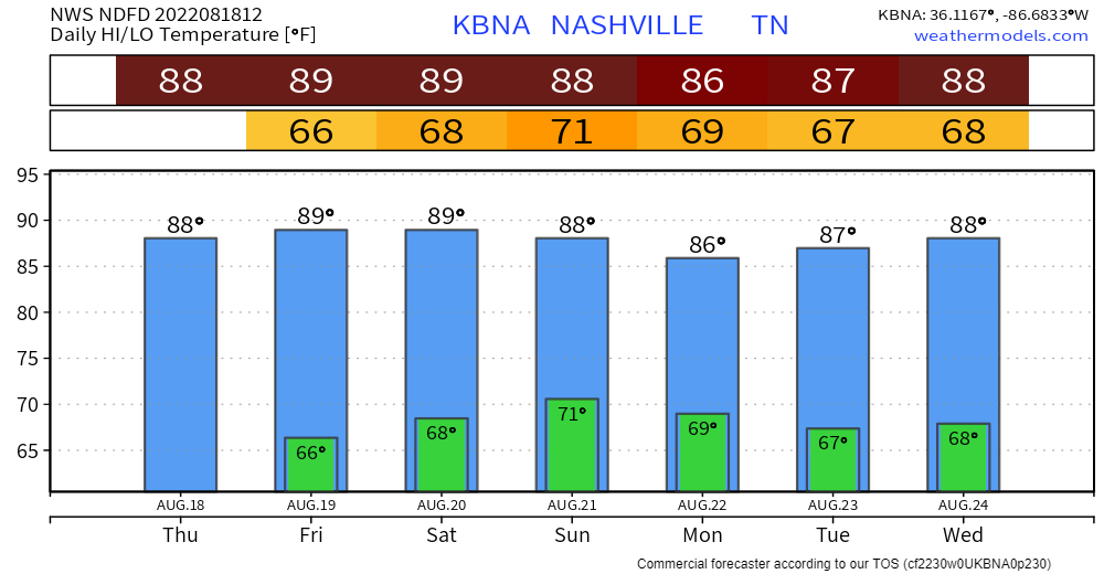
Great job everybody:
No tornadoes in this forecast but there is rain:
Quick References:

Weather changes constantly.
Follow @NashSevereWx on Twitter for any changes to this forecast.

Fog should mix out around 9 AM. It’s not gone in the classic sense, it still exists, it just won’t be here for a long time.
Rain in West TN this morning should miss us. Models pass it south of us:
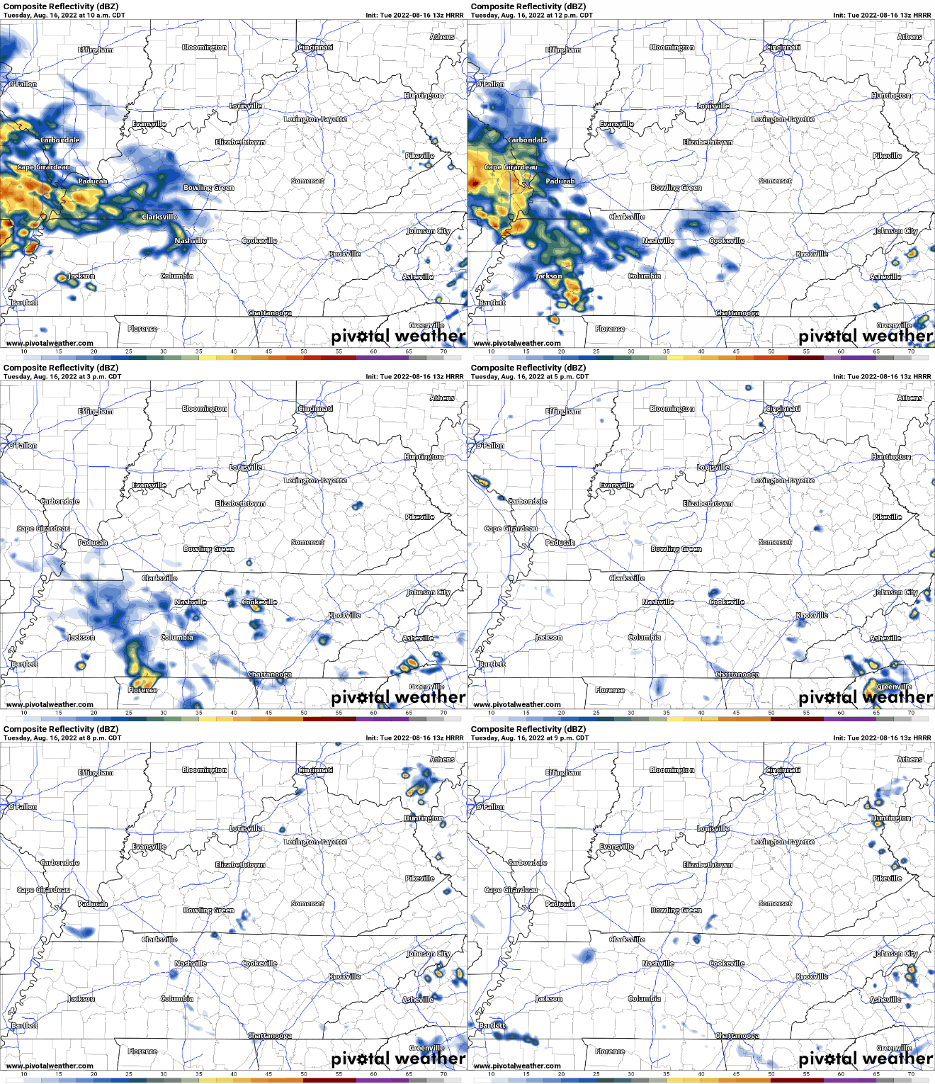
Light showers will arrive through the day as “I-24 Specials,” our term for weather that comes down the tracks of I-24 from Kentucky. The HRRR thinks these showers will not increase in intensity on our radar scopes during the day. In fact, they may struggle as they come through. The 13z run of the HRRR through 9:00 pm:
You must be logged in to post a comment.