Throughout today, we’re expecting to see some scattered showers. Some of these individual clouds could drop some heavy rain and wind. No need to cancel daytime or dinner plans, but carry an umbrella in case the rain scatters on you.

Throughout today, we’re expecting to see some scattered showers. Some of these individual clouds could drop some heavy rain and wind. No need to cancel daytime or dinner plans, but carry an umbrella in case the rain scatters on you.
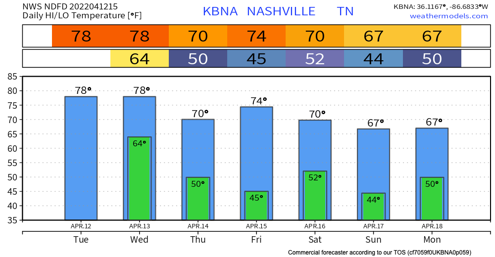
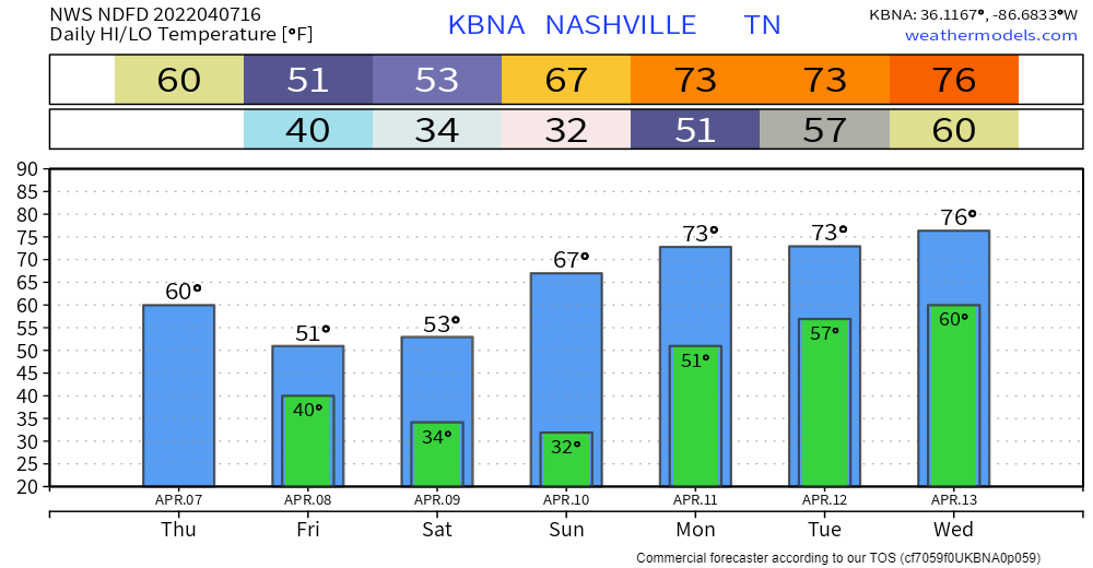
The cold front associated with yesterdays storms just passed through our area. This leaves us a little cooler for the rest of the week. Temps cool to the mid 60s by the holiday weekend.
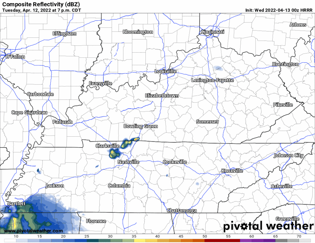
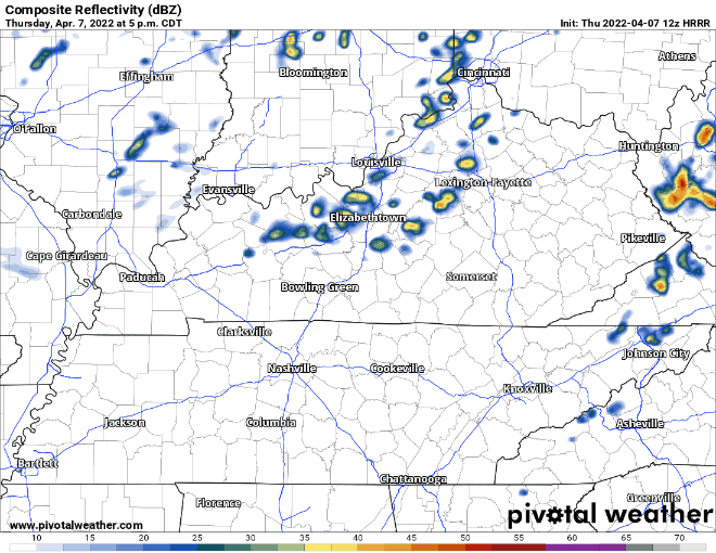
We’re taking a short break from the rain. Today and most of tomorrow will be dry. Next chance for rain comes in Friday evening. GFS and Euro models scatter showers around town Friday evening after dinner time and continue through the overnight hours. The HRRR has a higher resolution take and shows the rain getting here after midnight Friday night:

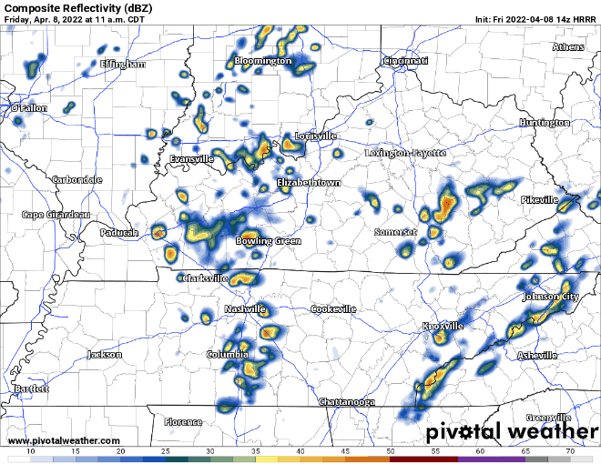
Scattered showers throughout the area so far this morning. Note that this is NOT the potentially severe event of the day. We’ll have a break in the rain this afternoon before tonight’s line of storms.

Quick References:
Weather changes constantly.
Follow @NashSevereWx on Twitter for any changes to this forecast.
Live coverage during tornado and severe thunderstorm warnings:
Look good.
Support the mission.
Most, if not all of the rain has moved out for today. One flood advisory remains at press time, Whites Creek near Bordeaux. Many creeks are high right now, take extra caution if you live or work by one. Turn around don’t drown.
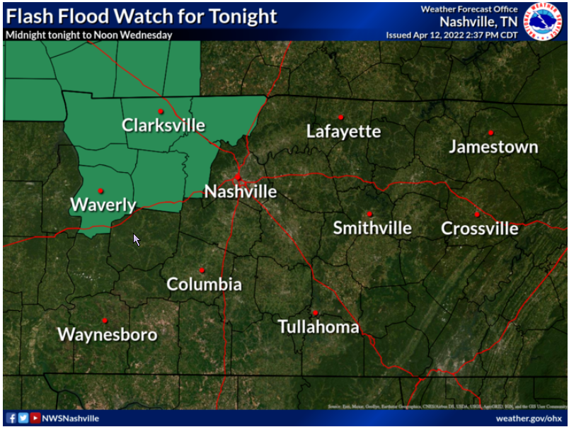
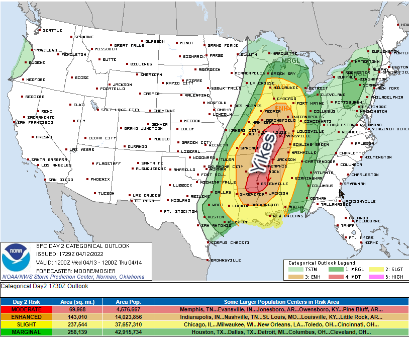
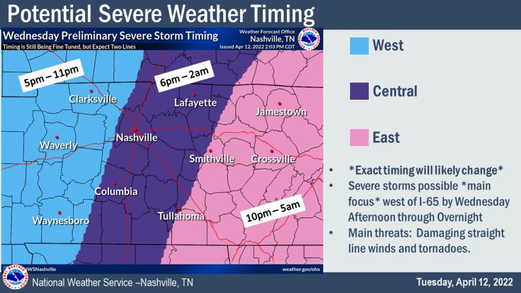
A wet, weather-filled week is ahead of us. Two rounds of potential severe weather are coming our way this week. Starting off with today:
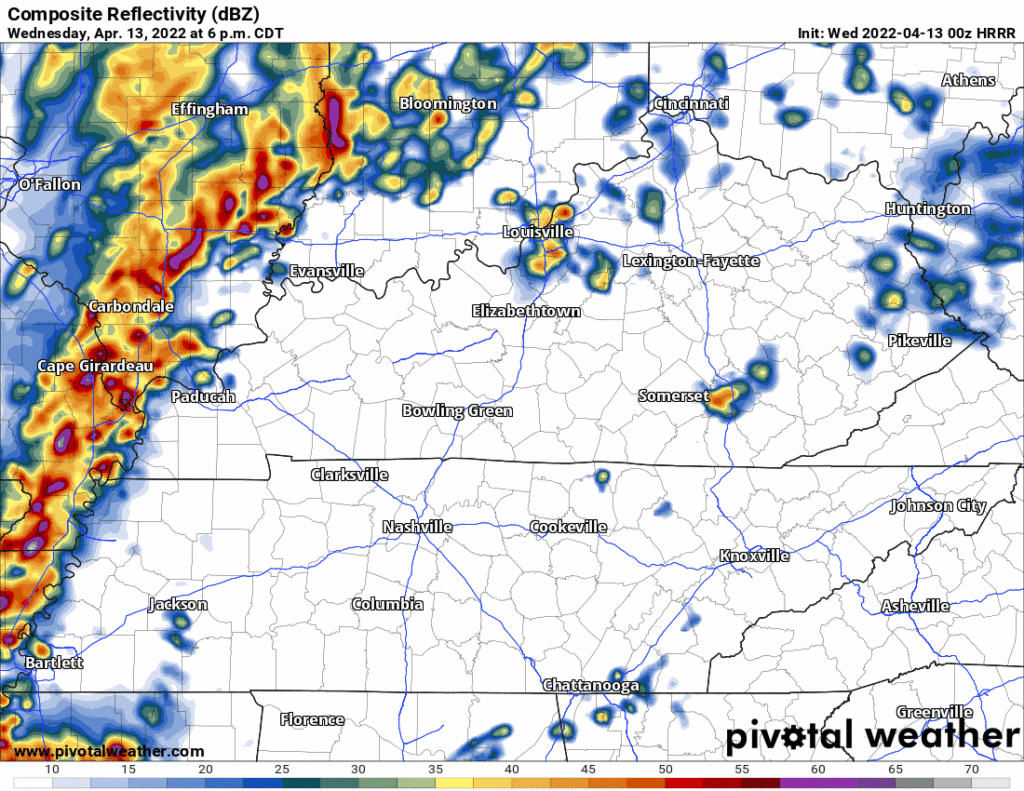
Showers persist today with a small break in rain this afternoon for some of us. HRRR model below has strong storms coming into our area after sunset. These continue into the overnight hours and should be out of our area by Tuesday morning.
Sunday will be warm and sunny. A little breezy, too. Perfect day to get outside, enjoy it because rain is coming.
Monday will bring on and off rain showers and storms. Classic spring weather. Expect more “off” than “on” rain. Nothing severe is expected. There could be some lightning and thunder, but that’s it. ETA looks to be just before lunchtime. See HRRR below:
We are on the last day of the cool trend of last week. Todays temps will be in the mid 50s. Lows will be in the mid to low 40s. There was a frost advisory and it expired earlier this morning.
No rain expected today. It’s east of us. HRRR below:
We will continue to see scattered showers for the rest of the day. Some sleet and graupel has fallen in some part.
Some rumbles of thunder are possible with a few of these storms, but nothing to be concerned about. As temps drop, some of these showers could be a little winter-y, but this is mostly to our East
Temps down a good bit from yesterday. Mostly quiet today except for maybe an inconsequential PM shower or two.
Chances for rain go up tomorrow. Scattered showers throughout the day. No strong/severe storms expected… Can’t rule out the occasional rumble of thunder. Not much accumulation expected with this system. No flooding concerns here.
You must be logged in to post a comment.