
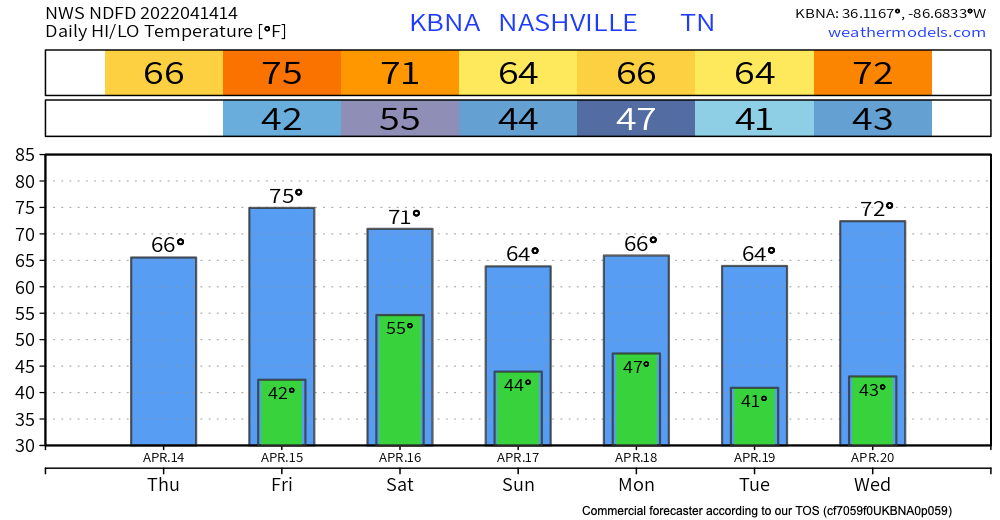
The cold front associated with yesterdays storms just passed through our area. This leaves us a little cooler for the rest of the week. Temps cool to the mid 60s by the holiday weekend.
We’re taking a short break from the rain. Today and most of tomorrow will be dry. Next chance for rain comes in Friday evening. GFS and Euro models scatter showers around town Friday evening after dinner time and continue through the overnight hours. The HRRR has a higher resolution take and shows the rain getting here after midnight Friday night:
These showers could have a thunderstorm or two but anything strong or severe isn’t expected. Rain should be departing by the time the sun comes up Saturday morning. It may be too wet to golf or rolly ball but I think it’s premature to start canceling stuff.
Rain is possible on Easter Sunday. Euro model has showers in the early morning Sunday with a couple sprinkles throughout the day. GFS holds the scattered showers off until Sunday afternoon. Sunrise services may be interrupted but let’s wait for the higher res models to arrive tomorrow before worry about having to move anything inside.
The safer bet for rain is later in the day Sunday night into Monday morning. That looks like a good bet right now. Nothing strong/severe.
In fact, the medium range models are pretty quiet for the next week-ten days. Medium range models aren’t super reliable though, but it’s a good sign considering we’re in the thick of severe storm season.
Quick References:
Weather changes constantly.
Follow @NashSevereWx on Twitter for any changes to this forecast.
Live coverage during tornado and severe thunderstorm warnings:
Look good.
Support the mission.
We are 100% community supported. No ads. No subscription fees. Keep it free for everyone.
Categories: Forecast Blogs (Legacy)
You must be logged in to post a comment.