

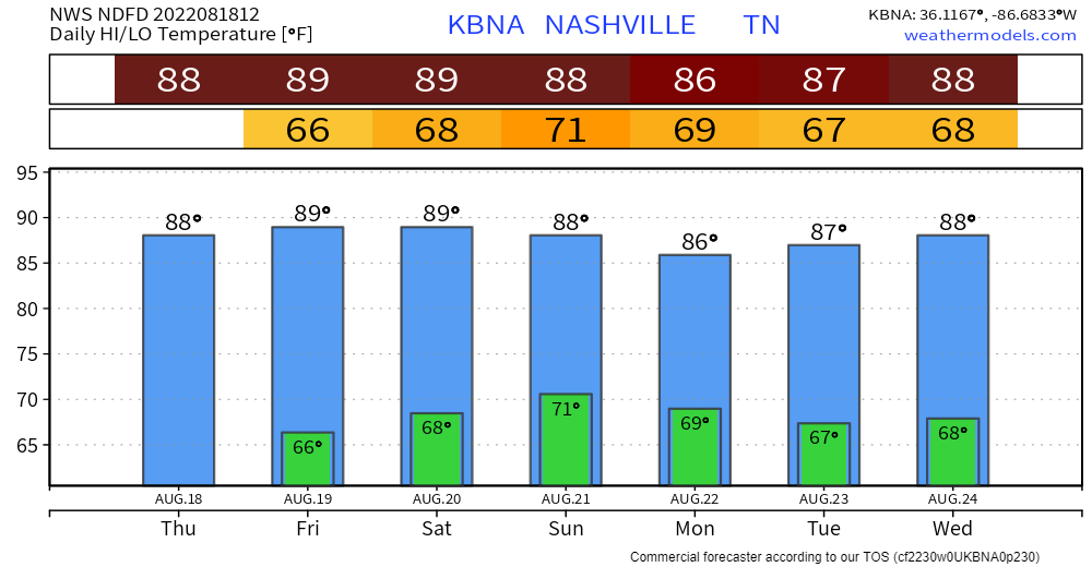
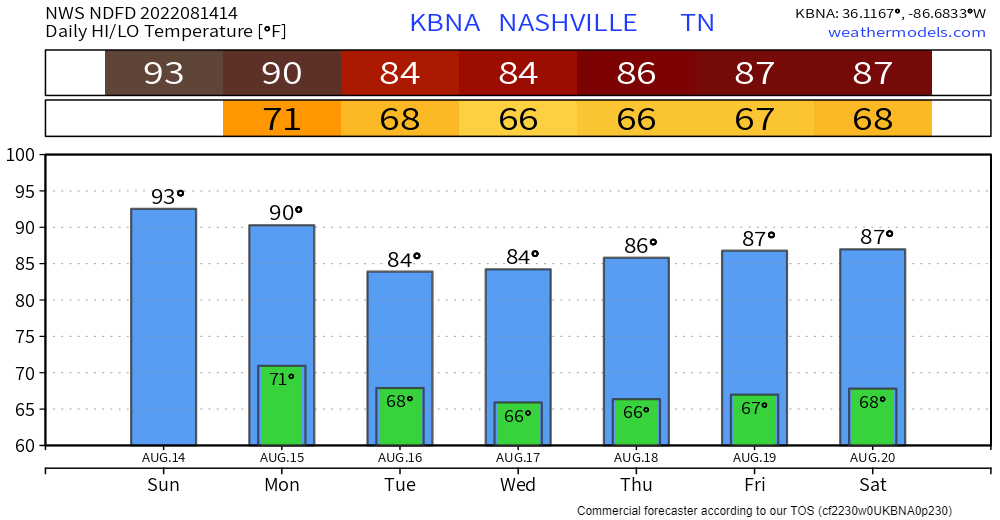
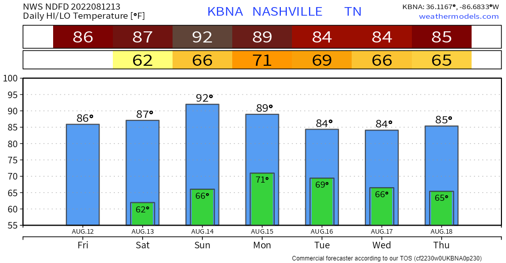
89° is the mid/late August average high.
Great job everybody:
No tornadoes in this forecast but there is rain:
- Today, Gore-geee-usss (for August). After today not so much, but not so bad.
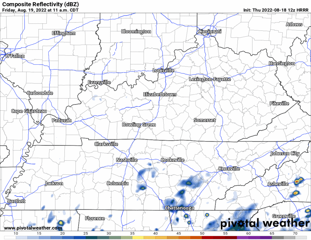
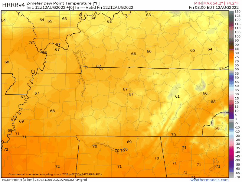
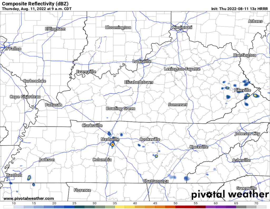
- We may encounter Friday afternoon/evening downpours and lightningstorms scattered around Middle Tennessee. Be lightning safe during HS football games and whatever else it is you’re doing. Most games should be OK but we don’t know which. Here’s the HRRR model (the NAM isn’t quite as stormy):
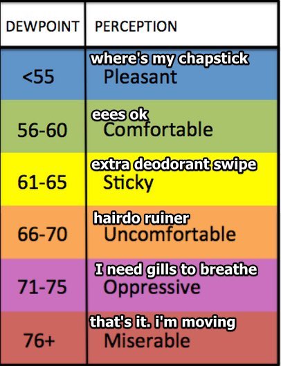
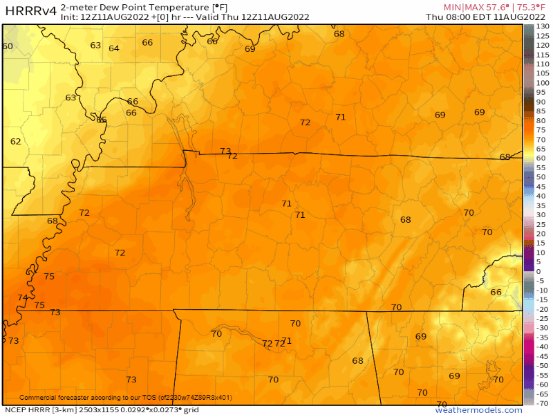
- Humidity will jump up to Sticky & Uncomfortable beginning Saturday.
- Beginning Saturday through next week, the nerdy sciencey things that make rain will kinda come together to create rain chances without the specificity and timeliness you prefer. I am sorry about that. Midwest low pressure, Canadian upper level low, and about eleventy billion other things, all of it moving at varying rates according to various models, will generally make rain possible here in Tennessee, what a world.
- Rainfall totals look modest, below flash flooding levels.
- No tornado, no hail, no damaging straight line wind events expected. But sure, there may be lightning.
- The most likely time for rain/storms is Sunday night. Confidence level is buns.
Quick References:
Weather changes constantly.
Follow @NashSevereWx on Twitter for any changes to this forecast.


You must be logged in to post a comment.