
A wet, weather-filled week is ahead of us. Two rounds of potential severe weather are coming our way this week. Starting off with today:
Storms Later Today
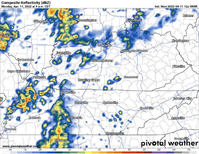
Showers persist today with a small break in rain this afternoon for some of us. HRRR model below has strong storms coming into our area after sunset. These continue into the overnight hours and should be out of our area by Tuesday morning.
Our counties are in a marginal risk(1/5) for severe weather today. Although the risk isn’t the greatest, a few severe storms are possible tonight. Since it is a night-time event we need to take more caution.
The main concerns with these storms are localized flooding (due to multiple rain events today) and damaging winds up to <60 mph. Hail is not expected. As we know with being in the South in springtime, we cannot rule out an isolated tornado although the risk is low.
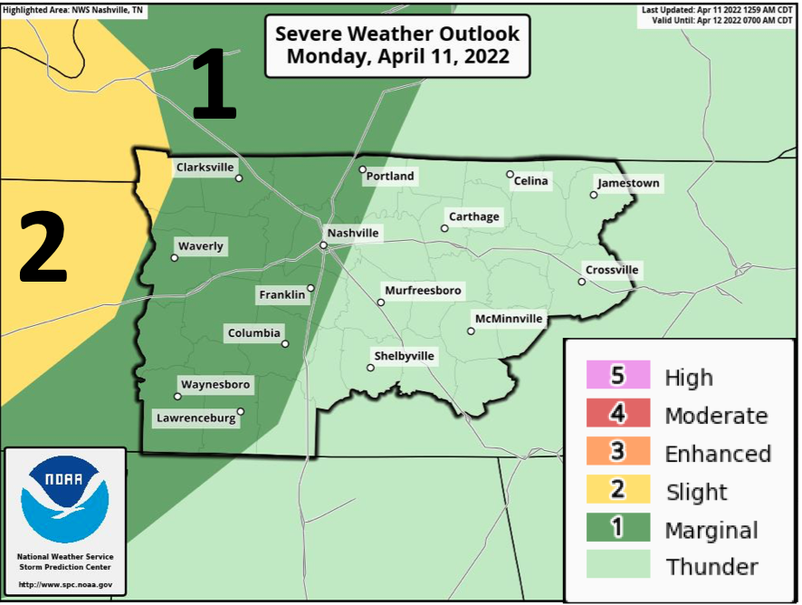
Since this event is looking to take place after sunset, make sure to have a way to get alerts especially if your power were to go out with those high wind gusts. If you are in a usually low spot or an urban area be on the lookout for potential flooding, turn around don’t drown.
For Tuesday we should have a break in the rain during the day. Some of us may see a sprinkle but storms are not expected.
Severe Storms Possible Wednesday
Rain comes in early Wednesday morning with scattered showers throughout the day. Storms ahead of the cold front come into our area late afternoon/evening time. Models have the line moving out of our area in the early overnight hours.
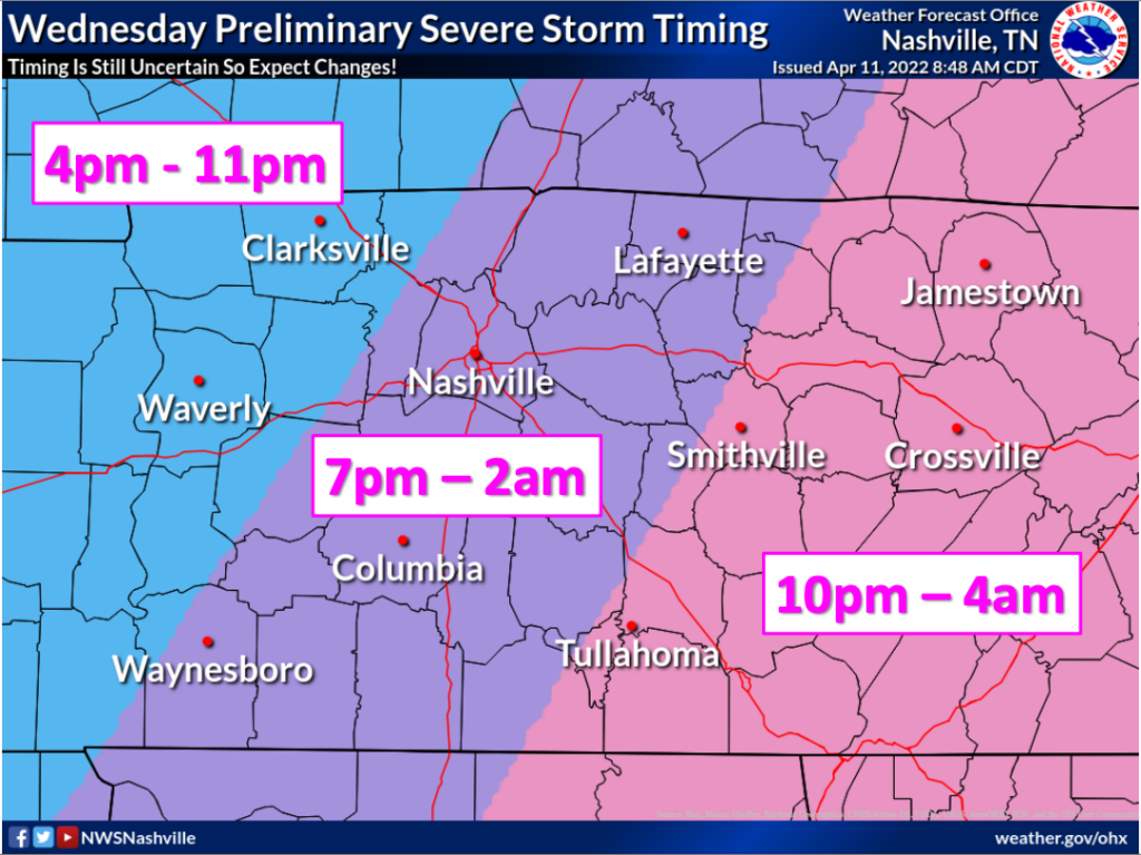
Davidson and Williamson counties are mostly included in a slight risk(2/5). The enhanced risk line stops at the edge of our counties, see graphic below. NWS says that the best threat is west of I-65. Because of the good storm ingredients available including decent shear and instability, NWS advises to prepare for all concerns that come with severe weather.
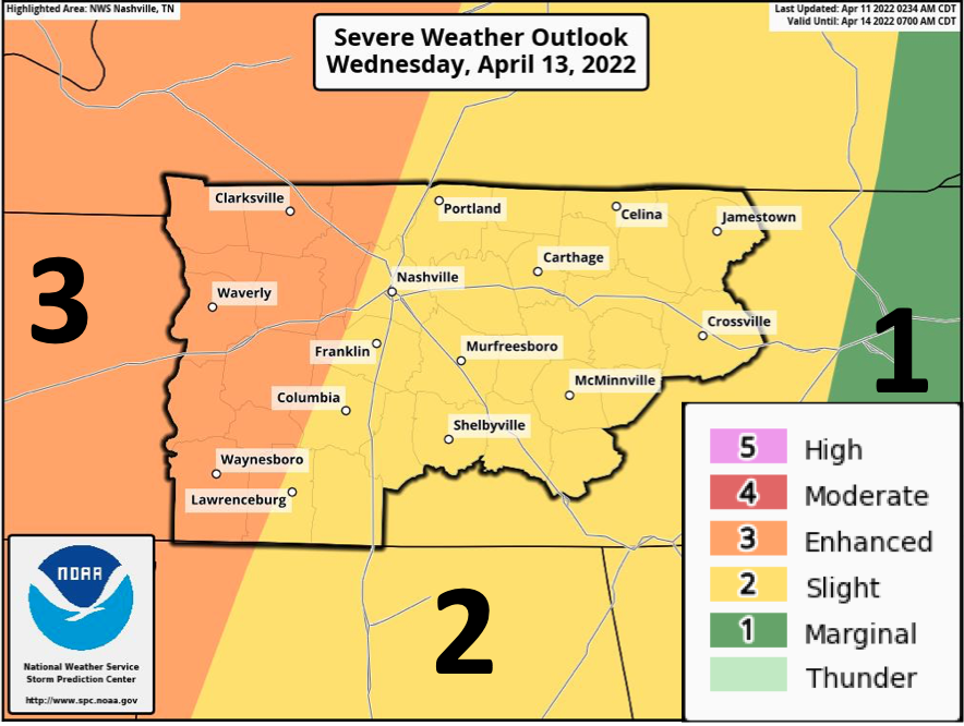
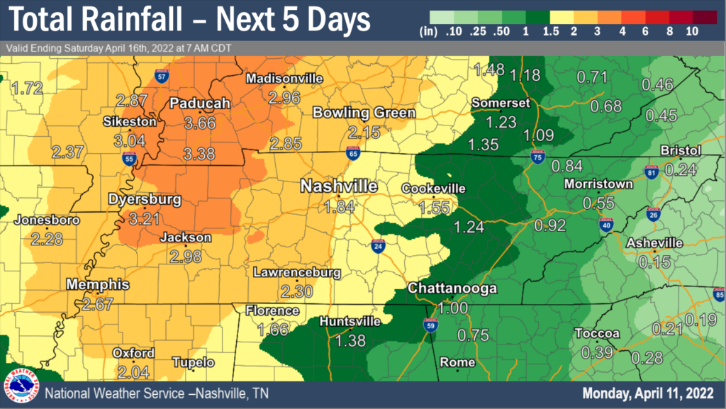
Flash flooding is possible especially because of the already saturated ground from earlier rain events. Our counties could see up to 3″ of rain from this week’s rain.
Be prepared for possible strong wind gusts, tornadoes and hail. Since this is a nighttime event, again make sure to have a way to get alerts. Alerts on your phone are great if you are in you are in your safe spot and cannot be glued to the TV or if your power goes out.
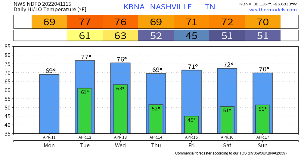
After this system we stay in the 70s and dry for a couple of days with the next rain chance coming at the end of this week. Models are unsure about timing with this and if it will land on Easter. Will keep you updated.
Quick References:
Weather changes constantly.
Follow @NashSevereWx on Twitter for any changes to this forecast.
Live coverage during tornado and severe thunderstorm warnings:
Look good.
Support the mission.
We are 100% community supported. No ads. No subscription fees. Keep it free for everyone.
Categories: Forecast Blogs (Legacy)
You must be logged in to post a comment.