Pop-Up Shower Chances Return Tomorrow
Tomorrow looks to be a pretty close repeat of today. The only differences for tomorrow will be that our high temps will reach the mid-90s and we will have to re-introduce those summertime pop-up shower chances.

Tomorrow looks to be a pretty close repeat of today. The only differences for tomorrow will be that our high temps will reach the mid-90s and we will have to re-introduce those summertime pop-up shower chances.
Heading out the Sounds game tonight? Other than wiping off your seat, we will remain dry!
GFS Model Through Tuesday AM
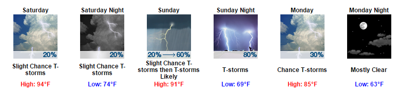
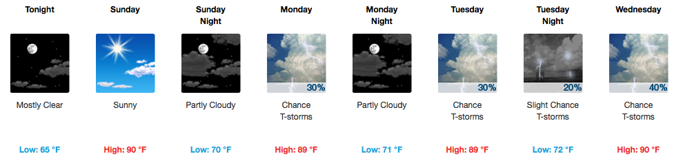
A continued string of hot and humid days is expected into the weekend, so don’t forget to throw in those pesky afternoon storm chances each day! Sunday looks to be oppressive humidity/heat-wise, and is also when our much greater chance for more widespread rain and thunderstorms will return. A cold front will clear through the area on Monday bringing drier and a *little* cooler air (89ºF for next Tuesday afternoon instead of the recent low to mid 90s).

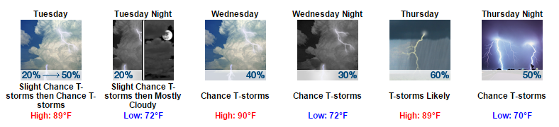
Another batch of early morning sunshine is expected tomorrow with highs reaching into the 90s. By the afternoon, showers and thunderstorms could develop with some becoming severe.
Once we reach the afternoon hours, it will become fair game for showers and thunderstorms to develop. Models are a bit inconsistent when it comes to timing for tomorrow, hence the large time frame.
A couple more pop-up showers/storms are possible this evening but should be gone shortly after sunset. If you get underneath one of these, the temperature will likely drop about 5-10 degrees.
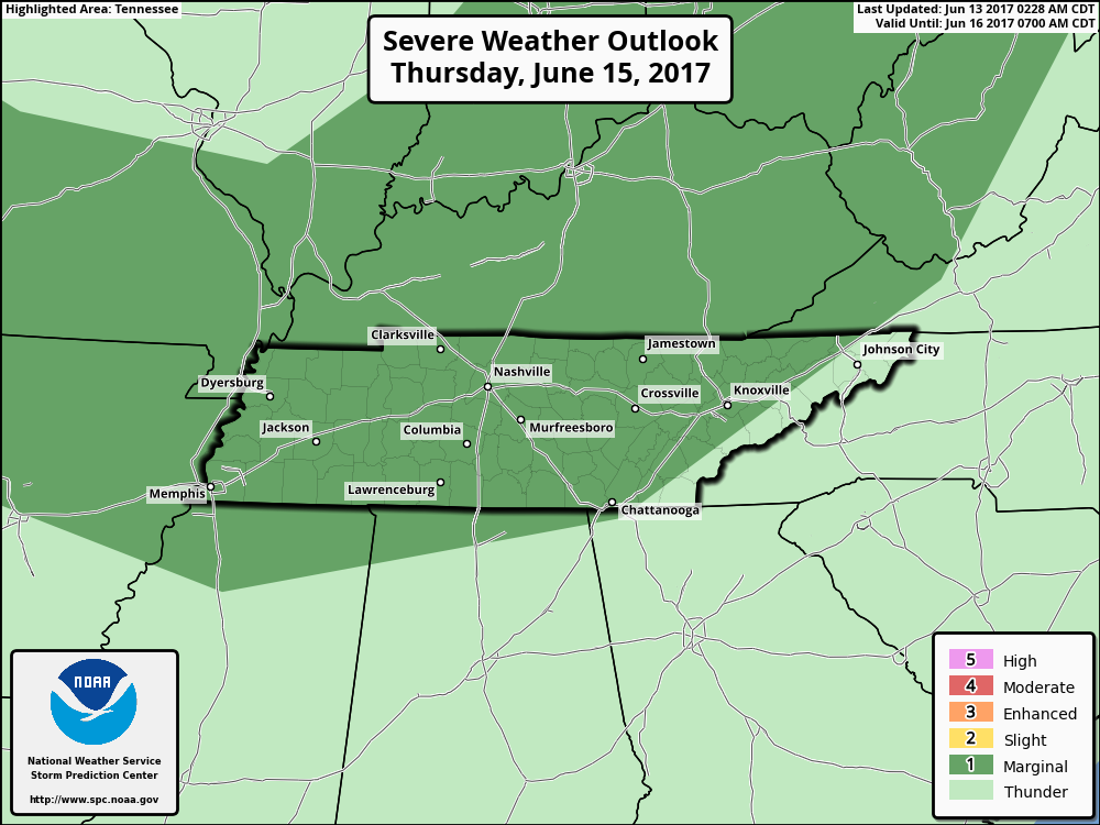
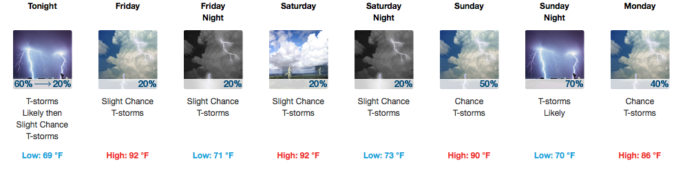
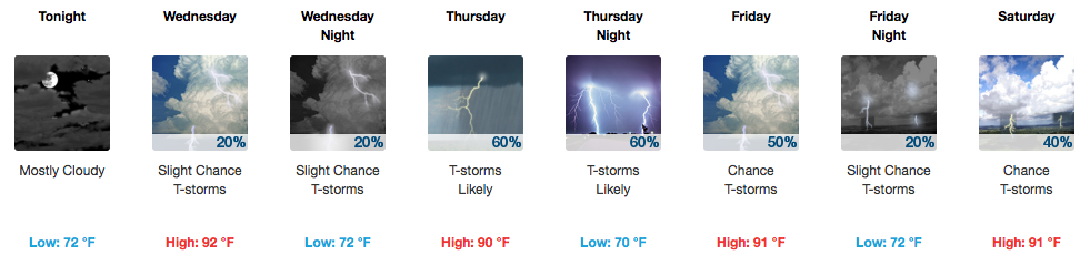
The Storm Prediction Center has placed all of Davidson/Williamson counties under a “Marginal Risk” for severe weather on Thursday. Marginal hail and wind gusts are the main threats with any storms that get going. There will likely be better coverage of rain, so the umbrella would be more useful Thursday than with these other pop-up PM storms.
It’s that time of year again. A couple of summer-like days will start the week with sunny skies during the days with highs topping off in the upper 80s. Dew point temps will reach into the low 70s now through Wednesday, ushering in those very uncomfortable outdoor conditions.
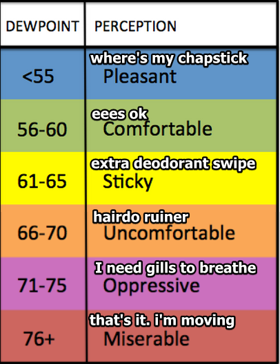
Humidity increases tonight. The dewpoint will rise past past 65° around 7 PM and settle in around 67° by 10 PM, which will be more humid than it’s been all week. Even though the temp will drop into the 70°s by 10 PM, those of you outside will be looking for water. It’ll be that humid.

A lot of big names are playing today/tonight at bonnaroo and the weather really couldn’t be much better for this time of year. It will be warm and *slightly* more humid than Thursday and Friday, but overall, it’s another great day for festival-goers.
Abundant sunshine will help to warm our afternoon temperatures into the upper 80s today. A return of southerly winds will increase our humidity ever so slightly, definitely becoming more noticeable by tomorrow. We will be in the “eees ok” category today, based on the dew point table below:
Sunny skies and temps on the rise now through the weekend. Tomorrow, dew point temps will still remain in the semi-comfortable upper 50s.
Whether you are planning on heading downtown this weekend for CMA Fest or to watch the Preds on Sunday night, looks like a fantastic weekend to be in Nashville!
More sunshine in store and the forecast continue to look great. Temps will rise through the weekend with highs today reaching the 80s, tomorrow reaching the mid 80s, and on Sunday reaching the upper 80s.
You must be logged in to post a comment.