Warmer, Humidity Going Up, and Storms Possible

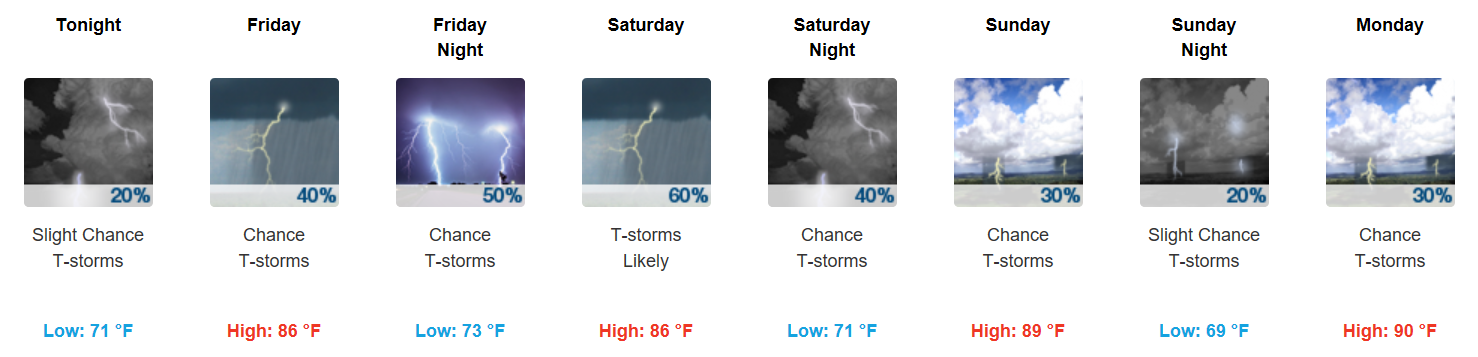
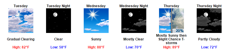
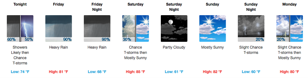
Opportunity for Rain/Storms Begins Today

Update: We’ve seen a few showers and storms roll through the bi-county area today. These should dissipate in conjunction with sunset, but heavy downpours remain possible through the evening.

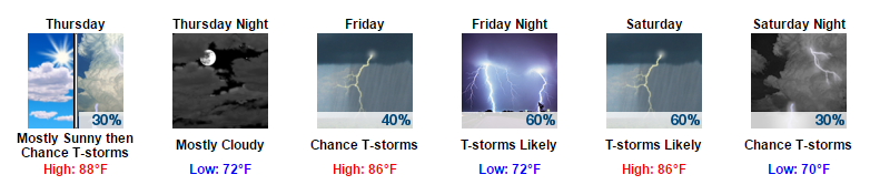
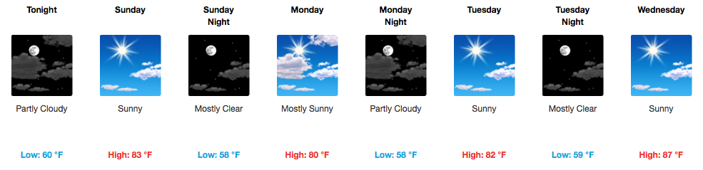
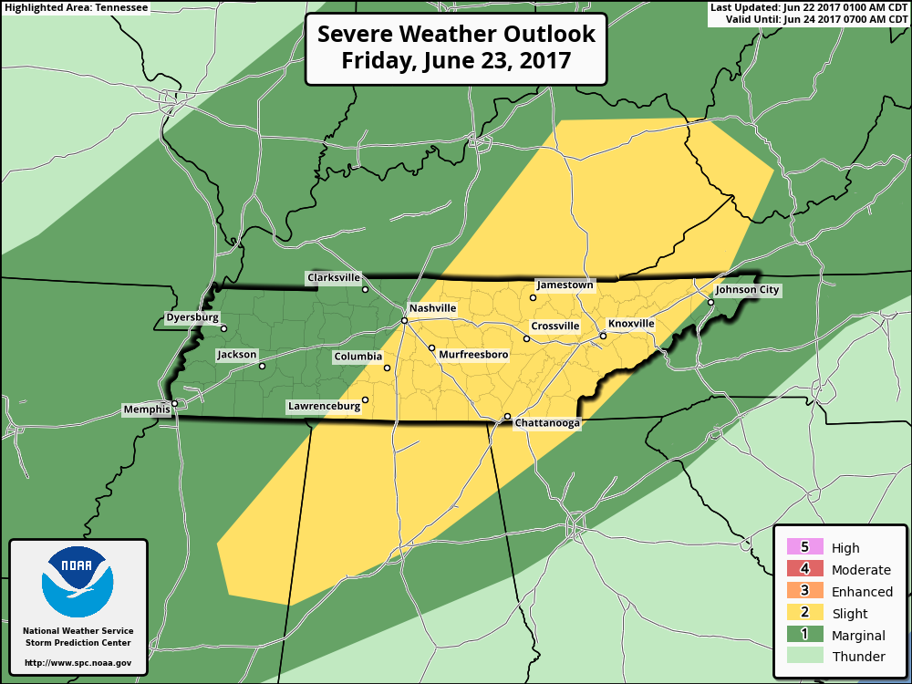
Friday will provide increased rain chances, but particularly Friday night into Saturday. We will need to carefully monitor the potential for strong/severe storms on Saturday. While shear values are not very impressive, instability is high enough that when combined, could produce a few misbehavers. The biggest concerns would be hail and damaging winds on Saturday. All of that being said, we are not yet under any formal severe risk. read more

Transitioning Back into Those Summer-Like Temps Tomorrow

Clear Skies into the Evening

Today appears to be our last day without those afternoon isolated shower chances. Enjoy our one last semi-bearable day.

https://giphy.com/gifs/scared-chris-farley-NIvUx6LX6w3lu

Into this evening, clear skies will prevail. Temps will not drop as low as they have in recent times, with overnight lows only expected to reach down into the low 70s. read more

Comfortable Temps to Start the Week, Hot & Muggy to End

Some Showers Overnight, Clearing Tomorrow

Into this evening, all evening plans are a go. Enjoy the cool temps!

https://giphy.com/gifs/goodgirlsrevolt-season-1-amazon-video-l2JhAeCLZfEFVpevu

Late tonight, we could see a few scattered showers. The latest run of the HRRR shows these showers moving in around to after midnight tonight. Unless you are up that late, you probably won’t even wake up from them. read more

Missing: Summertime Humidity

Today: Incredible

83°, with the dewpoint in the low 50°s. Low fifties! It’s like it’s not even summer!

Monday: Still Incredible

Low 80°s temps, and as far from summertime humidity as we can get.

Tuesday: Will Rain Sneak In?

Very light rain may sneak in from Arkansas and Missouri Tuesday morning, but it looks pretty iffy.  The GFS model shows only a sprinkle passing through Tuesday morning: read more

Sitting Pretty Through Wednesday, Cooler Than Normal

Editor’s Note: What Happened Yesterday?

Friday’s forecast came from a pretty unified prediction by the weather models. The models thought Tropical Storm/Depression Cindy was going to move north along the Louisiana/Texas border, then turn northeast, then east, and move into Middle Tennessee right as a cold front was going to sweep through. This combo was gonna make it rain and maybe even produce damaging winds and few isolated tornadoes.Hence the Flash Flood Watch and probabilities of tornado (5%) and damaging winds (15%).   read more

Slight Risk of Severe Weather Today. Main Concerns: Flash Flooding, Damaging Winds, & an Isolated Tornado.

More Rain & Severe Weather Potential For Today

Showers and some strong to severe thunderstorms are possible. Today will be one of those if you absolutely must do something/drive somewhere today, do it early rather than later. 

Timing: After Lunch into the Evening

This morning, we do have a chance of seeing a few scattered showers. However, the main bulk of showers and thunderstorms should arrive sometime around or after lunchtime. read more