
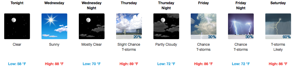
Wednesday Begins A Pattern Change
GFS Model Wednesday Through Friday Evening
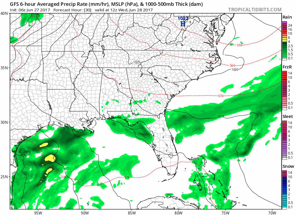
What’s the pattern change, you ask? Hotter temps and higher humidity is what’s in store heading into late week. Sunshine will be out in full force Wednesday, but dew points will remain in the mid-upper 50s. In other words, the air won’t be too “heavy” or overbearing quite yet.

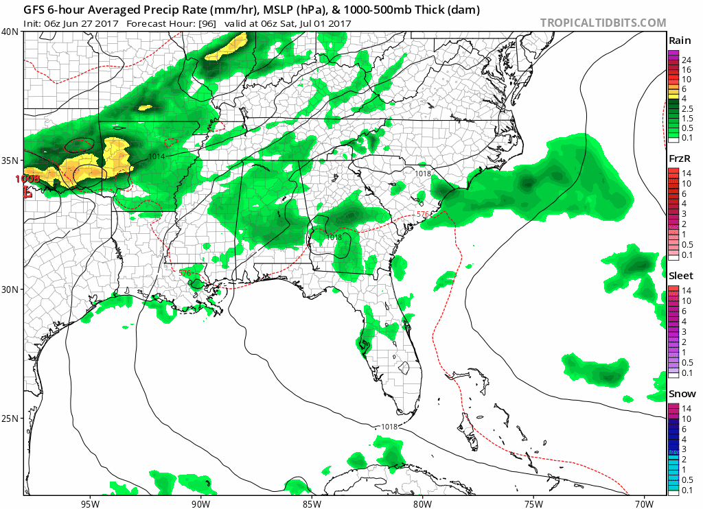
Thursday through Friday Night
Dew points soar.

Remember the remnants of Tropical Storm Cindy last week? Dew points were around 72-73ºF. For comparison, dew points starting Thursday will be in the upper 60s to near 70ºF.
Additional moisture + hotter temps = be ready for rain/storms to increase.
Thursday, expect much of the storm activity to be in the afternoon and on the Cumberland Plateau. An isolated storm is possible here in Davidson/Williamson counties.
Friday, an increase in coverage of afternoon storms is likely. If you have outdoor plans Friday PM, have the umbrella handy just in case.
Weekend is Unsettled, Saturday Looks Pretty Stormy
GFS Saturday AM through next Wednesday AM
An uptick in storms continues, for Saturday especially, and even into early next week, as a series of disturbances roll across our area. Strong storms cannot be ruled out, particularly on Saturday, but no organized severe weather is expected at this time. Wind shear values will be low while instability will be at moderate levels. Next week’s rain chances will be more scattered once again.
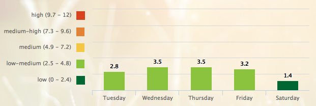
5 Day Pollen.com Forecast

Categories: Forecast Blogs (Legacy)
You must be logged in to post a comment.