Sunny Skies and a Short Break From the Rain
Happy Friday! While it will still be very hot outside, we are not anticipating any rain throughout the daytime and into the early evening hours.
https://giphy.com/gifs/excited-the-office-yes-t3Mzdx0SA3Eis

Happy Friday! While it will still be very hot outside, we are not anticipating any rain throughout the daytime and into the early evening hours.
https://giphy.com/gifs/excited-the-office-yes-t3Mzdx0SA3Eis
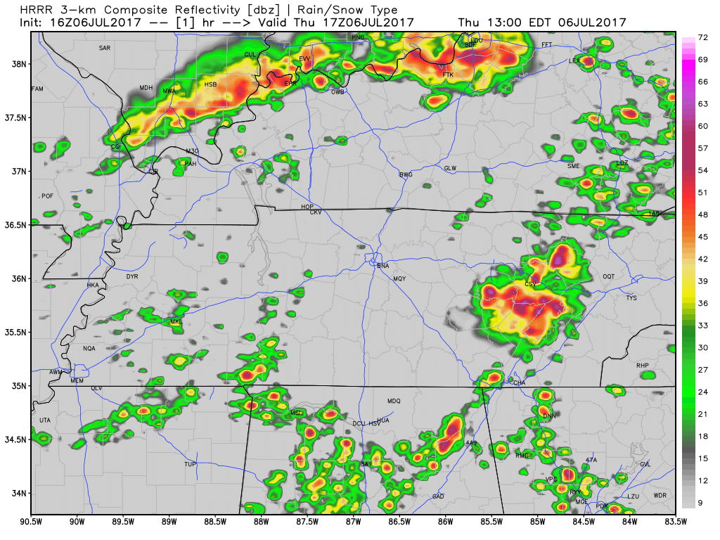
Latest HRRR Model
Showers and storms are again expected to “pulse up” this afternoon and evening across Middle Tennessee. Some could be on the stronger side with a few severe storms capable of damaging straight-line winds.
A few scattered showers continue to move across the area. If you have early evening plans, bring the umbrella just in case.
Into the remainder of the evening, all eyes are on a few lines of showers currently located in western Tennessee. If these showers hold together, which some models think they will, we could see another round of showers and thunderstorms later tonight.
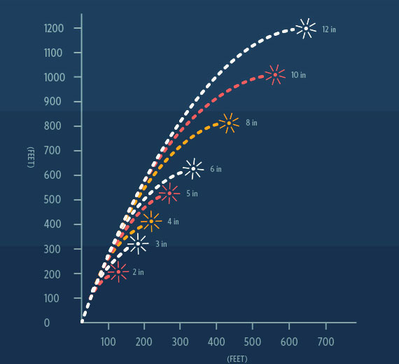
Most fireworks only fly about 1,200 feet up.
Models think “LCL levels” will be low tonight, meaning clouds should be closer to the ground. Some models predict cloud levels as low as only a thousand feet.
We’ve already seen a couple of severe thunderstorms this afternoon. As always, if you have any damage from today’s storms tweet using #tspotter to report it to our local National Weather Service Office.
A typical summertime day is expected with highs in the upper 80s and dew point temps in the low 70s. It’ll be nice and sunny to start, with diurnal heat showers possible later today.
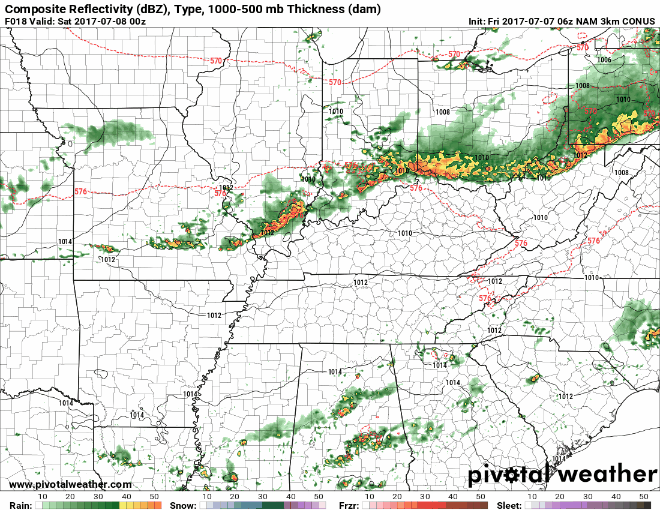
Into this afternoon, we introduce those shower and thunderstorm chances. Latest run of the HRRR, shown below, displays what it thinks will happen today.

Warning: Weather models aren’t very good at handling summertime thunderstorms.
Summer storms are very hard to predict, but as a general rule: rain and storms are mostly likely to develop between mid/late afternoon and early evening.

There are times weather models can see what’s coming so we can provide you a good, reasonably reliable (not perfect), “when and where.”
This is not one of those times.
Weather models, which in a perfect world should arrive at the same thing, predict different things. Weather models also aren’t very good at handling summertime thunderstorms.

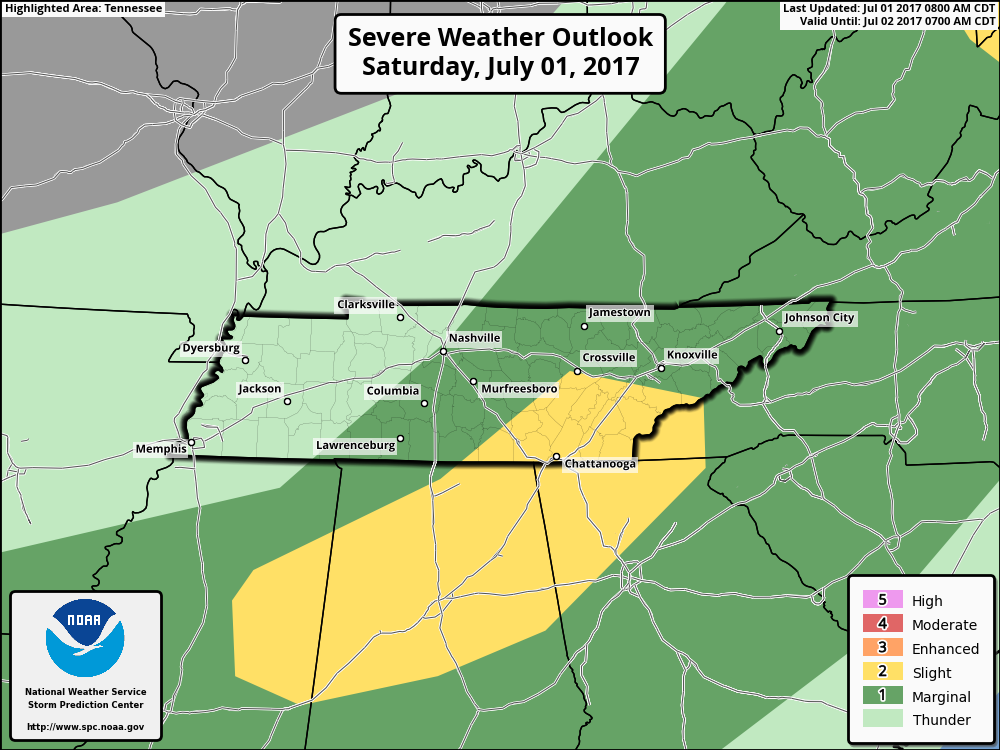
UPDATE as of 5:00PM CDT: The eastern half of both Davidson/Williamson remain under a “Marginal Risk” (1 out of 5) for damaging winds and some hail.
We’ve seen several showers and thunderstorms impact Davidson/Williamson counties today, some with ~40 mph wind gusts. More could develop through the evening, so we will be monitoring radar for developments.
So far today we have stayed, for the most part, rain-free. Latest radar scans do not show a whole lot on the radar, so good news so far. Into the rest of the evening, we will still need to keep an eye on showers attempting to move our way.
You must be logged in to post a comment.