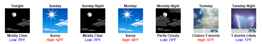
Sunshine and Summertime Weekend
A pretty fantastic weekend is in store for Middle Tennessee with highs in the low 90s. Dew point temps will remain in the low 70s.
Sounds like a great weekend to be outside or to take a jump in the pool if you ask me!

A pretty fantastic weekend is in store for Middle Tennessee with highs in the low 90s. Dew point temps will remain in the low 70s.
Sounds like a great weekend to be outside or to take a jump in the pool if you ask me!
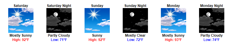
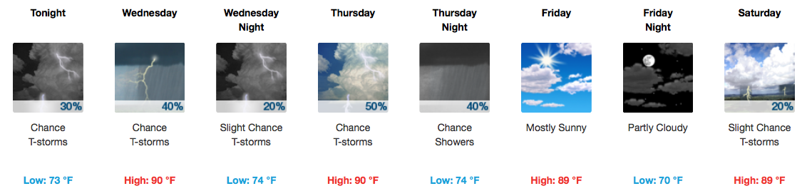
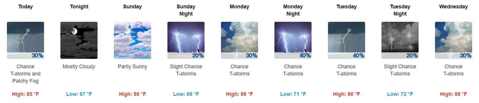
A pretty mild three-day stretch is ahead with no substantial chance of rain. Highs will coast in the 90s over the next few days with dew point temps slowly creeping back to the 70s by Sunday.
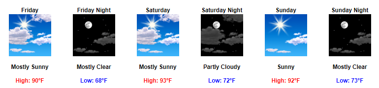
Friday Night Lights – Great Conditions
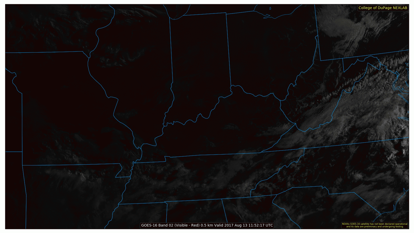
Clouds have continued to increase throughout the day ahead of tonight’s frontal passage. Scattered showers and a few thunderstorms have already developed and are heading our way.
We are expecting these broken showers to arrive between 6 PM to 8 PM. We may see a few thunderstorms in the mix, but they should remain non-severe. Luckily, showers should move quickly and we are not anticipating a complete washout for the evening.
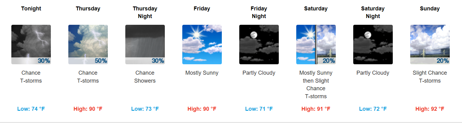
Thursday + Live on the Green (LOTG) Forecast
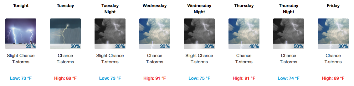
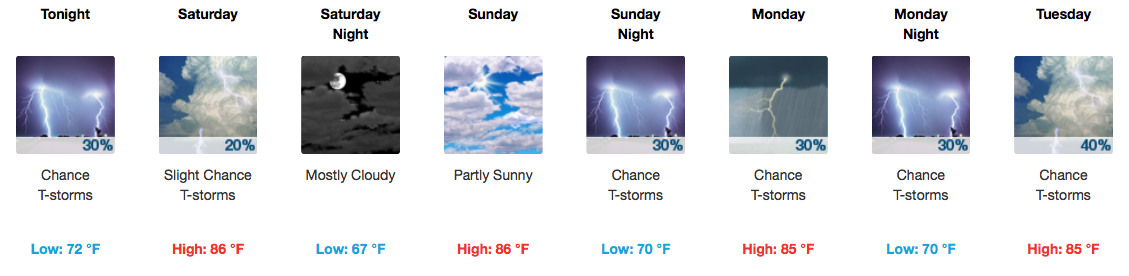
Rain chances going up! A cold front will arrive late Thursday into early Friday, sparking showers and storms out ahead of it Thursday afternoon and night. Provided below are two solutions: a wetter, more active-throughout-the-day GFS vs. much drier until Friday morning NAM3…
As the sun sets, the rain chances diminish rapidly either way. Still, a muggy evening is expected.
The upper levels of the atmosphere are not exactly what you would call “organized” at this time. There’s no real telling where a shower or storm could pop up on Wednesday, but the heat and humidity will definitely be supportive.
The hose is expected to finally shut off around dinnertime, leaving us with a drier evening. Temperatures will sink into the low-mid 70s by Tuesday morning.
Afternoon storms are possible on Tuesday and again on Wednesday, aided by the warm and soupy airmass in place. Not everyone gets a free car wash, though!
Clouds our west may bring rain tonight.
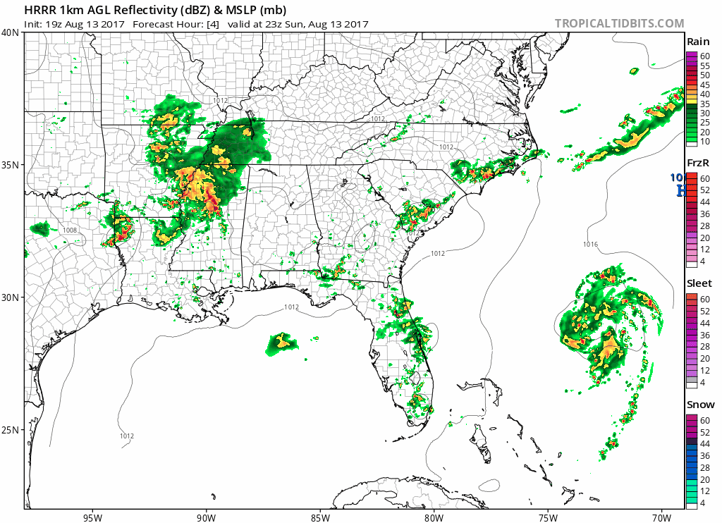
The HRRR model thinks very light rain will start sometime after dark, as shown in the below animation (Sunday 6 PM to Monday 2 AM):
Some rain may not reach the ground. And to look at the radar, yeah, looks like that rain is coming, but I’m not sure it’s making it all the way down.
Today brings the week’s best weather. Lower humidity (north winds!) and temps only 87°.
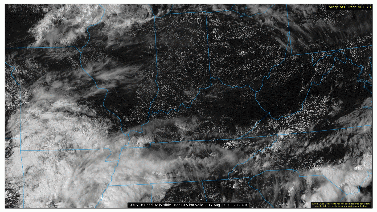
As I write, clouds stream east to west from Arkansas.
Late tonight or Monday morning or Monday around lunchtime, those clouds coming this way may bring us rain.

The weekend is here! During this past work week, we talked about occasional storm chances. Those storms happened, but most of them didn’t form right on top of us. Many places right around us saw substantial rainfall and even flooding, but some of us in Davidson & Williamson Counties are actually getting pretty dry. Here’s where a tenth of an inch of rain or more has fallen over the past few days.
First and foremost…happy Friday!

We are watching two weather features in specific today:
The first is a chance for pop-up afternoon storms, thanks to decent moisture in the area.
The second is a line of showers and storms still well to our west this morning that models are expecting to fizzle, but confidence is not high in this solution yet. Decent lift along an approaching cold front might support this line moving in to our area later today AND/OR more storms could re-develop as part of that line this afternoon.
You must be logged in to post a comment.