
On behalf of us here at NashSevereWX, we want to wish you a safe and happy Holiday Weekend!

A gorgeous 4th of July is in store for us today, with temperatures in the mid 90s and NO RAIN!
Humid, humid, and more humid weather for Independence Day.

On behalf of us here at NashSevereWX, we want to wish you a safe and happy Holiday Weekend!
A gorgeous 4th of July is in store for us today, with temperatures in the mid 90s and NO RAIN!
Humid, humid, and more humid weather for Independence Day.
Independence Day Eve (Today)
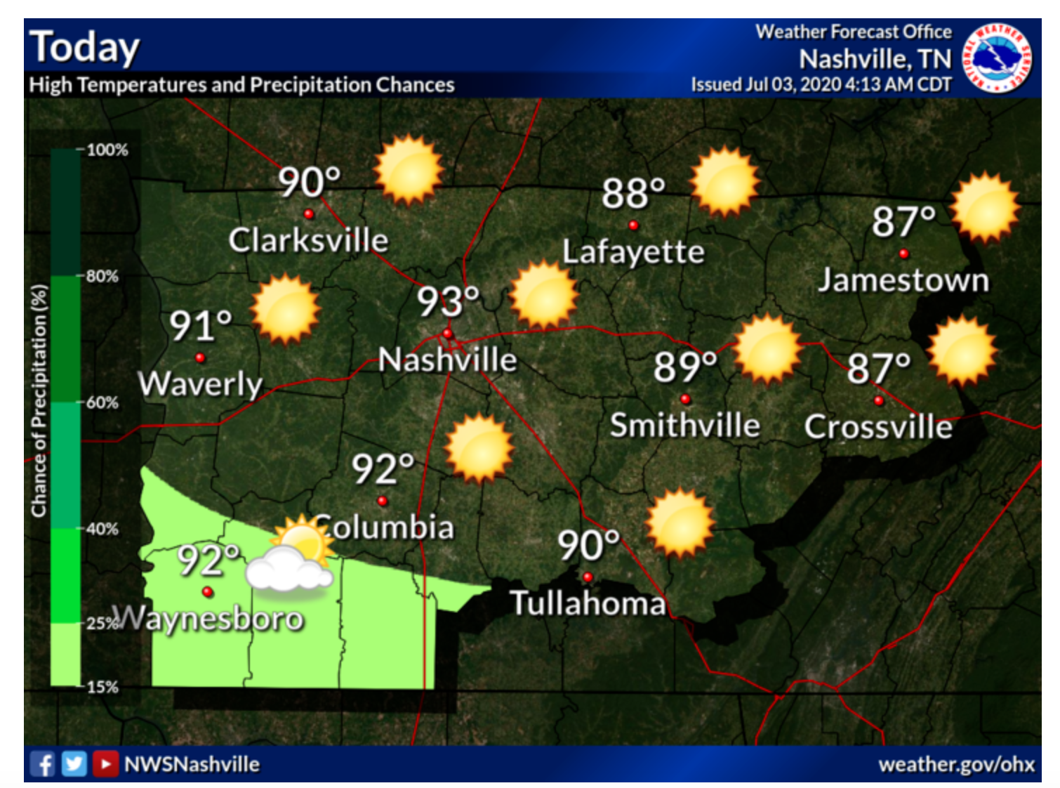
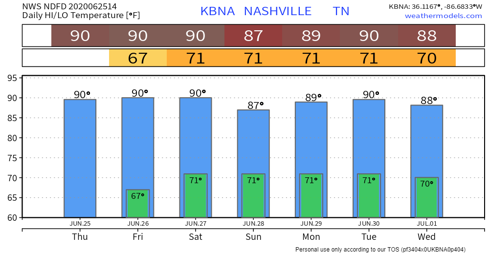
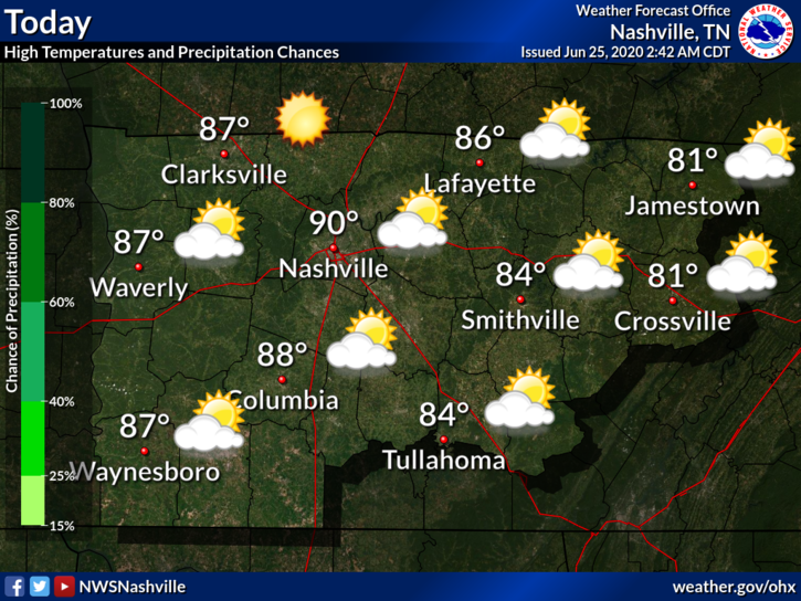
Right now we are looking at mostly sunny skies which will continue throughout the rest of the day with temperatures continuing to rise into the low 90s.

A thunderstorm is possible in south western Middle Tennessee as the graphic shows, but the Nashville area is in the clear.

We’re finally getting a break from the rain!
Skies should be partly sunny today with rain chances staying mainly to our south. We can’t rule out a stray shower or storm rolling into your backyard, but for the most part we should stay dry.
Scattered Showers will Continue Throughout the Day, But Will We Get Any?
Storm Threats
We are not included in the SPC outlook regions for tornadoes, wind, or hail. The biggest threats with any storms we will receive today are lightning and downpours.
A line of thunderstorms is making its way across the state this morning. Upwards of an inch has already fallen, sparking the National Weather Service to put out a flood advisory for Nashville.
Some stronger storms will be arriving later this afternoon into the evening hours. Some could form as early as 2 pm, but they look to be coming through around 4. They should be leaving the area by midnight tonight.
Partly Cloudy skies for today developing our next round of possible showers and thunderstorms late tonight into tomorrow morning.
We could see a pop up shower develop in the area after 1 PM, but most of the activity increases before midnight.
Storms are ongoing in Kentucky as I write this. Those storms will miss us, but they may send south cold air which can trigger us some rain and thunderstorms this afternoon. It’s iffy tho, let’s dive in:
Saturday
Current weather conditions consist of overcast skies and showers in the vicinity.
You can expect more rain and storms later today as instability and rising air become more favorable. Some storms could potentially be strong bringing gusty winds. The primary timing of these storms will be from 3pm tp 8pm. In the latest AFD, the weather service mention a possibility for gust winds late in the day. Some may be up to 35mph.
You heard it here first – rain, rain, and more rain.
Today may be our last day to see the sun for a few days, as we settle with partly cloudy skies and temperatures in the upper 80s this afternoon.
Mostly sunny today. Rain should stay to our south, but we can’t rule out a stray shower or thunderstorm popping up in your neighborhood.
Highs will be near 90°. The dewpoint will drop from the mid 60 this morning into the low 60s this afternoon.
You must be logged in to post a comment.