
Saturday
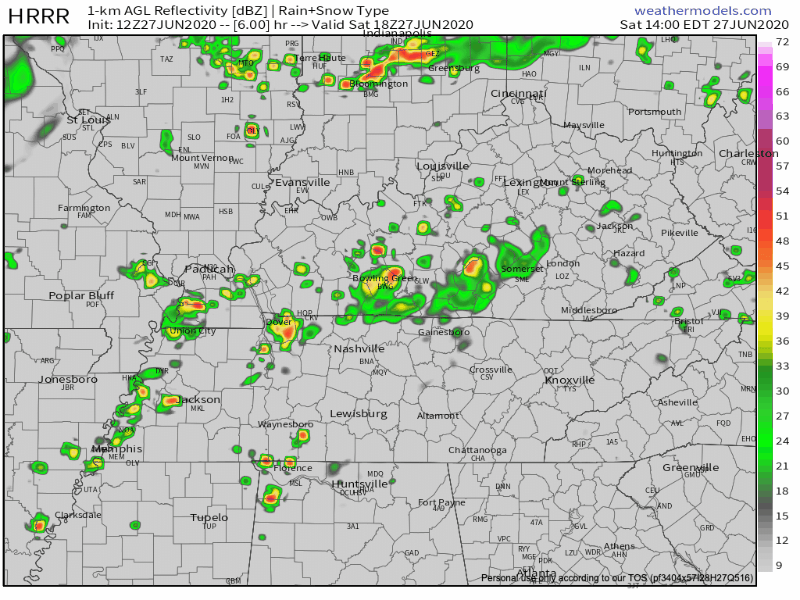
Current weather conditions consist of overcast skies and showers in the vicinity.
You can expect more rain and storms later today as instability and rising air become more favorable. Some storms could potentially be strong bringing gusty winds. The primary timing of these storms will be from 3pm tp 8pm. In the latest AFD, the weather service mention a possibility for gust winds late in the day. Some may be up to 35mph.
EDITOR’S NOTE: Tie down your patio umbrellas.
Sunday
The storm threat continues into Sunday as shear and instability continue to develop. These storms will be similar to today’s storms. Starting after 11am into Sunday night. Even hotter temps are expected. High of 90º. But, the abundance of moisture in the air will make it feel like 97º. Ouch.
Timing for the storms is up in the air, but NWS Nashville says our best chances will be in the afternoon. Starting to notice a pattern here? Summertime…

Next Week
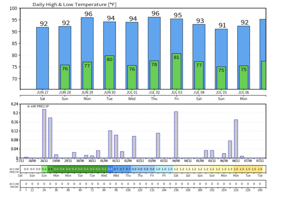
Summertime pattern continues. Take a look at this graphic. Top part is temp. Bottom part is chances for rain. Lots of both. Too soon 4th of July forecast? Hot and chances for rain.

Categories: Forecast Blogs (Legacy)
You must be logged in to post a comment.