
Tuesday
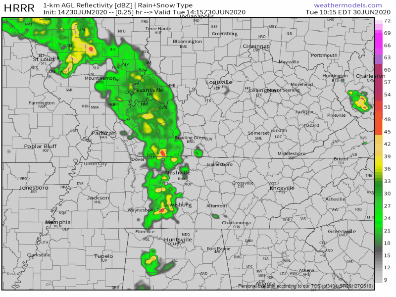
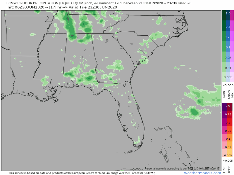
A line of thunderstorms is making its way across the state this morning. Upwards of an inch has already fallen, sparking the National Weather Service to put out a flood advisory for Nashville.
Some stronger storms will be arriving later this afternoon into the evening hours. Some could form as early as 2 pm, but they look to be coming through around 4. They should be leaving the area by midnight tonight.
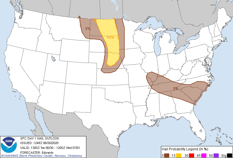
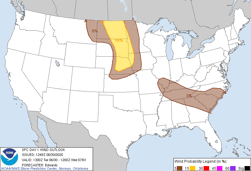
The main threats with these storms are some gusty winds, small hail, and heavy rain. The Storm Prediction Center has put us under a 5% probability of both strong winds and hail happening within 25 miles of a point.
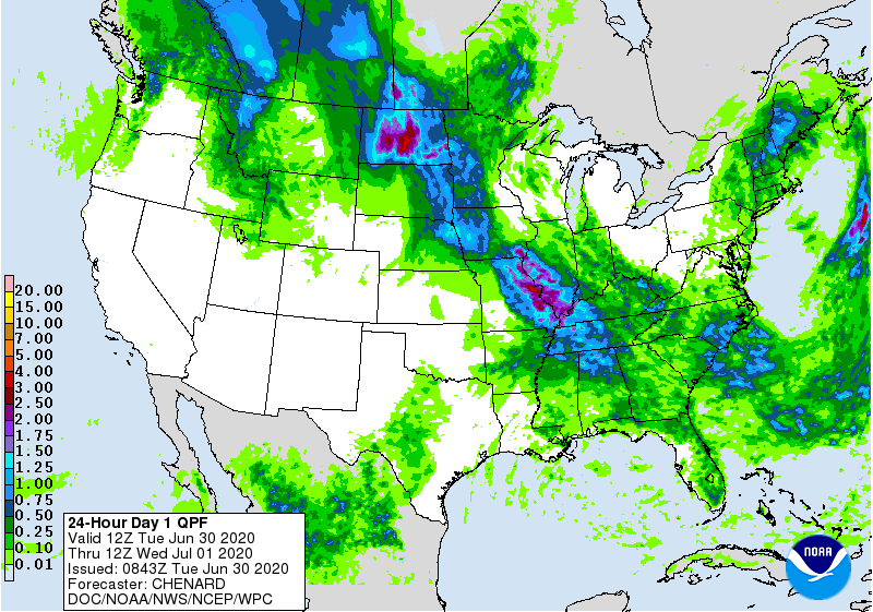
The Weather Prediction Center is predicting anywhere from half an inch to an inch of rain to fall today. Some areas have already received this much rain today! Heavy downpours are very likely with storms that form, causing locally higher rain totals.
If you see a flooded roadway: turn around, don’t drown!
Wednesday
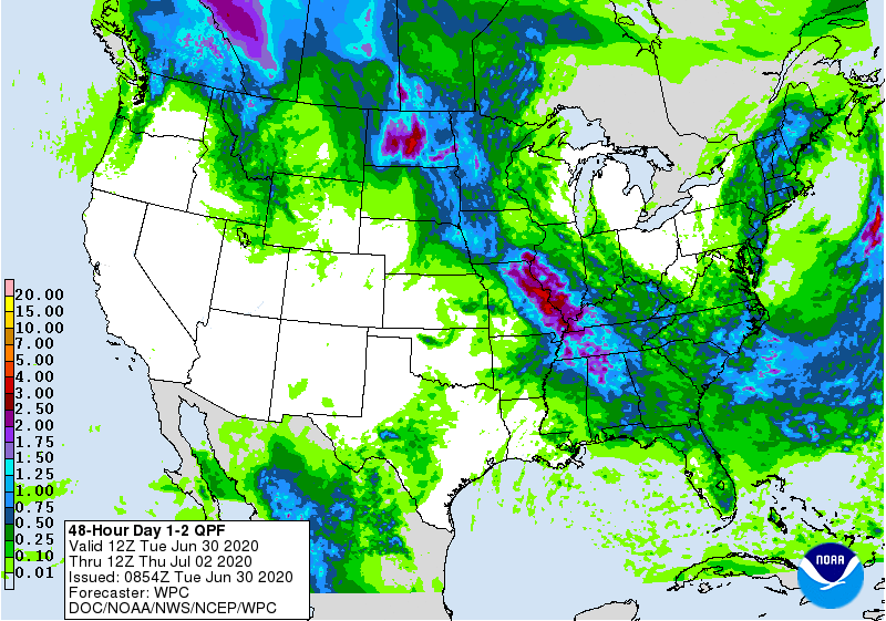
Rain will pick back up Wednesday morning, around 8 am. It will stick around throughout the day, dropping another half of an inch to an inch of rain.
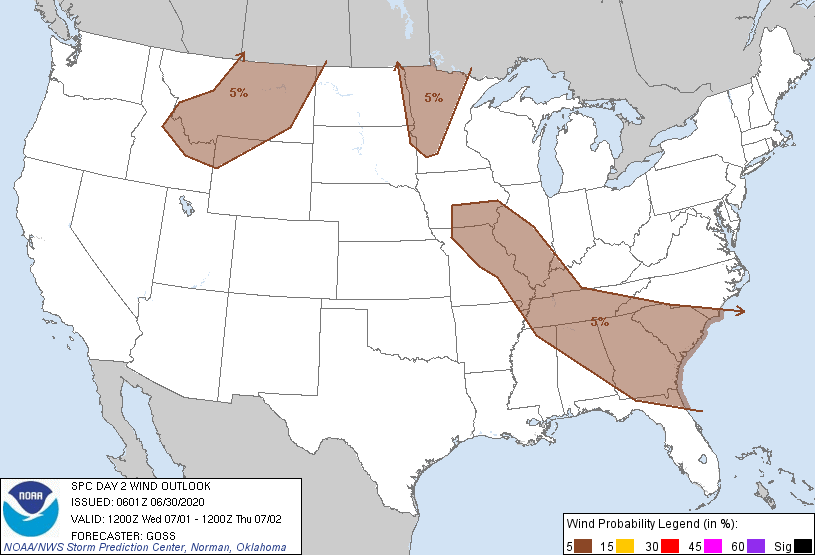
There is a slight chance of some more stronger storms coming through tomorrow. Gusty winds and heavy rainfall are the main threats. The SPC has again put us under a 5% probability of some strong winds within 25 miles of a point.
Flooding is still a possibility throughout the day Wednesday. With the addition from the rain today, we’re gonna be looking at one and a half inches to two inches of rain total, with some areas having locally higher amounts.
How About This Weekend?
Things will begin to dry up Thursday afternoon, but that does not particularly mean a dry weekend.
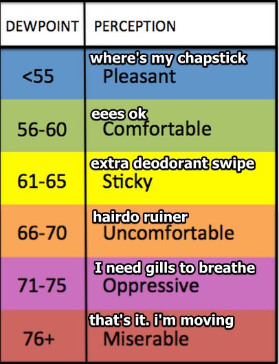
It will be hot and muggy. Dewpoints will stay in the upper 60s and lower 70s, making it feel super sticky outside.
Those scattered storms will stay in the forecast through Sunday. Some areas may get rain, some won’t. Keep an eye on the radar!

Categories: Forecast Blogs (Legacy)
You must be logged in to post a comment.