
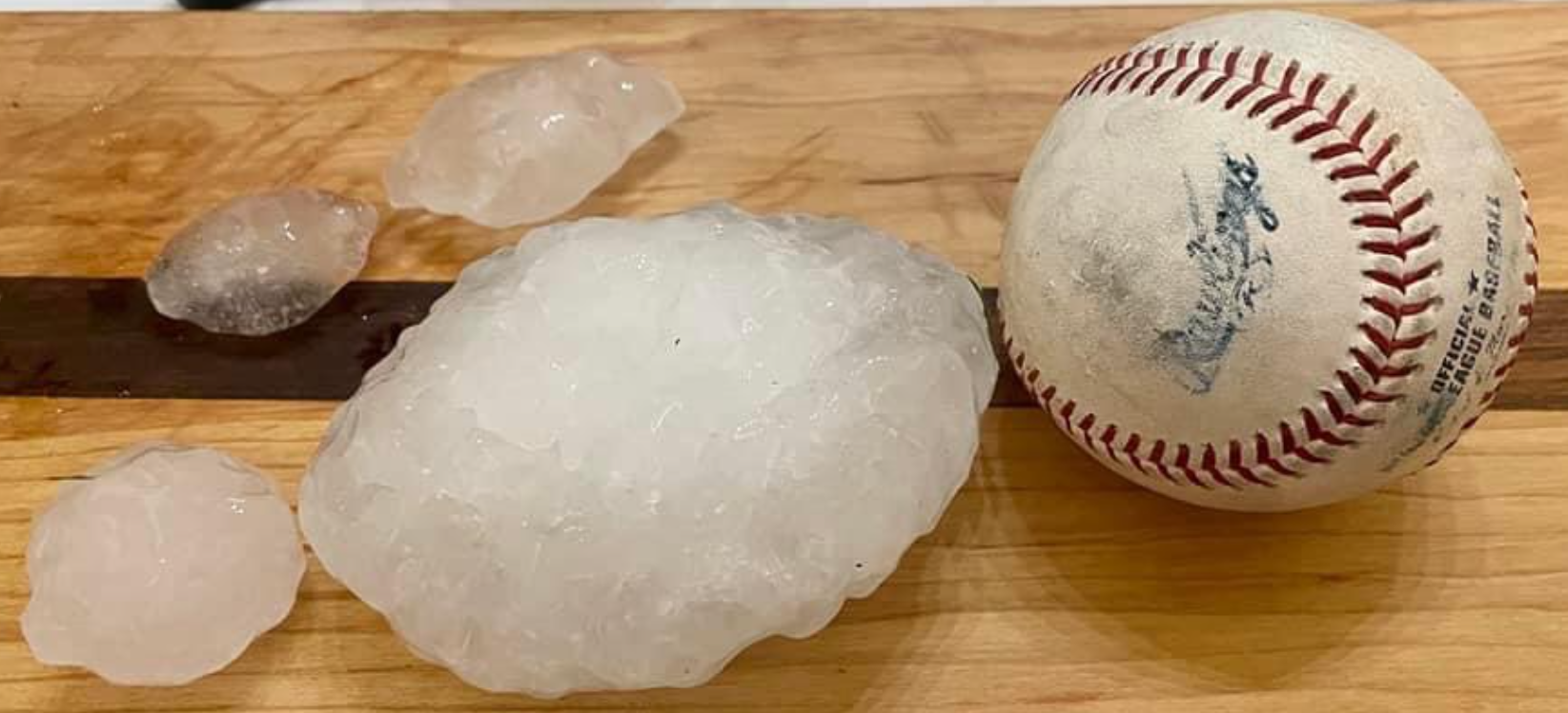
Yesterday’s forecast had wins (HRRR timing on Will Co storms, damaging straight line wind threat) and losses (SPC did not mention hail yet Will Co saw 1″ hail then that storm blew into Marshall Co and dropped 4″ hail on Chapel Hill).
Several Hours From Now, Big Impact Storm forecast perfection remains out of the reach of the best forecasters in the world. No one has the special sauce. It’s why I hate all these claims of “accuracy” from marketing departments. Y’all aren’t stupid, you know we don’t have a firm grasp on everything all the time.
Even before the event my spidey senses tingled:
(Rest of Rant Omitted, you’ve heard it before).
So Behold! An imperfect forecast! May we score forecast wins and absorb forecast losses with intellectual honesty.
Some rain will be around Middle TN over the next 48 hours but that should be confined to south and east of us. Suppose it’s possible one wanders in here but the data says: unlikely. I think outdoor activities are probably a go until maybe late Sunday afternoon when the Wattery resumes.
Temps resume normal levels for mid July:
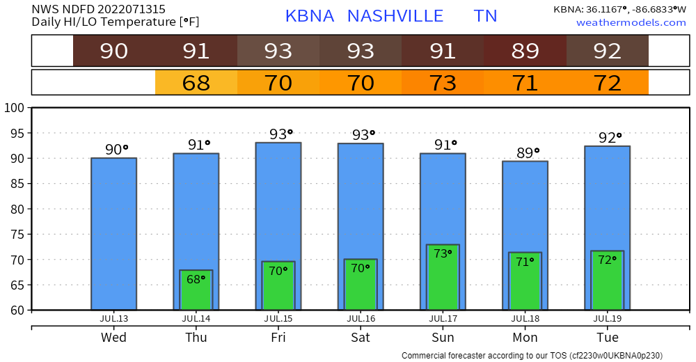
Humidity sticky and uncomfortable with dewpoints in the 60°s this week.
Oppressive dewpoints return early next week and with them, a chance of showers and storms popping up. 100° Heat Index will come along early next week with the Wattery.
“Wattery” is a multilayered pun on Watt. As in (1) Water, (2) Lottery, (3) Watts as in electricity in lightning, (4) WAT as in “WAT? A storm? I thought we’d be good,” and (5) [I forgot this one, I am very, very tired], oh wait, I remembered: it’s usually so hot your house consumes WATTs and increases your power bill.
Quick References:
Weather changes constantly.
Follow @NashSevereWx on Twitter for any changes to this forecast.
Live coverage during tornado and severe thunderstorm warnings.

Look good.
Support the mission.

We are 100% community supported. No ads. No subscription fees. Keep it free for everyone.


Categories: Forecast Blogs (Legacy)
You must be logged in to post a comment.