

Previously mentioned showers coming in from Kentucky look weak. If they do make it here this afternoon, they would just be some very light showers. No need to alter any plans. No severe weather worries with these. HRRR model gives its’ take below.
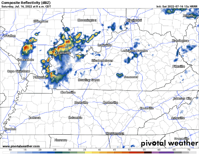
Rest of Saturday looks dry.
More rain moves in Sunday around lunch. Will be on/off through Monday. Sometimes heavy, maybe some lightning and gusty winds, but no severe weather expected.
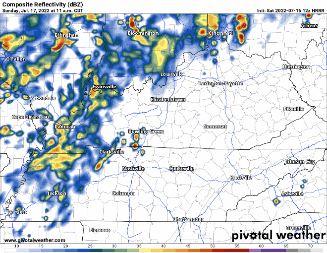
No one really knows when the rain will be “on” and “off”. Any outdoor plans Sunday should probably have a plan B which includes being indoors. The heaviest rain looks to fall Sunday overnight into early Monday morning. Looks like most will pick up around an 1″ of rain, some more, some less.
The HRRR model only goes out until 7AM Monday, but on/off rain should linger throughout a good portion of Monday.
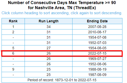
Today, Saturday, we should easily surpass the 90° mark making it the 27th consecutive day, tying the 5th longest streak.
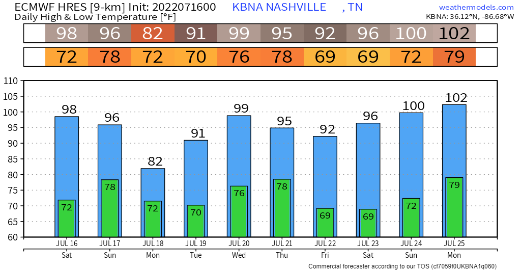
This rain will be the reason we might stay below 90° maybe Sunday and Monday. We could reach the mark on Sunday if the rain holds off until a little later, but Monday looks like the day the streak should finally come to an end. If (big if) anyone is sad about it, 90’s return Tuesday and look to stay for the remainder of the week. Below is what the EURO model thinks, don’t know if those 100’s will actually become true, but moral of the story, it will be hot. July weather is here to stay.
Quick References:
Weather changes constantly.
Follow @NashSevereWx on Twitter for any changes to this forecast.
Live coverage during tornado and severe thunderstorm warnings.

Look good.
Support the mission.

We are 100% community supported. No ads. No subscription fees. Keep it free for everyone.


Categories: Forecast Blogs (Legacy)
You must be logged in to post a comment.