
No more upper 90’s, but it will still be in the low 90’s with dewpoints in the mid 70’s, will equal heat index nearing 105°. Better? Yes. Noticeable? Eh.
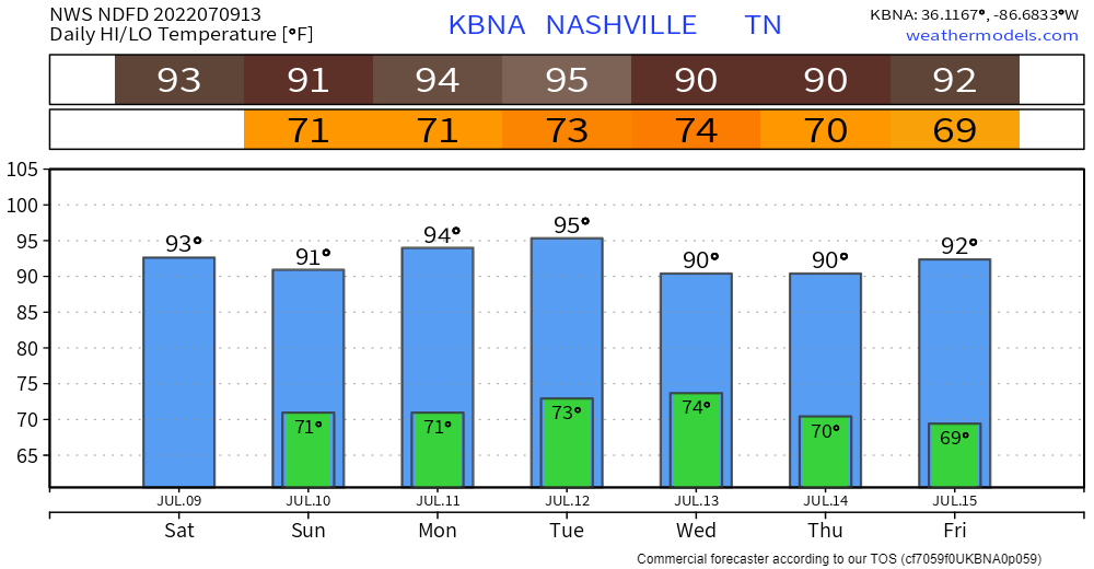
Looks like we won’t be able to shake the 90’s for a while. Just like all the fashion trends that are still around.
The Wattery continues for one more day before a brief pause.
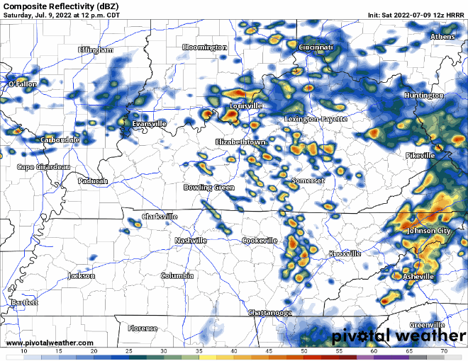
The HRRR model continues to think pop-up storm coverage is few and far between. However, I have my doubts about this, as the past several days have overperformed. Afternoon/evening is really the only timing I can give you.
The Storm Prediction Center and Weather Prediction Center has outlooked us for a 5% chance of straight-line damaging winds and flash flooding within 25 miles. Unlikely, but there is a chance of a rogue storm.
Sunday is THE day for any outdoors activities. Temps in the low 90’s and dewpoints dropping throughout the day into the low 60’s. No rain chances.
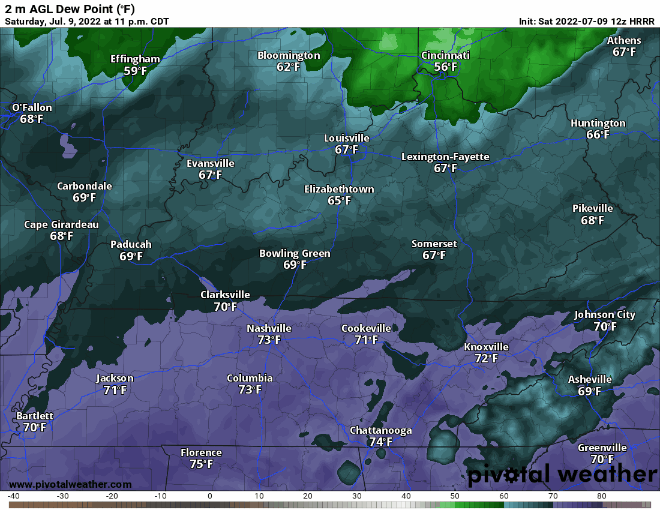
It’ll be just enough of a drop where you’ll be able to notice the difference.
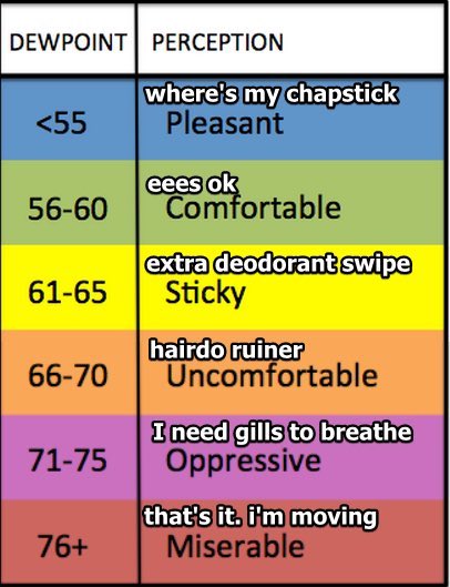
From ‘Oppressive’ to ‘Sticky’, you’ll only need one extra deodorant swipe instead of 10.
Monday and maybe Tuesday we stay dry. Temps and dewpoints remain somewhat in check.

Quick References:
Weather changes constantly.
Follow @NashSevereWx on Twitter for any changes to this forecast.
Live coverage during tornado and severe thunderstorm warnings.

Look good.
Support the mission.

We are 100% community supported. No ads. No subscription fees. Keep it free for everyone.


Categories: Forecast Blogs (Legacy)
You must be logged in to post a comment.