

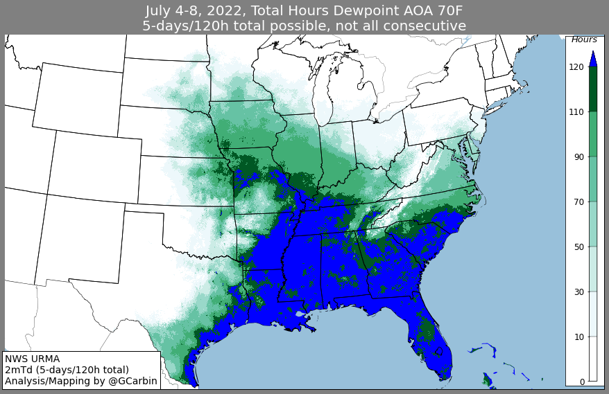
Storms and showers east and south today, I think we stay dry. Humidity also dropping, ending the streak of sweat, in hopelessness and rage, 70° dewpoints delivering oppressive humidity. Dewps today “only” sticky/uncomfortable, mid to upper 60°s, yay? It’s not football weather but at least it snapped a 120 hour 70°+ dewpoint streak depicted in blue below, a message straight to your soul:
Dry streak looks over. We’ve seen some rain! Yesterday was the wettest July 9 on record in Nashville. 2.34″ broke the 1916 record (2.02″). July rainfall in the official BNA rain totals 4.52″. That’s 3.19″ above normal for July and 5.97″ above normal for 2022. The hatches were battened, thunderclouds rolled, and the critics stormed. Rain has been unevenly distributed, some lawns remain thirsty, this feels like a metaphor for other things but this is a weather blog.
Heat recranks Tuesday, cruel mortality, heat index to 100° helped by a high of 96°.
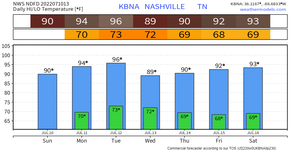
Next system late Tuesday into Weds should cool us back off and set up a humidity drop for Friday and Saturday. The rain/storms late Tue-Wed look meh — scattered and unevenly distributed. Very little rainfall expected. SPC hasn’t outlooked us for anything severe. Rest of the week may be dry. Weekend data looks fuzzy.
Not much else to say so I’ll publish this weather diary, it’s how I got to know you.
And it’s all right.
Quick References:
Weather changes constantly.
Follow @NashSevereWx on Twitter for any changes to this forecast.
Live coverage during tornado and severe thunderstorm warnings.

Look good.
Support the mission.

We are 100% community supported. No ads. No subscription fees. Keep it free for everyone.


Categories: Forecast Blogs (Legacy)
You must be logged in to post a comment.