
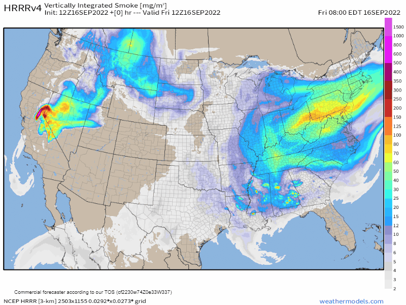
Wildfire haze should slightly dim clear skies. Those are controlled burns south.
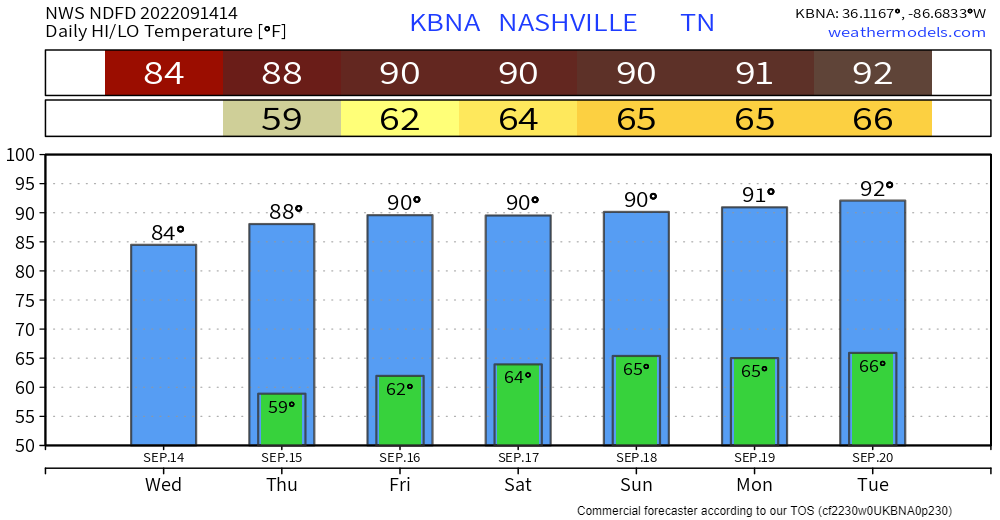
Heat without bad humidity will build into next week when the heat index (what it “feels like”) might approach 100°.

Wildfire haze should slightly dim clear skies. Those are controlled burns south.
Heat without bad humidity will build into next week when the heat index (what it “feels like”) might approach 100°.

It’s been a great weather week. Well, the good times never stay. And the cheap thrills always seem to fade away.
Fall begins at 803 PM in one week (September 22) so you’d expect temps to be easing on down into Autumn range, but, no.

Boring is good.
A ridge is an elongated area of high pressure. We’ll have one for a while. That means
We will still sweat.
When will the heat break?
Models disagree (shocking, I know).
Euro (below) thinks late next week (Friday the 23rd), the first full day of Fall!

/stands up, stacks papers/
Just one item y’all. We ride. Check this out 👇🏽.
Warmer each day, eventually to 90° because it’s still summer.
I will now take questions.

How Long Will We Ride This Lower Humidity?

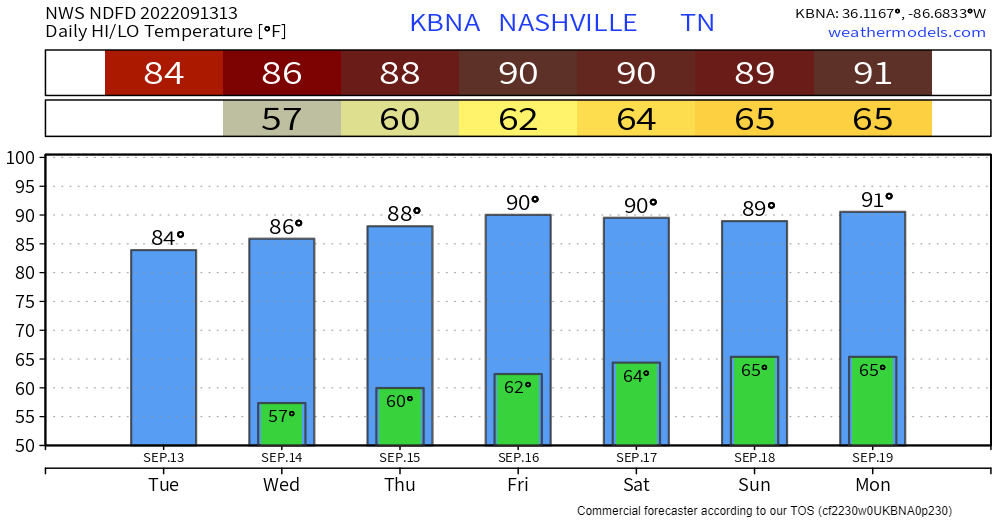
Today-Tuesday is back-to-back glorious. Temps either side of 80°. Pleasant humidity.
We warm up Weds and should be to 90° by Friday.
Dewpoints should stay below 60° all week. Last week dewps were in the upper 60°s and low 70°.


The HRRR model isn’t exactly sure what will happen this afternoon but the latest HRRR model run wants football.
HRRR Model Noon – 3 PM, tailgating off/on rain with a few lightning strikes possible:

Ongoing showers looks to wane away at some point this afternoon, as shown by the HRRR model below.
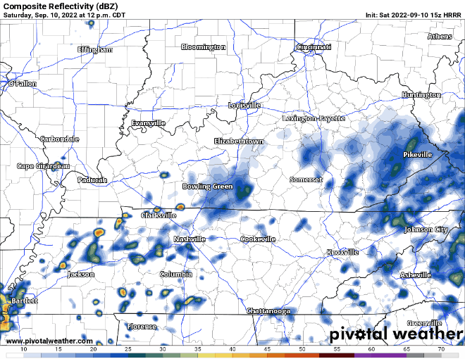
HRRR model thinks it is possible that more showers develop this afternoon. Unsure if this will actually happen, but even if it does, they look very scattered in nature, and you may stay dry. Looks as if evening plans are good to go but having rain gear close by for the NSC game or other activities wouldn’t be a horrible idea.

Mother nature thought one day of nice weather was all we deserved, as dewpoints creep back up into the mid 60s.
Rain chances are a thing today, but the HRRR thinks most of us end up dry today. If the model is right, Friday night football looks good to go.

Today and the majority of Friday you’ll probably catch yourself saying…

Mid 80’s for high temperatures, with dewpoints in the mid 50’s will have you feeling great. By Friday dewpoints will creep back up into the mid 60’s as a developing upper low brings in moisture, raising rain chances.
Today and Thursday should be fairly nice days, as high temps only reach the mid 80’s and dewpoints gradually fall into the mid 50’s. Only a very small rain chance today, as only one or two of you may see rain.
You must be logged in to post a comment.