

It’s been a great weather week. Well, the good times never stay. And the cheap thrills always seem to fade away.
Fall begins at 803 PM in one week (September 22) so you’d expect temps to be easing on down into Autumn range, but, no.
Instead, crank it up.
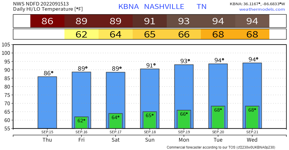
The Euro is running much hotter Tue-Wed-Thu (98°-99°-100°), again we think that’s too hot, outlier model data. I hope that’s not what your phone app says but if so give it these eyes.

I’m sure your phone is not watching you.
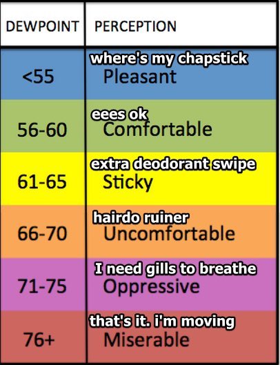
Humid-it-T
Seven plus days of dewpoints in the upper 50°s with low 60°s mixed in.
When’s the First Cold Front of Fall?
Euro model thinks it comes in when Fall arrives – right on time! – next Thursday night, one week from today. Check out the dewpoints illustrating a cold front passage:
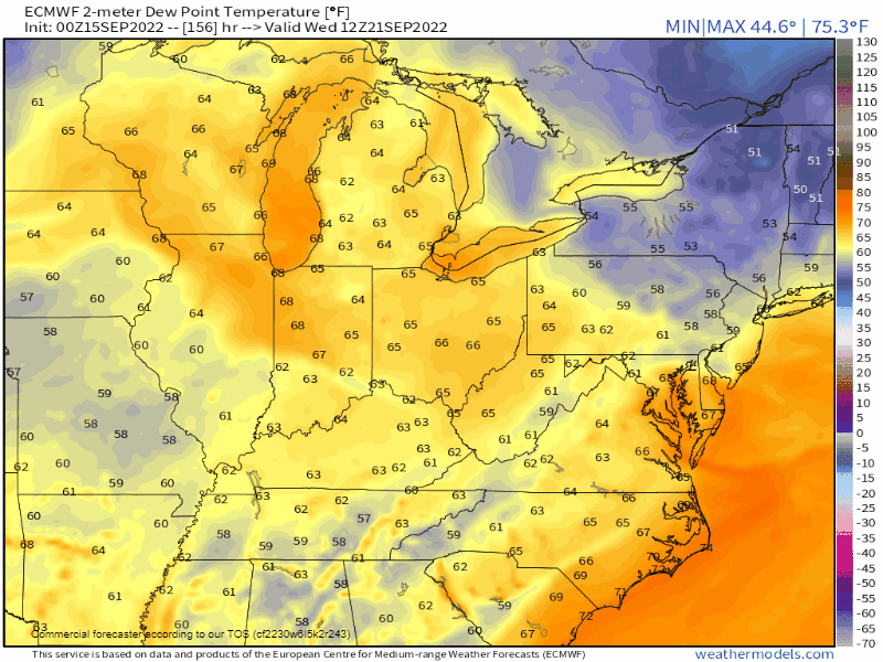
GFS model disagrees. It keeps us in this hot and dry pattern for at least the next 10 days.
Who’s “right?” Model performance at this range sucks. IDK.
Rain?
Nope. Nothing in the next 7 days. I could trot out some outlier deterministic model runs telling a story of a small chance of a little rain middle of next week. But I won’t! Deterministic models have no skill vs ensemble model approaches at this time range. The ensembles think no rain so I’m following the “good data” here.
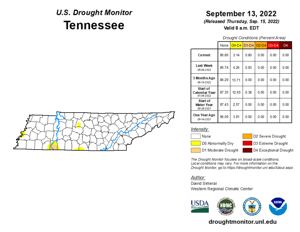
Abnormally dry conditions may advance in the drought monitor next week. Here’s the current map:
And it won’t matter now. Whatever happens will be. Tho the air speaks of all we’ll never be. It won’t trouble me.
Quick References:
Weather changes constantly.
Follow @NashSevereWx on Twitter for any changes to this forecast.
Live coverage during tornado and severe thunderstorm warnings.

Look good.
Support the mission.

We are 100% community supported. No ads. No subscription fees. Keep it free for everyone.


Categories: Forecast Blogs (Legacy)
You must be logged in to post a comment.