We got a decent rain yesterday, which was great. Best of all, no severe weather. Rain amounts were generally around a half inch. Officially .51″ at BNA. We’ll take it! Cocorahs rain reports below.

We got a decent rain yesterday, which was great. Best of all, no severe weather. Rain amounts were generally around a half inch. Officially .51″ at BNA. We’ll take it! Cocorahs rain reports below.
Some showers of no consequence moving through this morning, only will help water the grass a little.
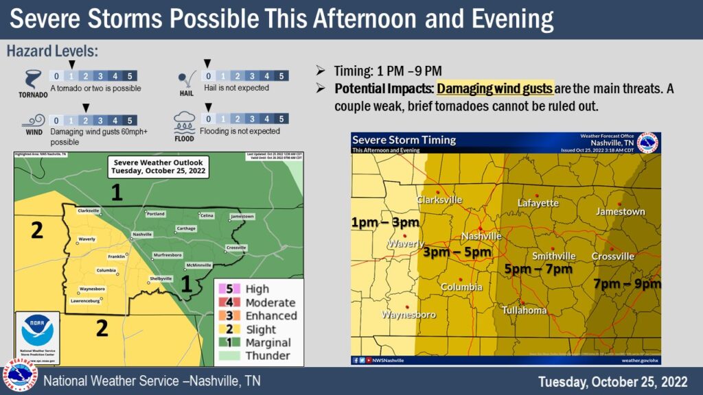
🍃Before the main line of storms arrive, it will be windy. We are under a Wind Advisory until 7pm for sustained winds 15-25 mph, with gusts up to 40mph. That could bring down a few tree limbs before the storms arrive. Also, may make it difficult for high-profile vehicles, especially on I-40. Would be a good idea to move Halloween decor inside and make sure trampolines are tied down so they don’t become frisbees.

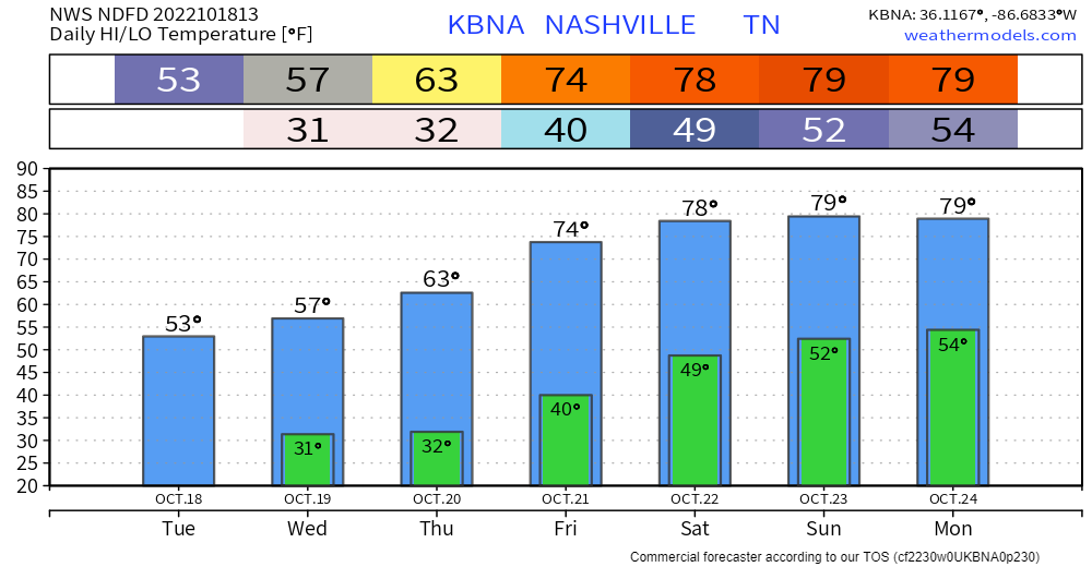
Nice today with a high temp getting all the way up to 80° (record is 85° set in 2000).
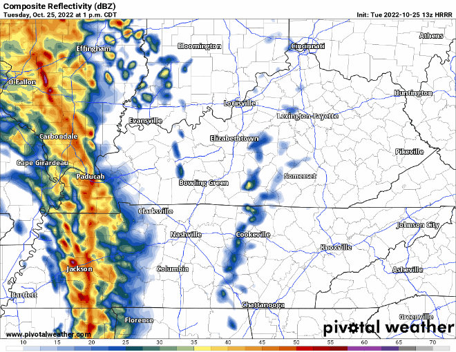
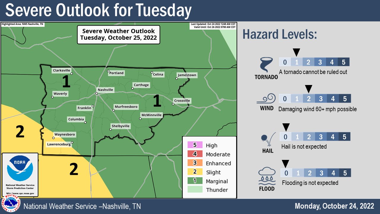
Looking ahead to tomorrow, the Storm Prediction Center has outlooked us for ⚠️severe weather, specifically:
Before the storms arrive, tomorrow during the day will be windy and a Wind Advisory may be issued. Tie down Halloween decor, trampolines, light aunts, etc.
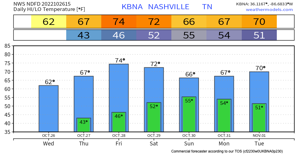
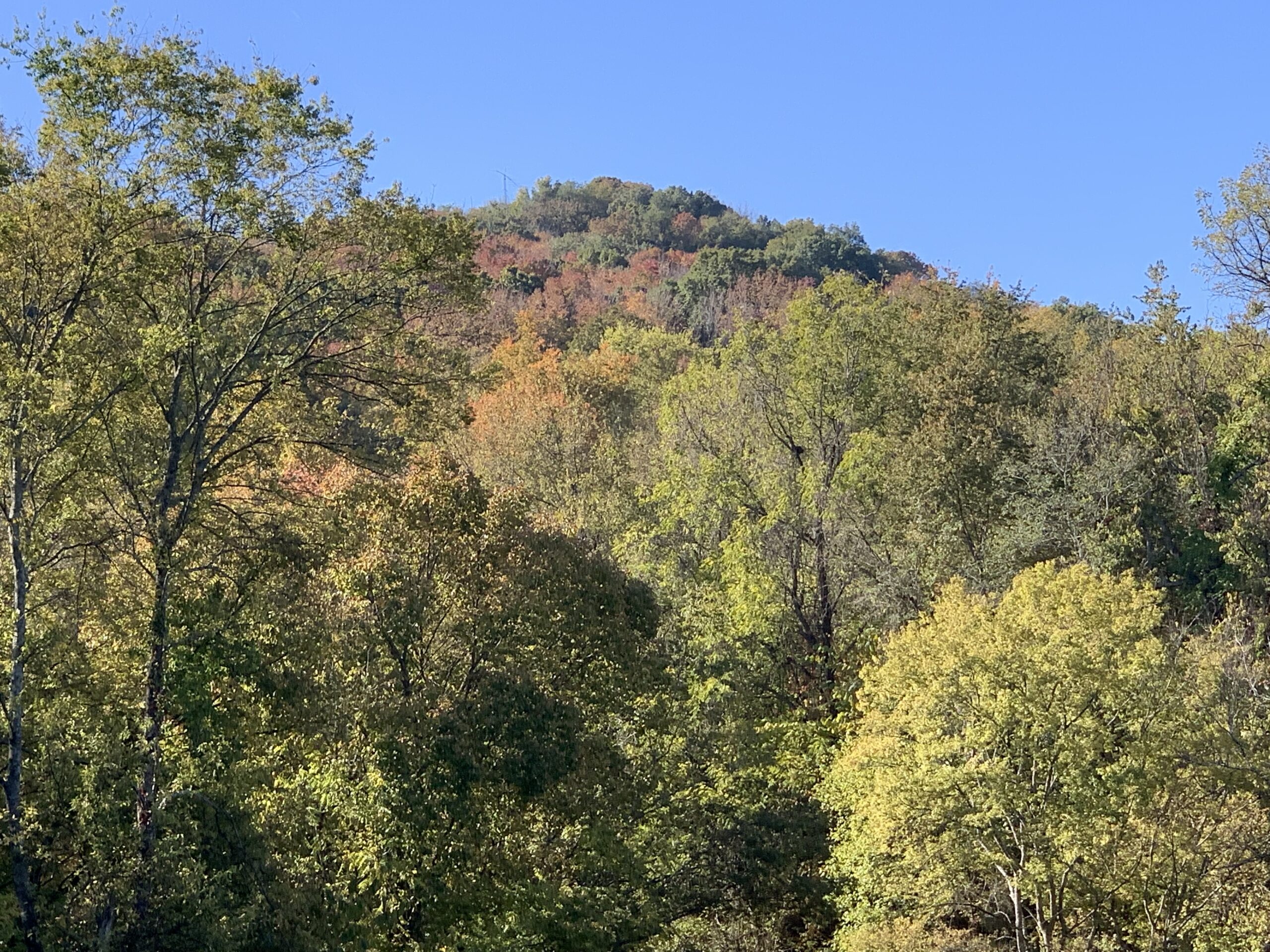
Today and tomorrow look like beautiful days with highs in the low 70s to even 80. Abundant sunshine and even a touch of humidity will remind you of the the best days we had this summer.
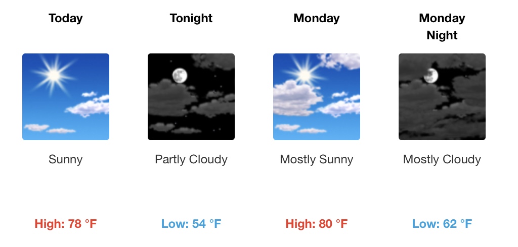
This beautiful weather gets interrupted on Tuesday by an approaching cold front. It brings our temperatures down and also brings a chance of rain for Tuesday and Tuesday night. Storm chances are meh, but a rumble of thunder isn’t out of the question.

I got a very generous birthday present yesterday. My very own Ego 650 CFM battery powered leaf blower….a perfect gift for an October birthday. It’s going straight to use.
Today, the breeze will almost surely drop some leaves. But, at least it will be a warm breeze. Temps up to 78° this afternoon.
Drought continues. A new seasonal drought forecast from the Climate Prediction Center isn’t encouraging. They forecast the drought to continue for us and continue to develop over the rest of the Southeast.

Growing szn is “effectively” over. No more Frost or Freeze Warnings. We’ll freeze again this fall/winter for sure. It’s just that there will be no more official frost or freeze warnings from NWS until next fall 👇🏽

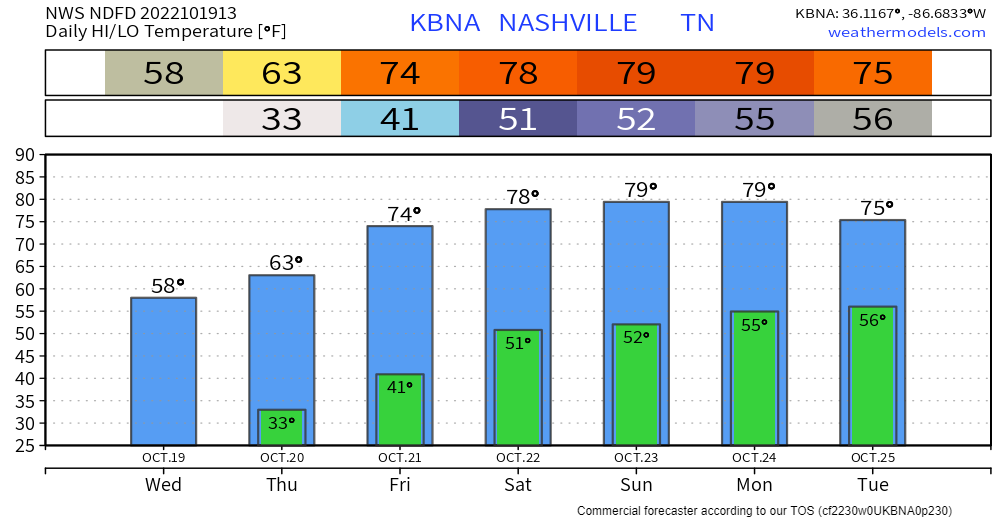
BNA did not hit freezing this morning but BNA runs hot. Most dropped unburrrr1️⃣ 30°. My backyard went sub 29°. Expect a repeat Thursday morning then temps rise 👇🏽
Rain?
Tuesday Oct 25 to Weds Oct 26 begins next rain chance. Euro mean says around 0.5″ or so total by late next week.
BNA should hit freezing Wednesday morning.
Warm up weekend, near eighty.
No rain in sight. The Mississippi River at Memphis is at its lowest depth since 1954.
Drought isn’t just local. Much worse west. Mississippi River receiving little water.
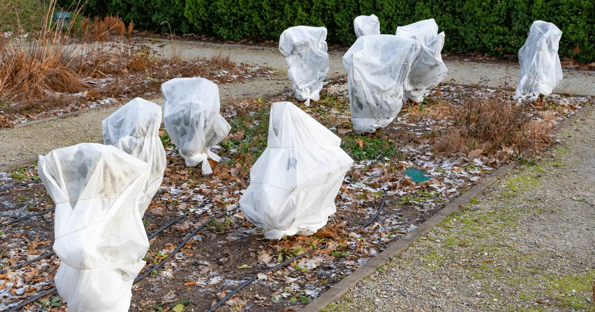
A Freeze Warning is in effect officially from 1 AM to 9 AM Tuesday. Coldest temps will happen around sunrise.
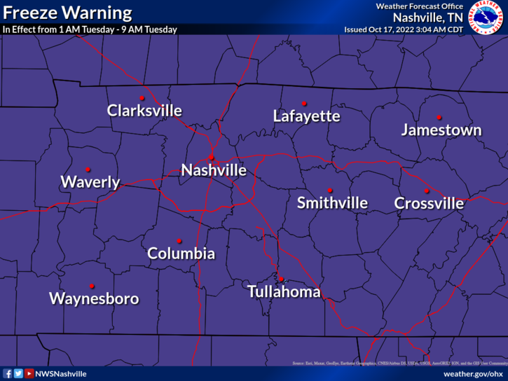
Frost and freeze conditions will kill crops, other sensitive vegetation and possibly damage unprotected outdoor plumbing.
You must be logged in to post a comment.