
- The average high for Nashville today is 60°. If only.
- Rain has moved out (save for a few sprinkles or some drizzle).
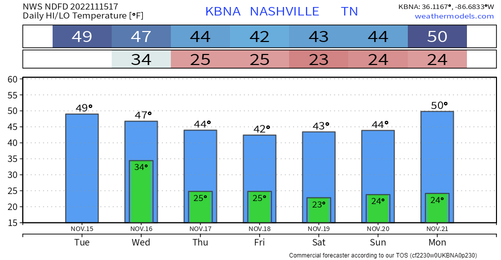
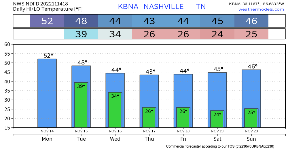
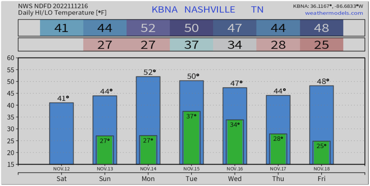
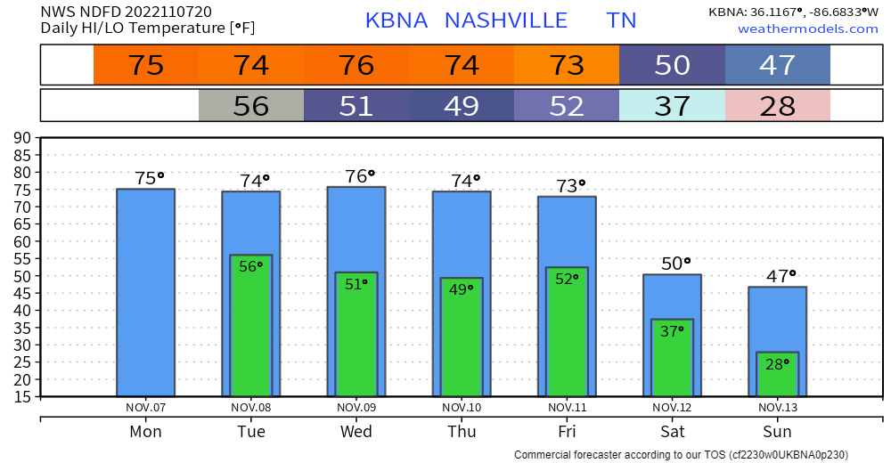
- There’s really only one story this week, and that is the continuing cold weather, especially late week. Thursday through Sunday temps probably won’t get above 45°, again, roughly 20° below normal.
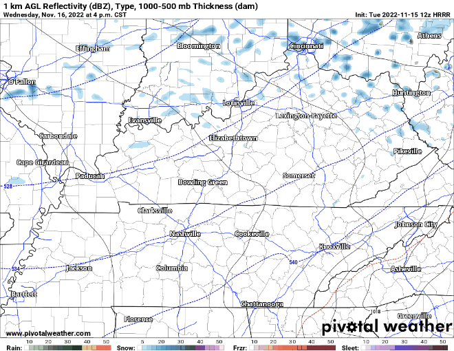
- We could get a passing flurry Wednesday night, according to the HRRR. No big deal. Loop 4 pm through 1 am Wednesday/Thursday.
Quick References:
Weather changes constantly.
Follow @NashSevereWx on Twitter for any changes to this forecast.
Live coverage during tornado and severe thunderstorm warnings.

Look good.
Support the mission.


You must be logged in to post a comment.