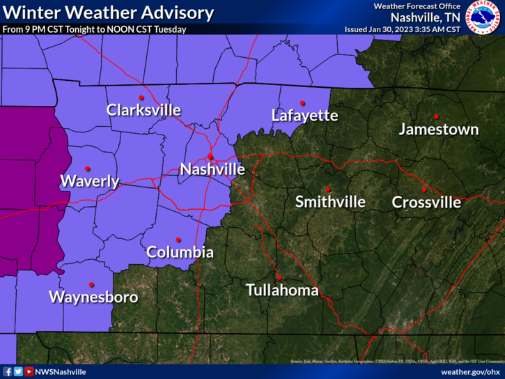
Over the next two days, we are looking at two possible rounds of freezing rain.
Disclaimer: We do not know if school will close, we also do not know if your flight will be delayed or cancelled – my apologies.

Over the next two days, we are looking at two possible rounds of freezing rain.
Disclaimer: We do not know if school will close, we also do not know if your flight will be delayed or cancelled – my apologies.

Showers are pretty much gone from this morning, maybe a few more tonight. Clouds will hang around all day.
Maybe some showers Monday morning, shouldn’t be too much of a disruption.
Overnight Monday and into the early hours of Tuesday, some more showers move in. Temperatures look to be around 31-32°, however our pal Ned will create a nose of warm air just above the surface, making precipitation fall as rain and potentially freezing on contact with the ground. Precipitation should stop before Tuesday rush hour, but some minor impacts are possible with the freezing rain. HRRR model, below, gives its best guess at what it’ll look like.
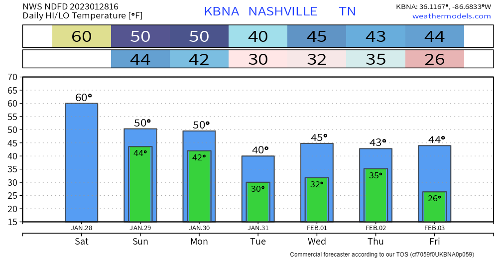
Until around 7-8pm tonight, it’ll be a beautiful day. High of 60°, can’t ask for too much better of a late January day. (besides the rain)
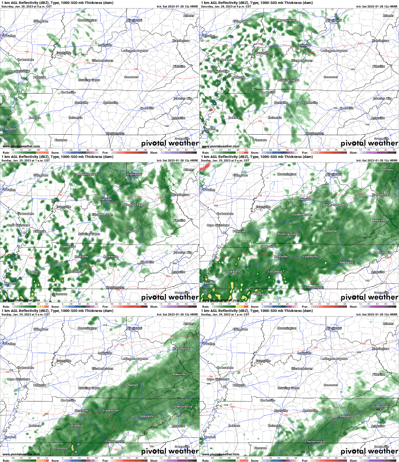
HRRR model (above) thinks the rain will move in after dark, looks around 7-8pm. Nothing serious, just rain. No severe weather or winter weather. Rain should move out by lunchtime Sunday.
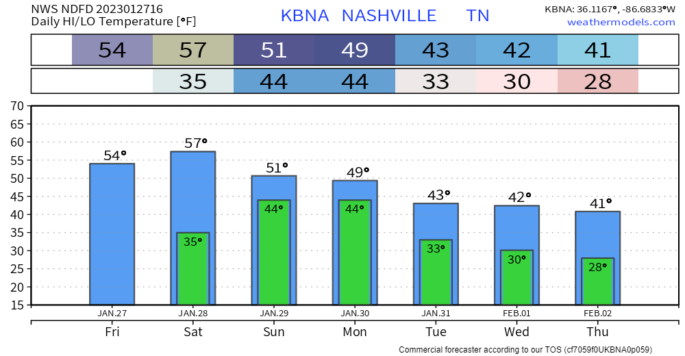
Clouds cleared out from this morning, leaving us with a cool, but at least sunny day.
The majority of Saturday will be a repeat of today.
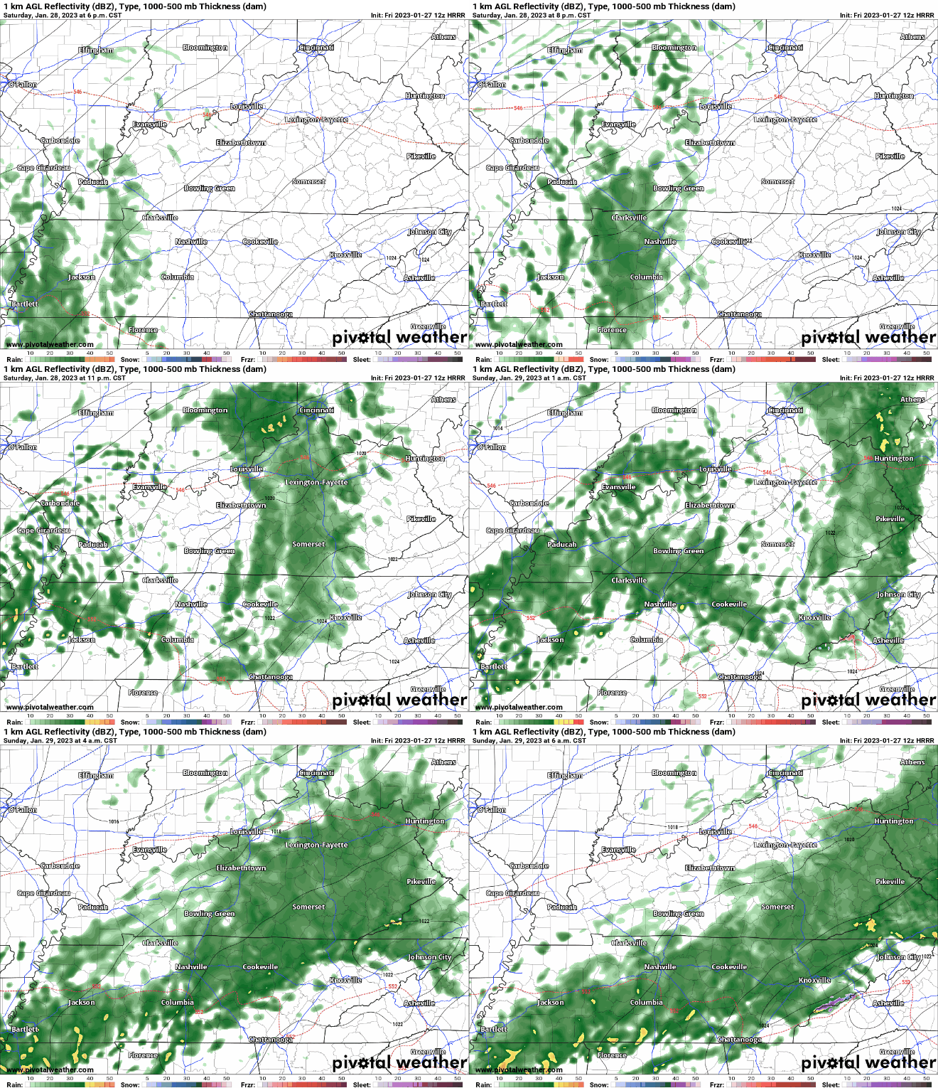
HRRR model (above) thinks rain disrupts our dry weekend Saturday night sometime after dark. Just rain, no severe weather or winter weather. Models think rain ends Sunday midday.

Well, the snow flurries took it as disrespect when we said no impacts and not to worry…

As of 9am, the temperature at BNA is 37°…surrounding areas are a few degrees cooler, but the areas where you may get a quick burst of snow showers may lay down a coating.
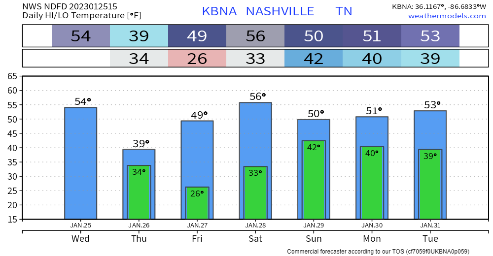
As of 10am, temperatures are in the upper 40’s, and will drop throughout the day. Gusty winds will continue through this afternoon, sustained winds of 20-25mph, with gusts up to 40mph are possible. They’ll calm down this evening and tonight.
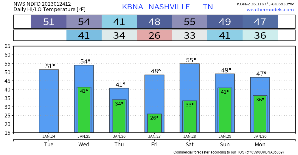
First half of today will be nice, I’d take this time to strap down any outdoor furniture, including trampolines. If today is trash day for you, I’d also bring in my trash can ASAP so you aren’t playing tag with it down the street.
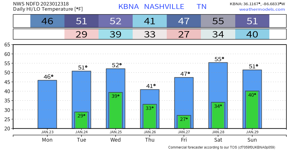
Decent day today, clouds from earlier are moving out. Temperatures are about where they ought to be for this time of year.
The majority of tomorrow will be similar to today, until some rain + non-thunderstorm wind moves in tomorrow evening.
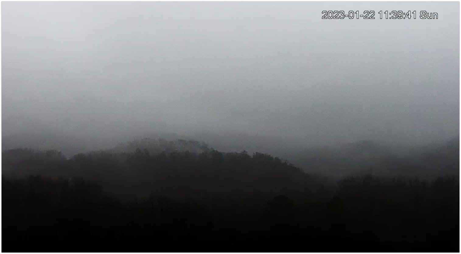
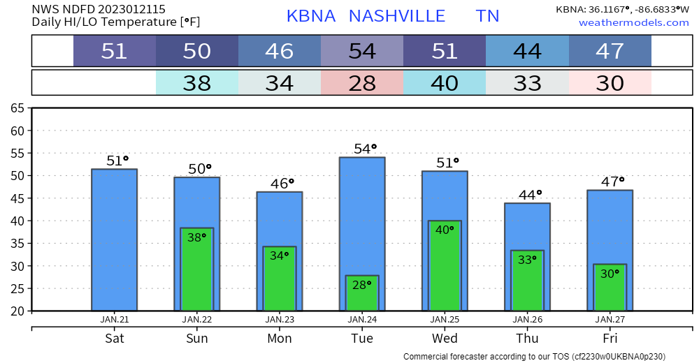
We’re been on a bit of a roller coaster lately. We are seeing disturbances here and to our north cause us to swing from lovely spring days to blerg. It’s the same story this week.
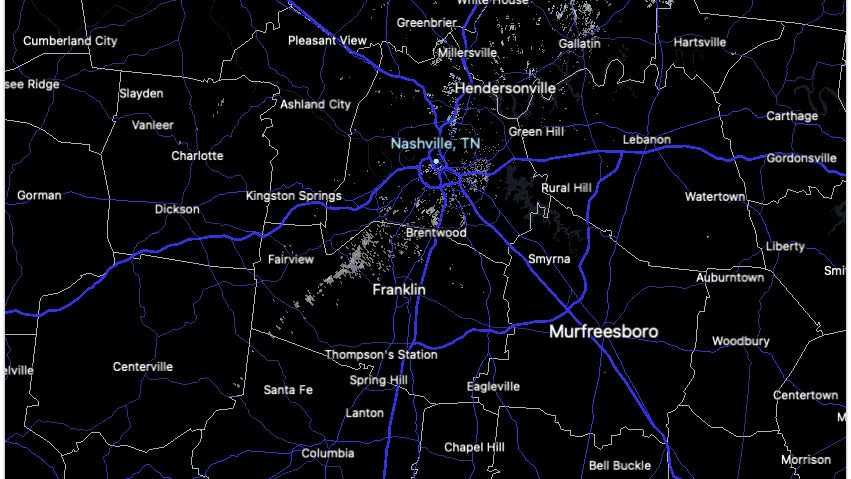
At this hour (Noon), the radar looks rain free. But the satellite and super mega cam tell a different story.
The year was 1985. New cars would set you back about $9000 on average. If you think that number is low, check out the low temp. On January 19th, Nashville recorded 5.3 inches of snowfall, and by the 21st, with 5 inches still on the ground, Nashville’s temperature plunged to -17°, the coldest temperature since records started in 1873…a record that still stands today. Franklin got even colder, dropping to -21°.
You must be logged in to post a comment.