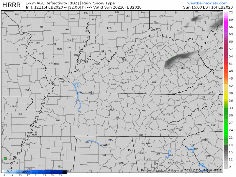
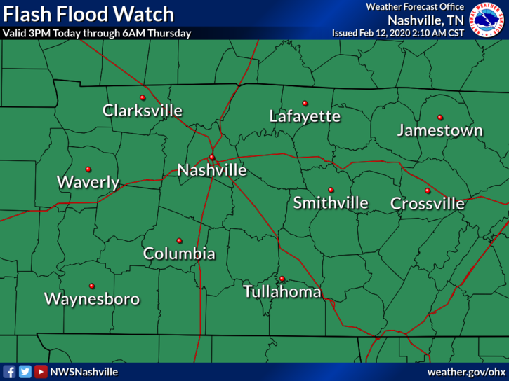
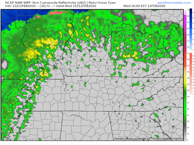
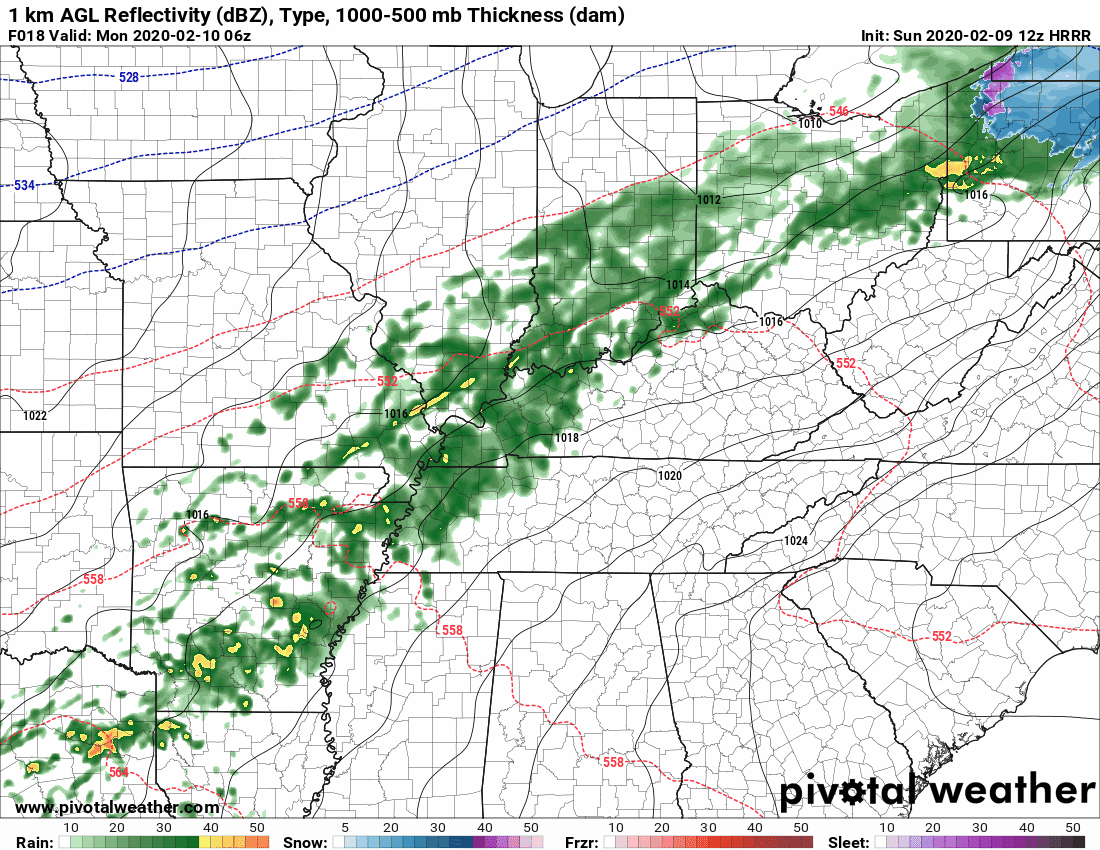
Now that all the excessive rainfall has moved on out of Middle Tennessee, cooler temperatures are going to stick around with us over the next couple of days. Due to all of that rain, some rivers and creeks are still pretty high, so rivers such as the Cumberland and Harpeth currently have flood advisories attached to them for elevated levels, although neither river is forecast to reach flood stage. Careful on the greenway near Percy Priest Dam, however. Portions of it will be impacted.read more
1″ to 2″ of rain today. Widespread flash flooding not expected. But area creeks, streams usually prone to flooding may be up tonight and Monday morning. *Looks at Mill Creek in Nolensville*read more
Today began with a good misting of rain for many of us.
That rain has pulled out and taken some of the cloud cover with it, but it won’t last long.
Here is a wide angle view of the radar at 12:35pm showing more light showers similar to this morning on our SW doorstep.
This won’t ruin any plans, but it will make the roads wet again, and usher in some cooler temps while it’s overhead. Bring a rain jacket to the honkey tonks tonight.
Sunday Rain/Storm Chances
An upper low will deepen as it swings off the Rockies and through the central part of the country. Southerly surface flow will pick up ahead of this system encouraging temperatures to warm into the
mid to upper 60s again on Sunday. PWATS are still running very high for the time of the year. Values of 1.5 inches or higher could be possible through the early morning hours on Sunday to Sunday night.
Models have shifted the axis of heaviest precip to
the west, over portions of west Tennessee and western Kentucky. However, this axis could easily wobble east or west over the next 24 hours as we see how the system evolves. For now, expect anywhere from 1 to 2 and a half inches of rain in Middle
Tennessee.read more
A few showers are showing up on radar this morning and on the HRRR model for this afternoon:
Most of us will stay dry throughout the afternoon, just a little trace of precipitation by the end of the day. Temperatures will be a lot like yesterday’s, high around 64°. read more
We’ll start to see more and more of breaks in the clouds as we progress through the mid afternoon. Rain for this afternoon will stay off to our East as it pushes out of the area. Now that the sun’s out, temps have risen quickly. We’re up to a balmy 67° at BNA as of 1:00 pm!read more
We have a blanket of clouds over us today. This is out ahead of our next chance at rain.
Clouds should keep our high in the mid 50°s. Rain should keep away for today.
Rain Chances Build Up
This system will mainly keep to our south. Model guidance is shaky for how this moves north. The further north this system tracks, the more rain we are likely to see.read more
Subscribe to Blog via Email
Privacy & Cookies: This site uses cookies. By continuing to use this website, you agree to their use.
To find out more, including how to control cookies, see here:
Privacy Policy
You must be logged in to post a comment.