
Light rain possible but not guaranteed tomorrow. HRRR model predicts tiny showers mid/late afternoon under 0.1″, and not everyone would get them:
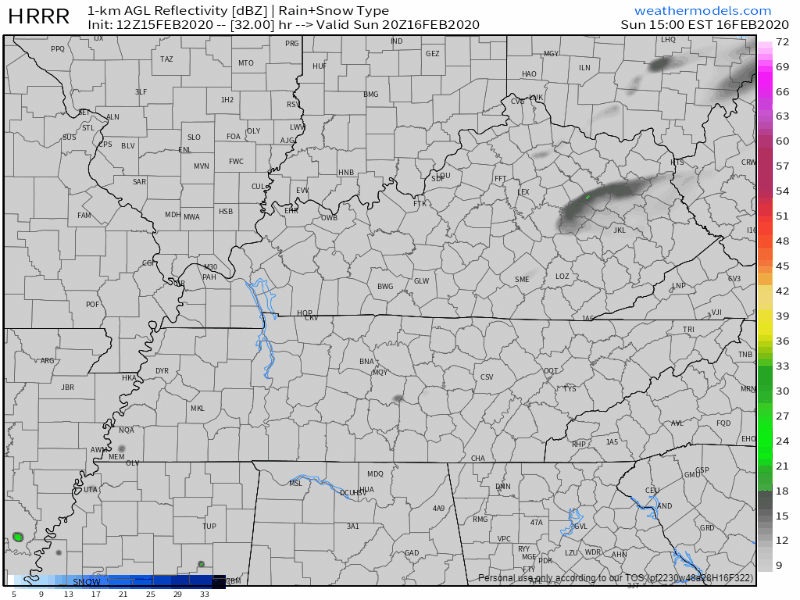
Euro thinks we’ll be cloudy, but not raining. If it does rain there won’t be enough rain to cancel anything.
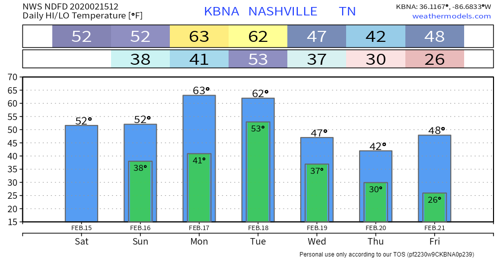
Steadier rain could begin anytime Monday but it’s more likely to start closer to midnight. Possible washout Tuesday, rain likely in the morning and almost certain Tuesday afternoon, ending Tuesday night.
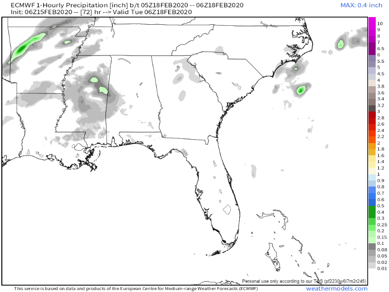
Thunderstorms possible Tuesday afternoon but that’s unlikely and not a current concern. Not an all day continuous rain; expect breaks.
This system keeps trending weaker with each model run suggesting a low threat for any strong storms or heavy rain. Most models suggest total rainfall amounts should be less than a half inch…a welcome change from the past few systems as some rivers still remain high.
NWS-Nashville, AM Forecast Discussion, 2/15/20.
Colder starting Wednesday, but not bitterly cold. February:

Rainfall so far this month. Worst of it has been south and east of us:
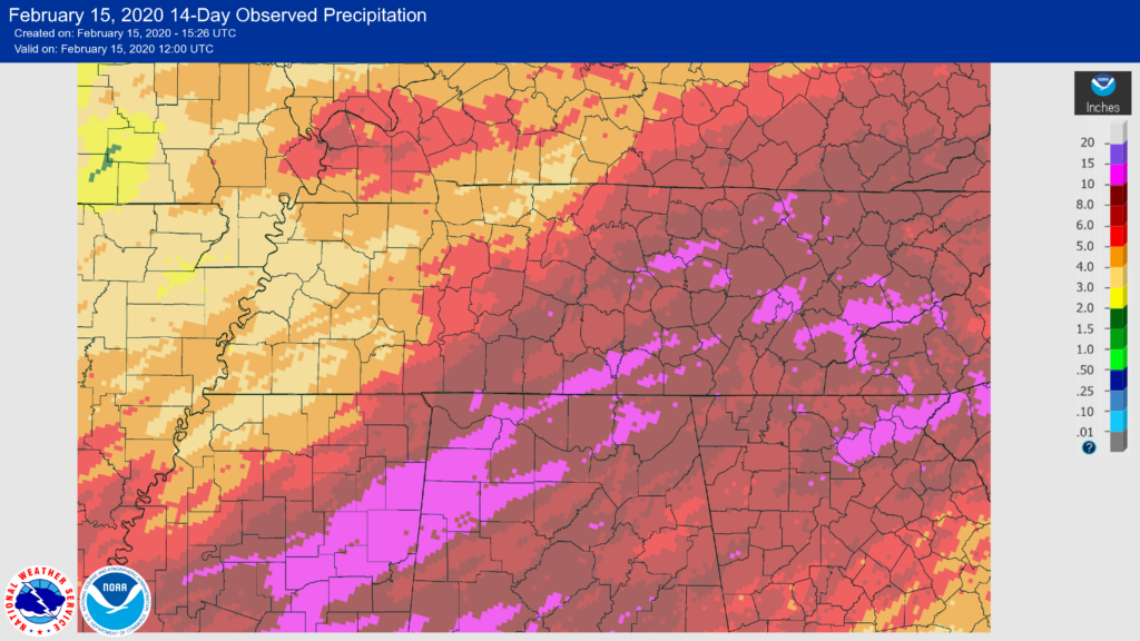
February 2020 is running 3.46″ more than normal.
We’ve had 10.50″ since Jan 1. That’s 4.79″ above normal.
I don’t see snow on the horizon. Snowshowers were showing up in earlier model runs for late Wednesday/early Thursday, but that assumed the rain Tuesday would still be around. We don’t think it will. Current thinking is we won’t have precip, the air won’t be cold enough for long enough, and the ground would be too warm.
The 15 day Euro Ensemble model (the gold standard of imperfect models) predicts 1.9″ of rain over the next 15 days and maybe a few flakes here and there.
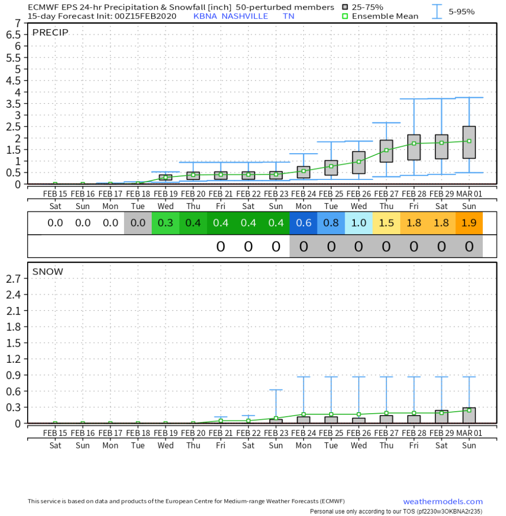
Nothing to get excited about. This model has shown the same pattern pretty much all winter with disappointing results. No big snows seen as we look into an unknown, fuzzy future.
Categories: Forecast Blogs (Legacy)
You must be logged in to post a comment.