
Calm, Dry End of the Week
We can expect mostly sunny skies Thursday and Friday. Thursday’s highs reach 65°, while Friday’s highs reach 76°.
Secure any hats Friday as winds will blow at 10-15 MPH, with gusts as high as 20 MPH.

We can expect mostly sunny skies Thursday and Friday. Thursday’s highs reach 65°, while Friday’s highs reach 76°.
Secure any hats Friday as winds will blow at 10-15 MPH, with gusts as high as 20 MPH.
We hit 30°F before sunrise. Bit of a scare for those who have already planted their gardens. Temperatures are expected to rebound nicely afternoon. High around 60°F.
A high pressure system is in place to make sure it stays sunny. Lows tonight will dip back into the upper 30s. Some frost may still be possible in many spots, though another hard freeze is not expected.
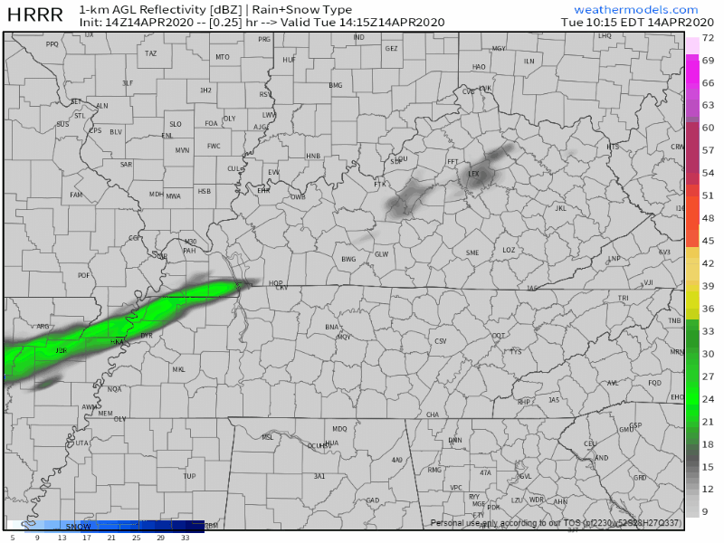
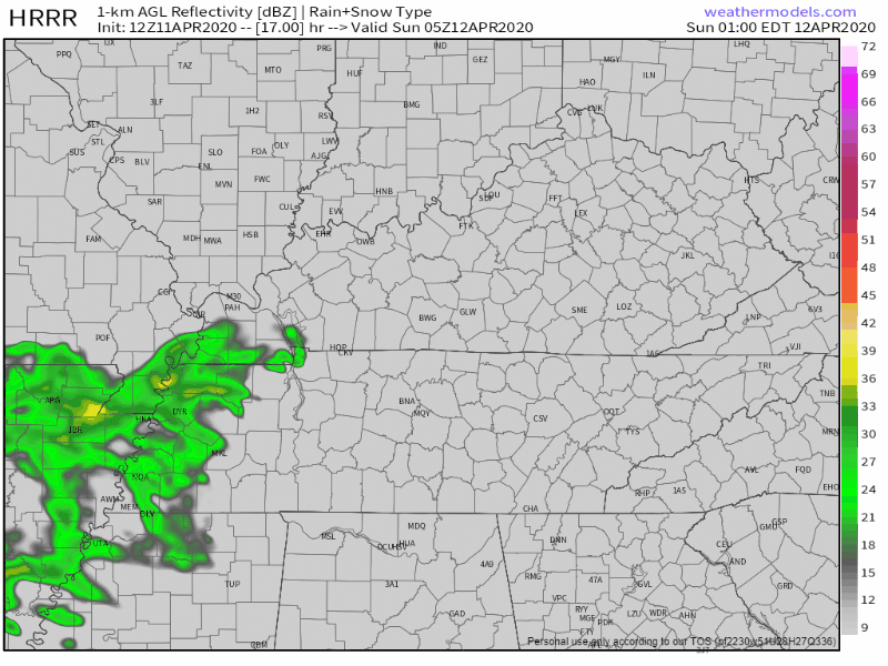
A few clouds and a stiff north wind will keep our high temperature at 50° for the high. Even if the sun is shining today, don’t be fooled, it’s still chilly. The wind won’t be giving us much of a break either, gusting up to 20 mph throughout the day. A slight chance of one or two light showers are possible, but the HRRR thinks we’ll steer clear of those:
After our noisy, gusty system (gusts to 36 mph at BNA overnight) exits to the NE, we’re left on the cool side. Stiff NW winds will keep us in the 50s for highs today. No rain is expected.
Clouds will hang around for a while, but a clearing line is slowly making its way our direction from the NW.

The main storm line departed at 5:15 PM. It caused a Severe Thunderstorm Warning for 60 MPH winds.
No Tornado Watch and no Severe Thunderstorm Watch is in effect for Davidson or Williamson County.
The following is for Davidson and Williamson Counties only. Those south and east of us may end up dealing with a much different situation tonight and overnight.
Note: this forecast is for Davidson and Williamson Counties only. It is not written for all of Middle Tennessee. This forecast would be much different if our audience was in southern or eastern Middle Tennessee.
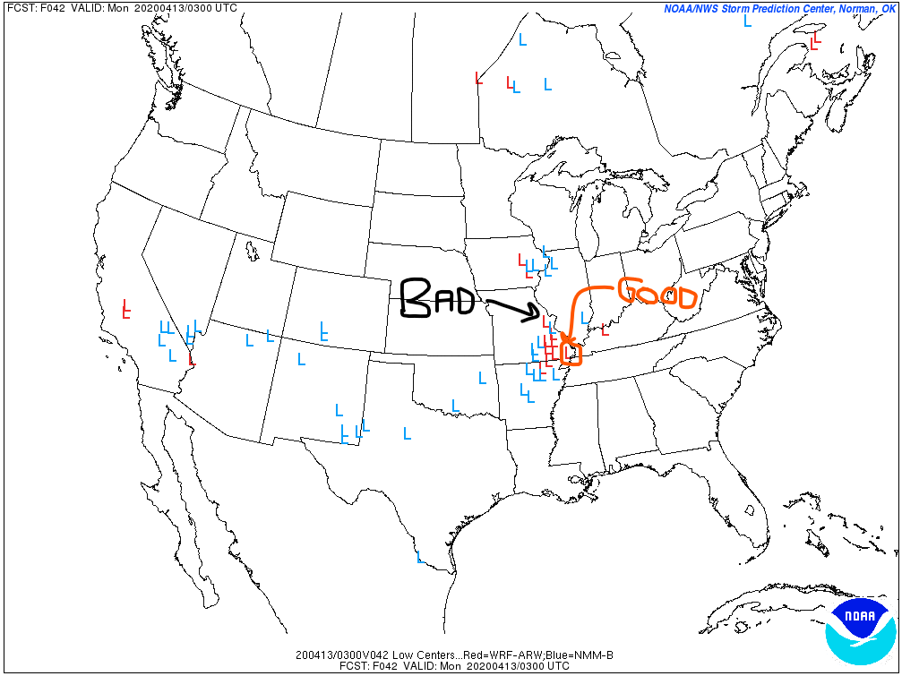
This forecast may change tomorrow as uncertainties clear up. Stay connected. Have multiple reliable ways to get warnings.
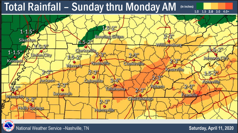
We think it’ll rain in the morning. Starting before sunrise, off and on through the morning. Just rain, not severe weather.
It’s going to rain hard on Easter, but probably not raining all day. The flash flood threat is mostly for those to our SE, but some models deliver us heavy rain so be alert.
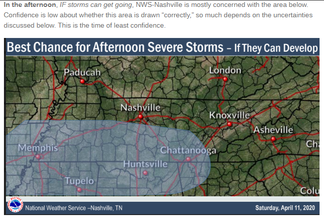
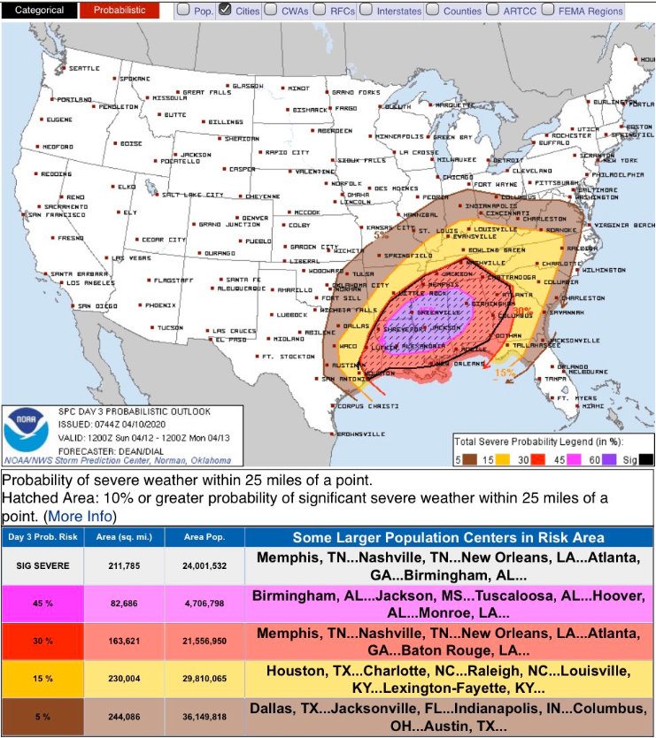
Severe weather? I’m glad you asked.
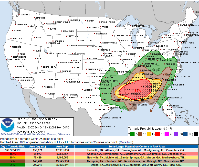
Middle Tennessee is under an enhanced risk of severe storms on Sunday, mainly in the late afternoon and evening. Damaging straight line winds, large hail, and isolated tornadoes are all possible.
NWS-Nashville
I’m going to trust you. If you’re going to skim this, don’t read it at all because you’ll miss important details.
Two really nice spring days today and Saturday. Cold Saturday morning though.
We’ll warm up considerably on Saturday with a slight chance of showers before midnight.
As always, but especially Sunday . . .
You must be logged in to post a comment.