
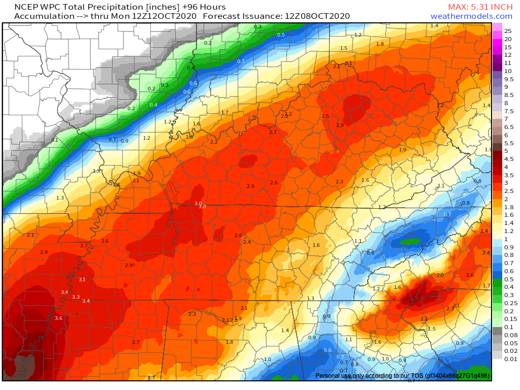
Keep The Rain Gear Handy This Weekend!
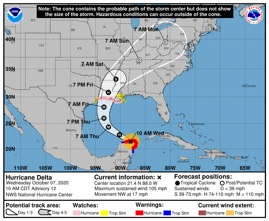
Category 3 Hurricane Delta still churning in the Gulf of Mexico this morning as its arrival time to make landfall awaits tonight.
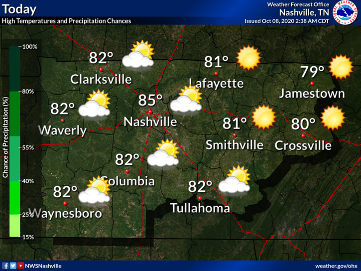
A build-up of cloud cover over the Middle Tennessee area into the afternoon is due to the very outer bands of Delta as it approaches the Louisiana coastline.


You must be logged in to post a comment.