

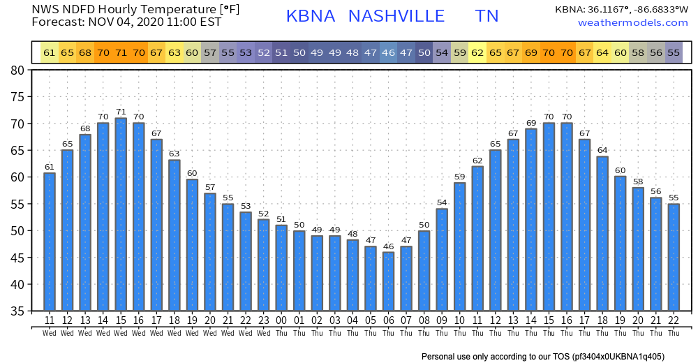
Another warm, sunny (ish) day in store!
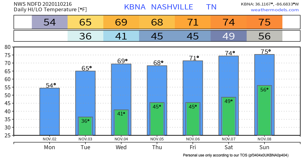
High today will reach 69 degrees, some of us will make it into the 70’s, which is fairly average for this time of year.
Mostly sunny, with some clouds.
Temps will drop the low tonight and overnight into the mid 40’s.


You must be logged in to post a comment.