

David says Fall doesn’t smoothly transition. Temps go up and down. Like this:
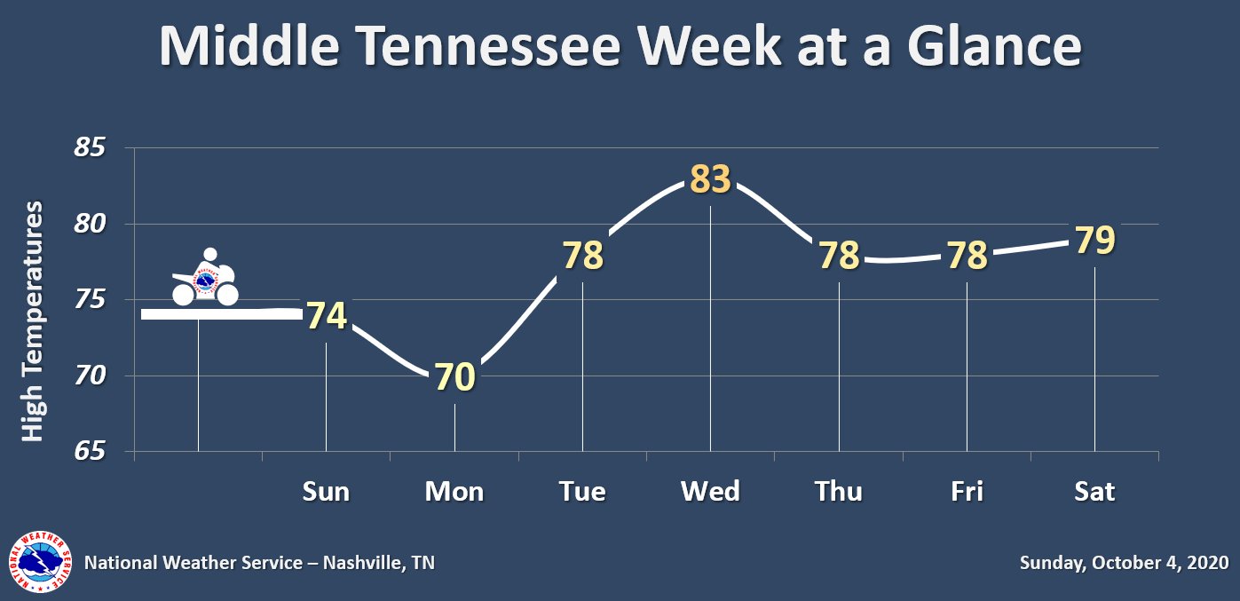
That temp dip Monday is due to an approaching cold front that gets here later tonight. Lows Monday morning into the 40s.
This approaching cold front could bring some isolated showers ahead of it this (Sunday) afternoon, however, most of the rain will stay in our northern counties.
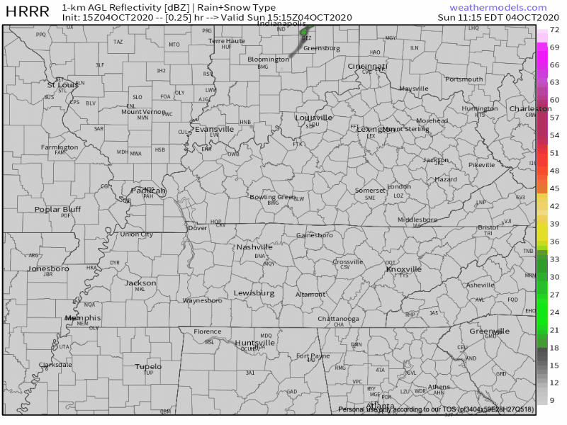
If you have any outdoor plans today, keep them. We don’t see this rain affecting much, if at all.
No Rain This Week!
Rain preventing high-pressure will linger over the area for the remainder of the week.
Nothing close to freezing this week. It would be early for that anyway.
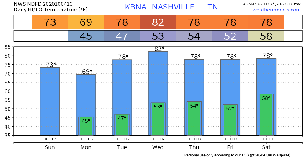
Enjoy the rain-free, pleasant temp week!
What’s That In The Tropics?
Our next chance of rain may come from a tropical wave (Invest 92L, see below).
By next weekend, models continue to struggle with the overall pattern due to what happens with Tropical Storm Gamma and the tropical wave to its east, as well as a large approaching upper trough over the Plains. At this long range, appears enough moisture will spread northward from the Gulf Coast for a slight chance of showers across parts of the area next weekend. However, it should be noted that the extended forecast is highly uncertain.
NWS-Nashville Forecast Discussion, 10/4/20
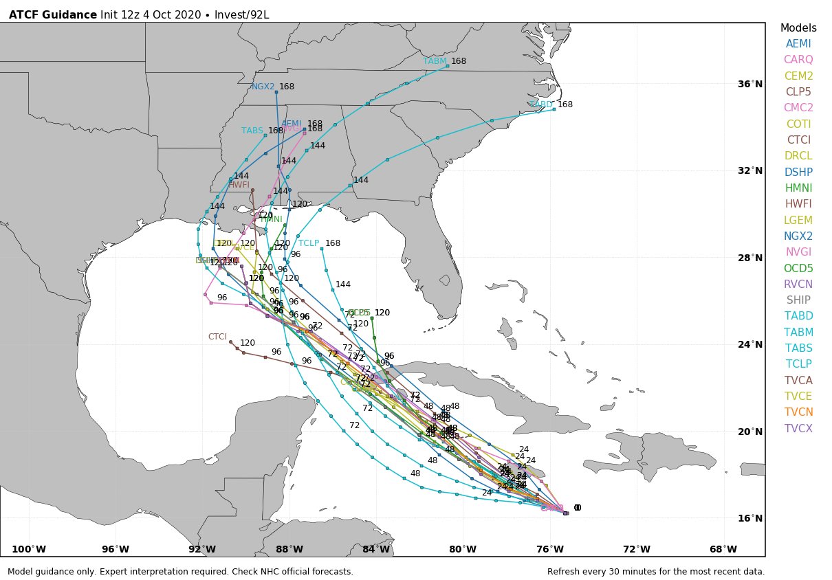
Models have no real idea what will become of 92L. For us, maybe late weekend rain. Meh.
Interestingly, both Euro and GFS models have a pretty big cold front coming through middle of next week (Oct 13-14). Reliability, lol.
As always, check back for updates to the forecast and be sure to follow @NashSevereWx on Twitter!
Categories: Forecast Blogs (Legacy)
You must be logged in to post a comment.