Here Comes Irma
Irma is on the way and we will begin to feel the effects of Irma on our Middle Tennessee weather pattern. Irma, now a tropical storm, will continue to make its way north and westward through the remainder of today and into tomorrow.

Irma is on the way and we will begin to feel the effects of Irma on our Middle Tennessee weather pattern. Irma, now a tropical storm, will continue to make its way north and westward through the remainder of today and into tomorrow.
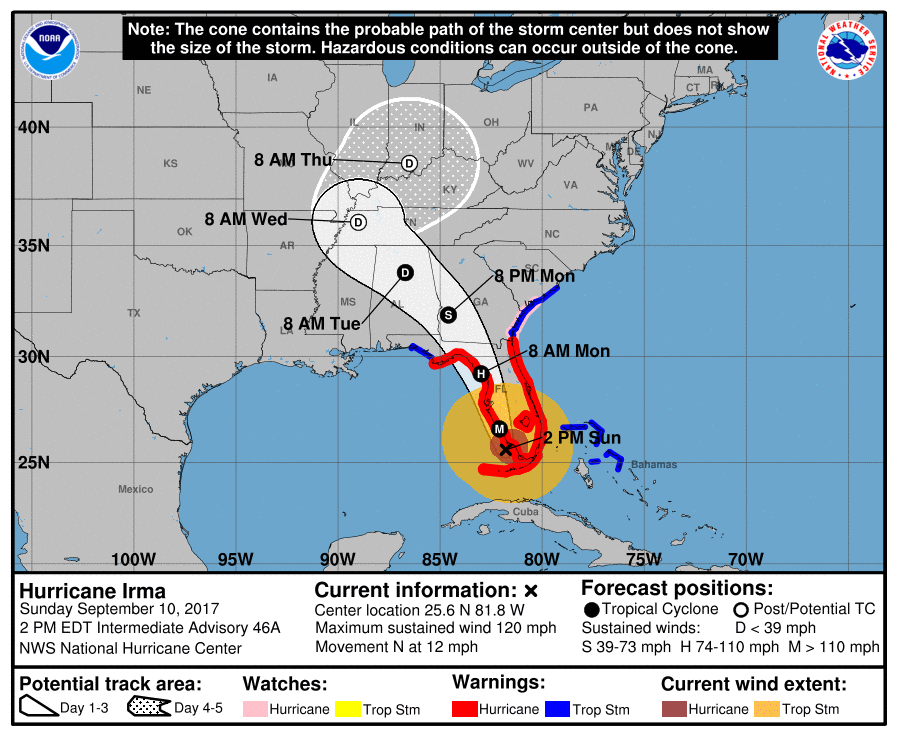
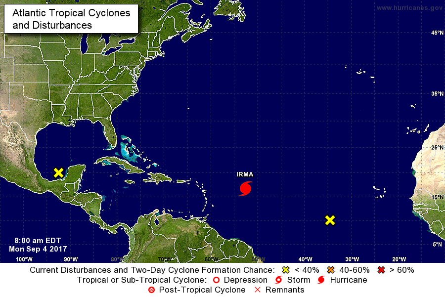
Late Monday night, Irma’s center will pass to our south. See the red “L” below.
Irma is a large storm. Before Irma’s center crosses I-65 in Alabama, rain will approach from our southeast.
This morning, Irma is a Cat 4 hurricane with maximum sustained winds of 130 MPH.
Sunrise revealed Irma’s eye striking Key West at 7:49 AM CDT:

Irma is a large storm. Although its center is in Key West, the moisture train extends to the North Carolina-Virginia border:
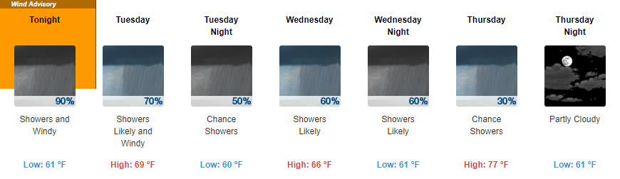
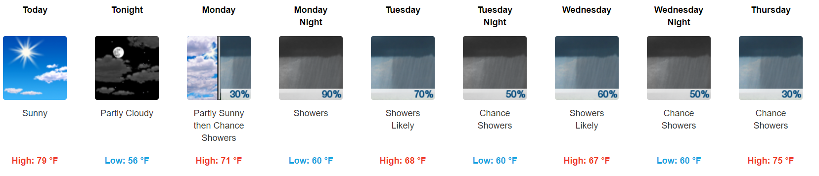
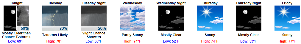
Northeasterly flow continues today and tomorrow with wind gusts as high as 25 mph. It’s the time of year for dual-wardrobes — shorts during the day and jackets during the evenings.

First things first, we broke a long-standing record this morning for the record low temperature on September 8th.
This morning we set a record low for September 8, 50°, breaking the old record of 51° set in 1898. pic.twitter.com/0mYukYAV5N

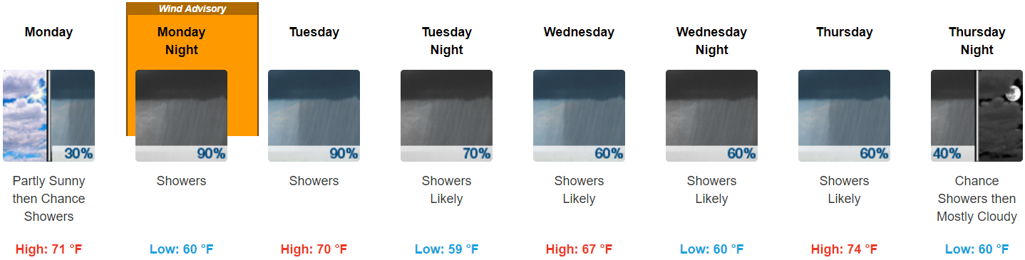
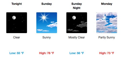
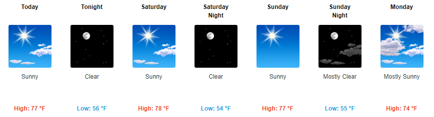
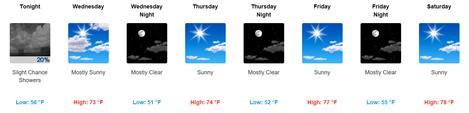
All the way through next Monday, expect daily afternoon temperatures in the mid to upper 70s and overnight lows in the low to mid 50s! Definitely feeling like fall.
This morning’s run of the GFS keeps us rain-free through Monday morning:

Let’s start with the NWS Nashville’s AM discussion, there really isn’t a better way to put how the next few days will be:
With yesterday`s showers and scattered thunderstorms just a distant memory, there really isn`t a whole lot to talk about in this morning`s forecast package. We continue to monitor the behemoth Irma and her monster winds in the Atlantic and what she could bring to Middle TN, but the bulk of this morning`s discussion is going to revolve around unseasonably cool temperatures and a mostly dry forecast.
GFS 250mb Winds through Sunday (Jet Stream)
The beginning of this loop is today’s storm energy moving through, with a cold front behind it.
High temperatures the rest of the week will remain in the 70s, gradually warming by the weekend. Northerly flow will keep our daytime temperatures nearly 10-15 degrees below normal for this time of year. Additionally, with mostly clear skies each night, our overnight lows will be exceptionally chilly…somewhere in the low to mid 50s through next Sunday!
We aren’t sure when it’ll start.
Chances begin around 3 AM, or . . . around 10 AM . . . or sometime in between. Models disagree!

(1) The NAM3 model thinks 3 AM. Here it is coming down I-24 tonight:
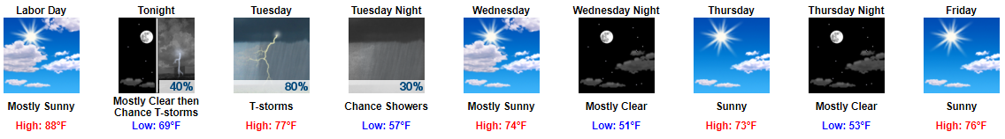
Sunny, high 88°, with mid-60°s dewpoint will make a great Labor Day.
Late tonight, rain and a few thunderstorms will form in the midwest, then dive southeast, pick up I-24, and arrive here in the wee hours of Tuesday morning.
You must be logged in to post a comment.