Severe Threat Today
*Outdoor plans at First Tennessee Park, Ascend or somewhere else? Keep your radar handy and check in frequently. Could have some storms around. See below.
It’s going to be hot and steamy today. The high will reach into the low 90s with the dewpoints staying in the low 70s.
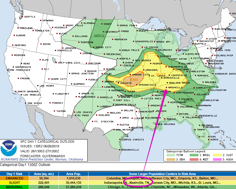
The Storm Prediction Center has placed us within a Slight Risk [2 out of 5] of severe weather today. What can we expect from this?
Parameters for potential strong/severe weather are setting up across middle Tennessee. Daytime heating will create the lift needed for severe storms to grow.

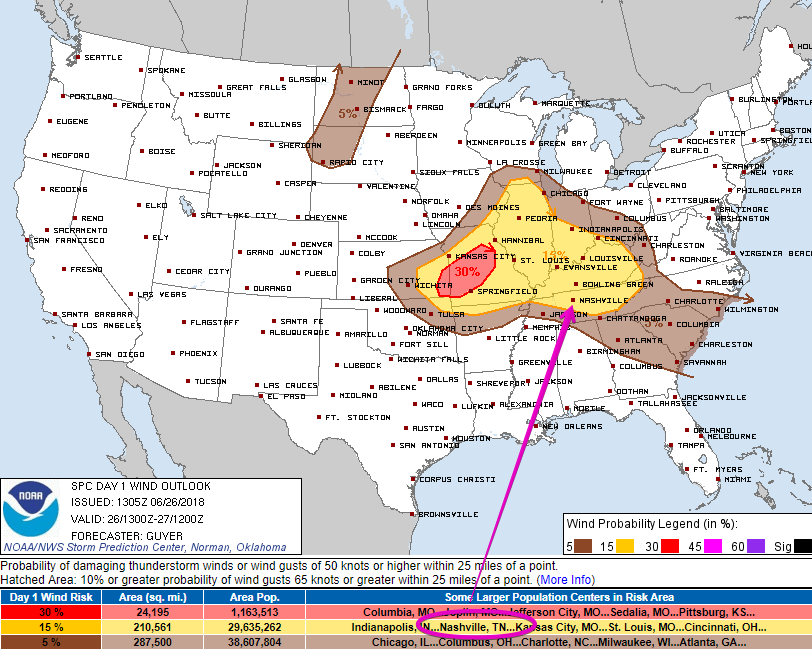
For Williamson and Davidson counties, the main threat is wind. Large hail and tornadoes are not expected for us.

The SPC thinks there is a 15% chance of damaging winds within 25 miles of you.
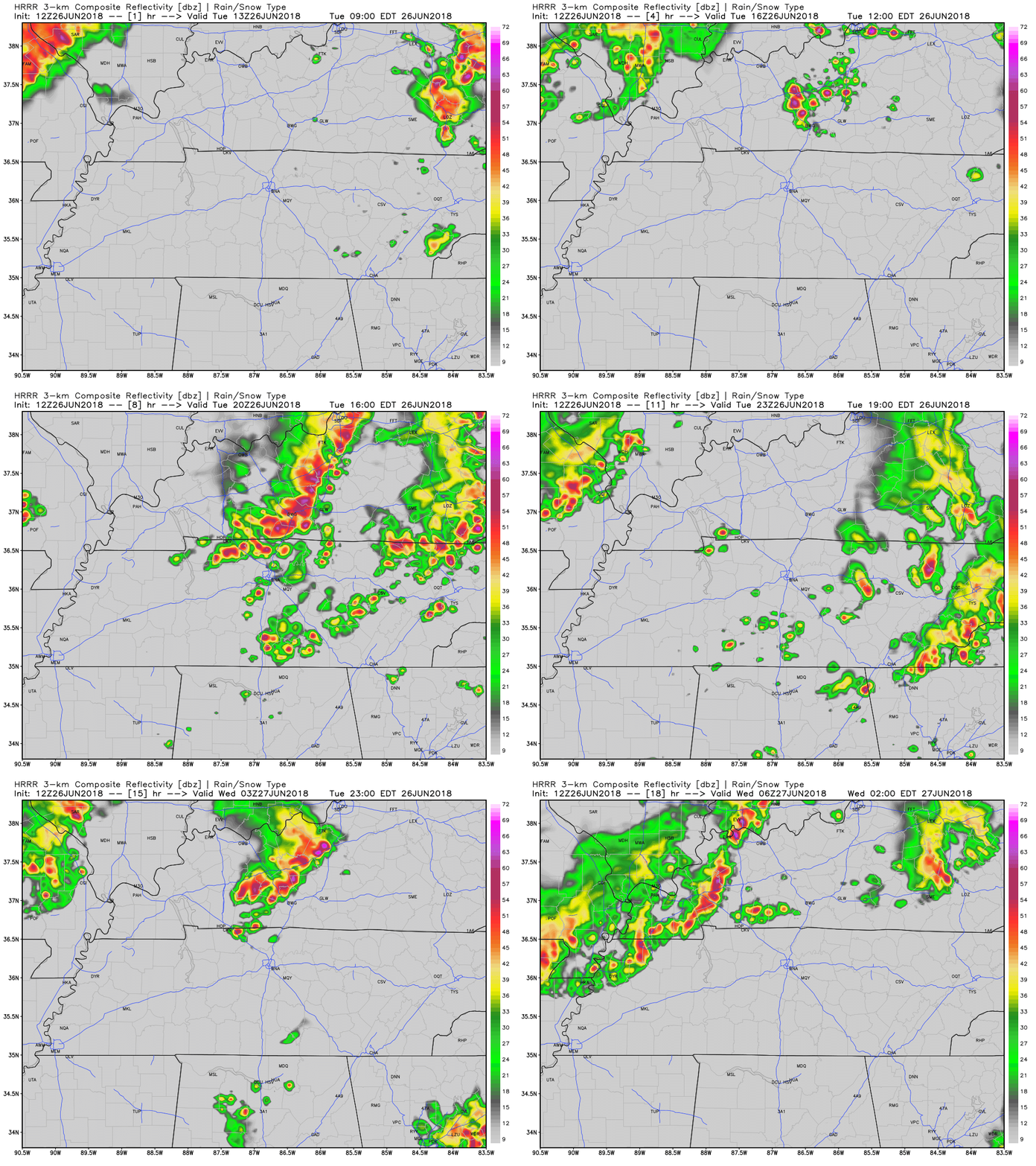
As we’ve mentioned before, this week has been difficult to predict. We have the HRRR to give us an idea of what the radar could look like. Afternoon heating will be that spark needed for storms to fire.
[Editor’s Note: Marti is referring to the fact that models such as the HRRR have had an exceptionally hard time predicting where our summer-time storms will develop and where they’ll go. Don’t mistake the below “future radar” product from the HRRR (or any model) for location certainty. If storms get going and dive our way….(continue below)]
Storms will likely hang around through the afternoon and into the evening. Models are indicating that we could have another line of showers/storms push through late tonight.

The Rest of the Week

We’re in a summer storms pattern. Daytime heating will allow for lift in the afternoons. Strong showers/storms could occur from this. Hail, gusting winds, and lightning can all come from severe storms.
We won’t be able to avoid the humidity through the end of the week. High’s are expected to remain in the low to mid 90s every day, but dewpoints are going to rise into the mid 70s.
Afternoon storms, oppressive humidity, and hot.
Sounds like summer to me.

Check back to NashSevereWx for updates on the forecast!
Categories: Forecast Blogs (Legacy)


You must be logged in to post a comment.