Potential Record Heat Next Week As We Move Into October

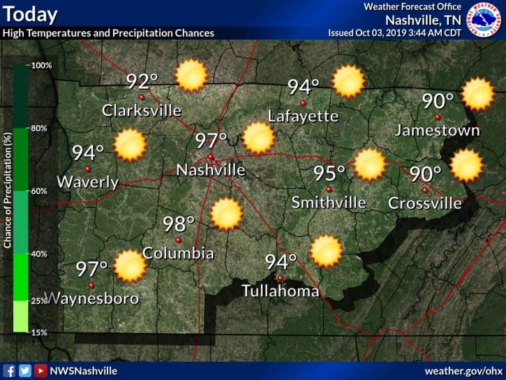
The 90s Aren’t Going Away Anytime Soon

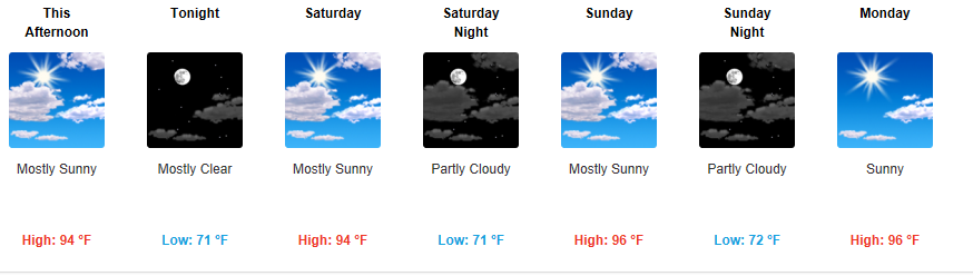
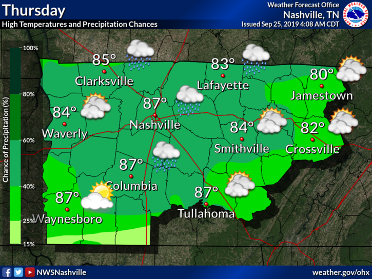
There are plenty of chances this week for some high temperature records to be broken with all forecasted highs in the mid 90s. Minimal rain chances through the week, not really any relief in sight. A strong upper level ridge boosts our temperatures mid week up to near 96°, making it feel like a July afternoon. The all-time record high for October, 94°, has a good chance of being snapped later on this week. read more

When is Fall coming? Ummmm, Well, …..

Today should be the nicest day of the week.

Humidity left. Dew points in the mid 40°s — fall quality! — but temps remain above normal for late September with mid/upper 80°s.

Rain chances return Wednesday night into Thursday morning.

Wednesday will be nice.

Showers arrive maybe Wednesday night but probably Thursday morning as another cold front moves into the region. read more

It’s the First Day of Fall! (it’s ghosting us).

We won’t see a lot of rain today, sorry.

At least it’s something?

These aren’t pop up storms, instead a weak cold front is moving through today, setting off this rain.

NWS-Nashville predicts less than .25″, with most areas receiving less than .10″. Your backyard could see more, some could see less; either way it’s not a lot. This will do little to cut into our monthly deficit. read more

Today

At the time of writing this the temperature is 89º, but it sure doesn’t feel like with a 52º dew point. A steady 10mph breeze doesn’t hurt anything either. All in all, if you’re tailgating, back yard tailgating, or outside for Pilgrimage, things are pretty comfortable. That being said, take some sunscreen. read more

Heat and Sunshine Currently Here to Stay; Drop in Dewpoints Friday; Update on the Drought Monitor

Copy and Paste Forecast? Pretty Much.

It’s still kinda humid and dry, though we will have a slight drop in high temps.

These above-average high temperatures keep pushing us closer to breaking a record:

“Still looks to reach the 90s for much of the area, with Nashville now at the #2 most 90 degree days ever in a year and inching ever closer to the all time record set in 1954.” @NWS-Nashville read more

Hot Today, Lower Dewpoints Tomorrow and Friday; No Rain in Sight

Wednesday? Nothing new. The Heat continues.

Hot, unfortunately. The heat continues into the middle of the month.

High today expected to be in the upper 90°s. Dewpoints in the mid 60°s. Bleh.

Any relief coming?

NWS-Nashville:

Surface observations this morning show it`s (surprise) another warm and humid one with current readings in the 60s and 70s. Some patchy fog is noted mainly over eastern counties, and cannot rule out a few dense spots. Otherwise, another unusually hot mid September day is on tap, although at least highs look to be a degree or two below yesterday`s levels. Models continue to show a surge of slightly cooler and significantly drier air coming down the east side of the Appalachians then spreading westward into our area later today.

Just barely. We might be dealing with some dry heat instead of our typical muggy heat. Let’s check the dewpoints on the models! read more