*After the Rain Ends Today
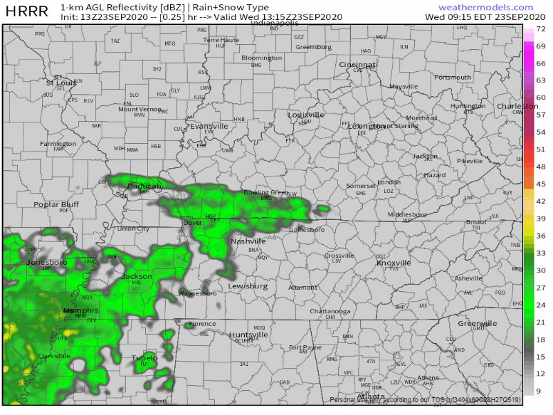
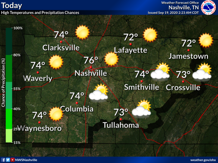
Lots of showers across Middle Tennessee today as a cold front moves our way. Washout conditions will prevail this morning. The HRRR agrees with this opinion:
The rain should clear the area by late afternoon, around 4pm.

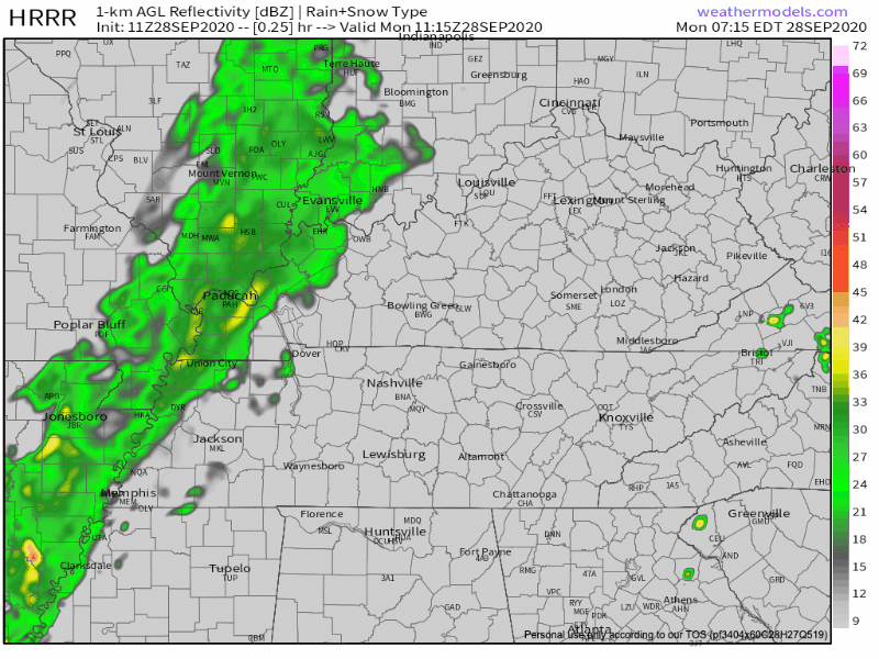
Lots of showers across Middle Tennessee today as a cold front moves our way. Washout conditions will prevail this morning. The HRRR agrees with this opinion:
The rain should clear the area by late afternoon, around 4pm.
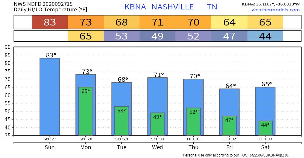
Sunday will be partly cloudy with a high of 83. Dewpoints in the mid 60s will make it feel sticky as well.
Upper-level low to our south might try and bring up a few Sunday afternoon showers. HRRR Model isn’t impressed and neither are we.
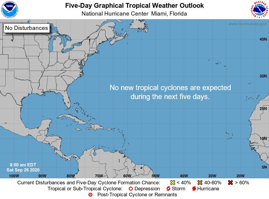
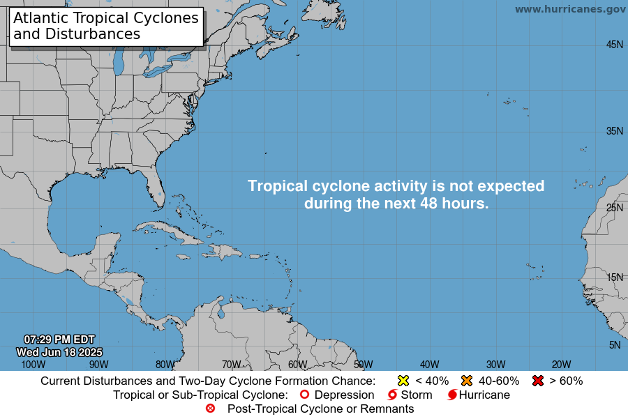
Not a single system on the map and nothing is expected to form over the next 5 days.
After a busy couple of months, we could use a break
Dense fog this morning will give way to partly cloudy skies and warm temps this afternoon. Highs should top out at 80. No rain.

The clouds will gradually clear up throughout the day today. The HRRR shows rain staying off to our east. A few popup showers may appear, but they will likely stay out of Williamson/Davidson.
Over the next day or so, the lingering moisture from Beta will also push off to the east. Make way for clearing skies and warming temperatures!
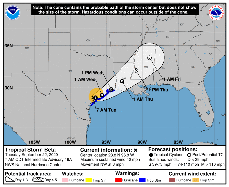
Post Tropical Depression Beta is now in central MS.
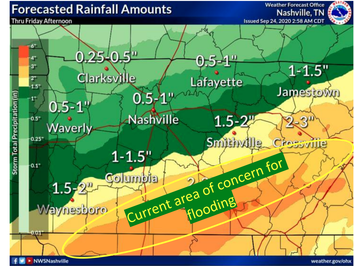
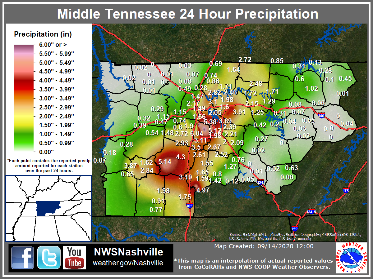
Beta’s northeast side is producing heavy rainfall in Middle Tennessee.
The north edge of that rain is cutting through our counties. More rain south, less rain to the north.
Step outside and you’ll feel a few sprinkles.
The HRRR model predicts more off and on light showers through the afternoon and evening.
Around a tenth of an inch of rain is expected. Probably not enough to rain out outdoor activities, but you may want an umbrella or rain jacket.
At 8:31 am this morning, we officially made it to the end of summer.
Not very “2020” of Mother Nature, but our temperatures will be below average today!
On the autumnal equinox, there are nearly equal amounts of daylight and darkness. Sunrise in Nashville is at 6:35 am, and sunset is 6:43 pm. The amount of daylight is getting smaller as winter inches closer…
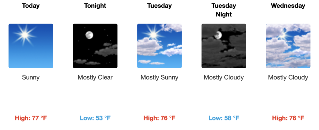
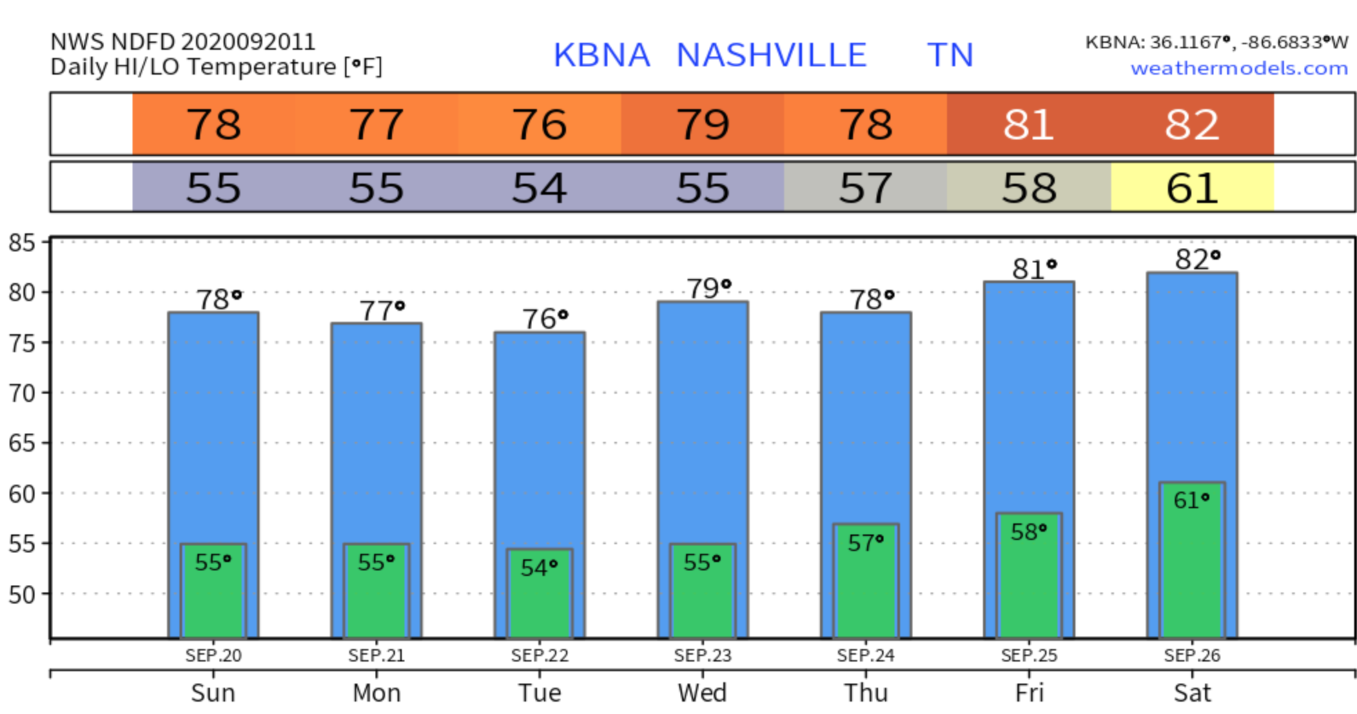
Kicking off our week by continuing our trend of high temperatures in the 70s and a lot of sunshine until mid-week.
We’re slightly below average in terms of high temperatures, but not by a lot. Normal highs for this time of year usually range in the low to mid 80s and for the past few days, our highs have been in the mid-upper 70s.
Today will be the opposite of a week ago.
Last Sunday:
Fall-like temperatures continue today along with mostly sunny skies. High temps shouldn’t exceed 80.

Fall officially starts Tuesday! As you can see by the graphic, the lowest temps this week will be on Tuesday. So festive.
It’s going to feel great today!

Highs will be near 76° with a nice breeze and clear skies!
Temps will drop into the lower 50s tonight. If you have any outdoor plans, you might want to grab a light jacket!
You must be logged in to post a comment.