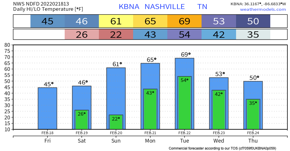

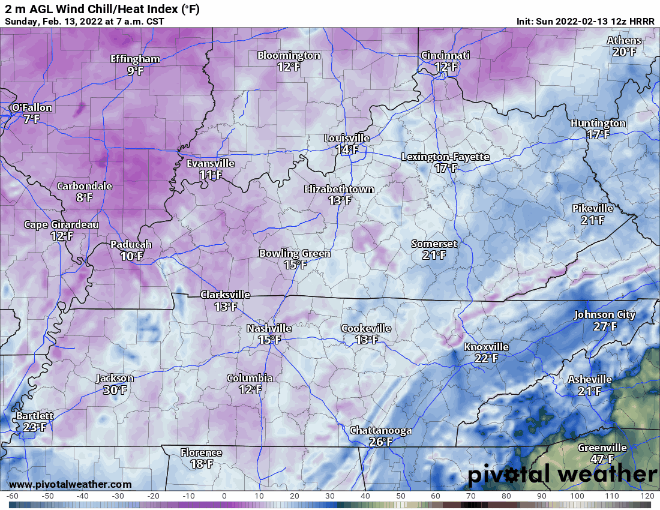
After yesterday’s storms and the passing of a cold front, we can expect some chilly temps this weekend. Lows drop into the low 20s tonight and Saturday night, so make sure plants and pets are accounted for.

After yesterday’s storms and the passing of a cold front, we can expect some chilly temps this weekend. Lows drop into the low 20s tonight and Saturday night, so make sure plants and pets are accounted for.
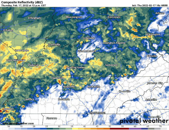
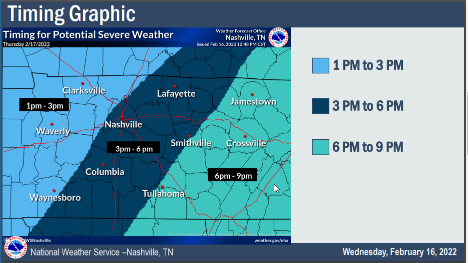
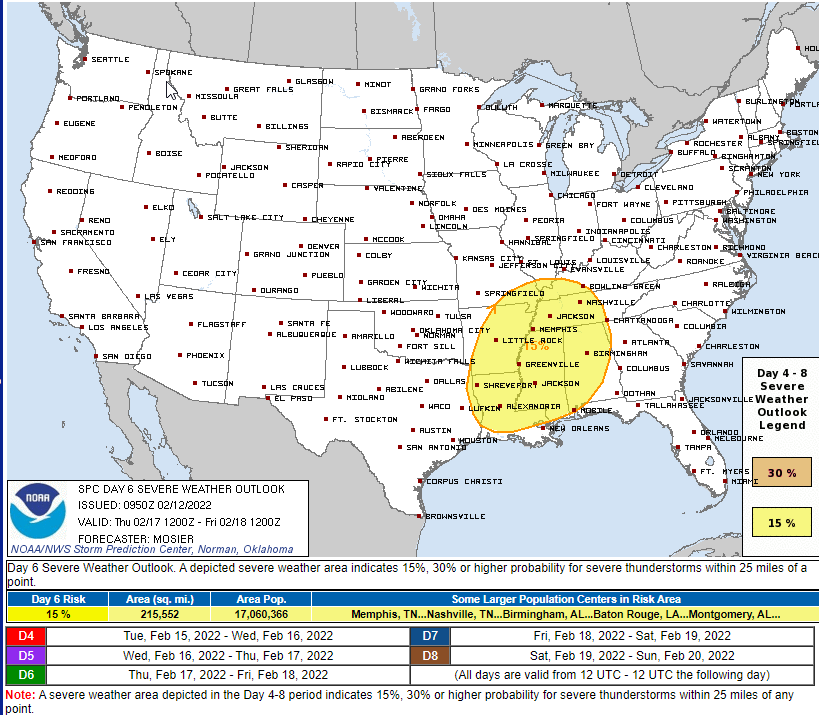
Here’s the main takeaway for today: wind is guaranteed, tornados are not. You’ll want to secure any loose objects on your porch, and avoid parking your car under unstable trees or tree branches. If you have a weather radio, today is a great day to use it. Our damaging wind probability is 30%. Our tornado risk percentage down from 10% to a 5%.
A MIGHTY WIND
Before the storms expect south winds sustained 20-30 MPH, with gusts to 45 MPH. Loose objects will be relocated.
MORNING RAIN
This should not be a big deal. Insufficient CAPE to power storms will be the reason.
Storms are fed by instability. The question for tomorrow’s potential severe event: will there be enough storm food to fire up storms AND sustain themselves? CAPE values are relatively low, but recent model runs show a slight uptick (which could be just enough).
Severe weather isn’t easy for our atmosphere to create. For severe weather to occur, there are ingredients that must be present at the “right” place at the “right” time and at the “right” amount. If these ingredients don’t line up in place, time or amount, we’re left with less than. But, who’s disappointed?
No rain is expected to interfere with any Valentine’s day plans.
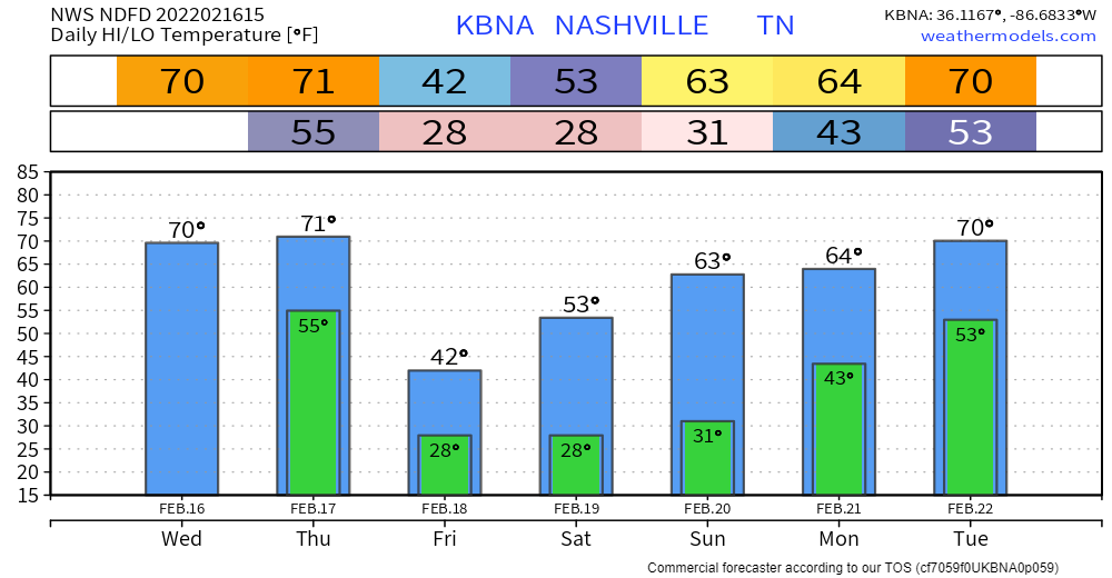
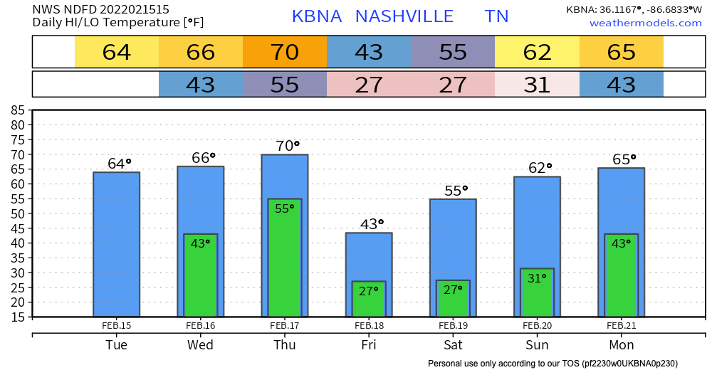
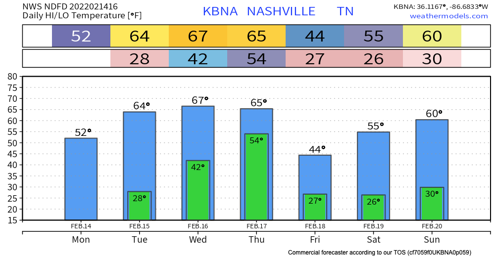
Up until Thursday, the sun stays out keeping us dry. Temperatures rise into the mid 60’s by Wednesday.
Thursday, low pressure sweeps north of Tennessee. A strong cold front will pass through our area Thursday evening bringing strong storms and maybe severe weather.

This morning is cold. Wind chills were in the teens.
Temps top out around 40 today. Hopefully your Super Bowl plans are indoors.
Monday & Tuesday are the same deal as today, but with warmer temps. We’ll crack the 60’s on Tuesday. Those warmer temps will hang on until Thursday, then begin to fall again.
Blerg today.
We got to talk blerg today. Blerg means no snow, no sun, temps under 40°. I issued a Blerg Watch today (conditions favorable for blerg) but not a Blerg Alert (blerg in progress) because we may see a few flakes this afternoon, the sun may show up briefly this afternoon, and some of us may actually hit 40°.
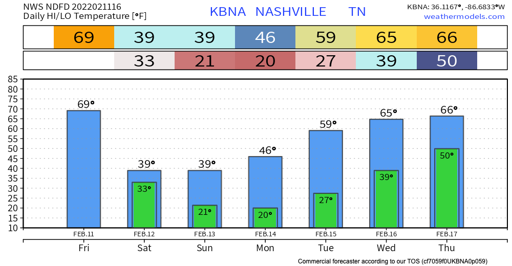
As a cold front makes its way towards us, enjoy todays higher than normal temps. Between today and tomorrow, we will be dropping about 30 (!?!?) degrees before slowly climbing back into the higher temps next week.

Mild highs today, even warmer Friday. Not record-breaking, but tomorrow’s highs are around 20 degrees above average. The comfy temps will be short-lived. Cold air is making a comeback this weekend. Turnaround of almost 30 degrees from Friday to Saturday!
You must be logged in to post a comment.