
Severe weather isn’t easy for our atmosphere to create. For severe weather to occur, there are ingredients that must be present at the “right” place at the “right” time and at the “right” amount. If these ingredients don’t line up in place, time or amount, we’re left with less than. But, who’s disappointed?
Thursday’s Setup
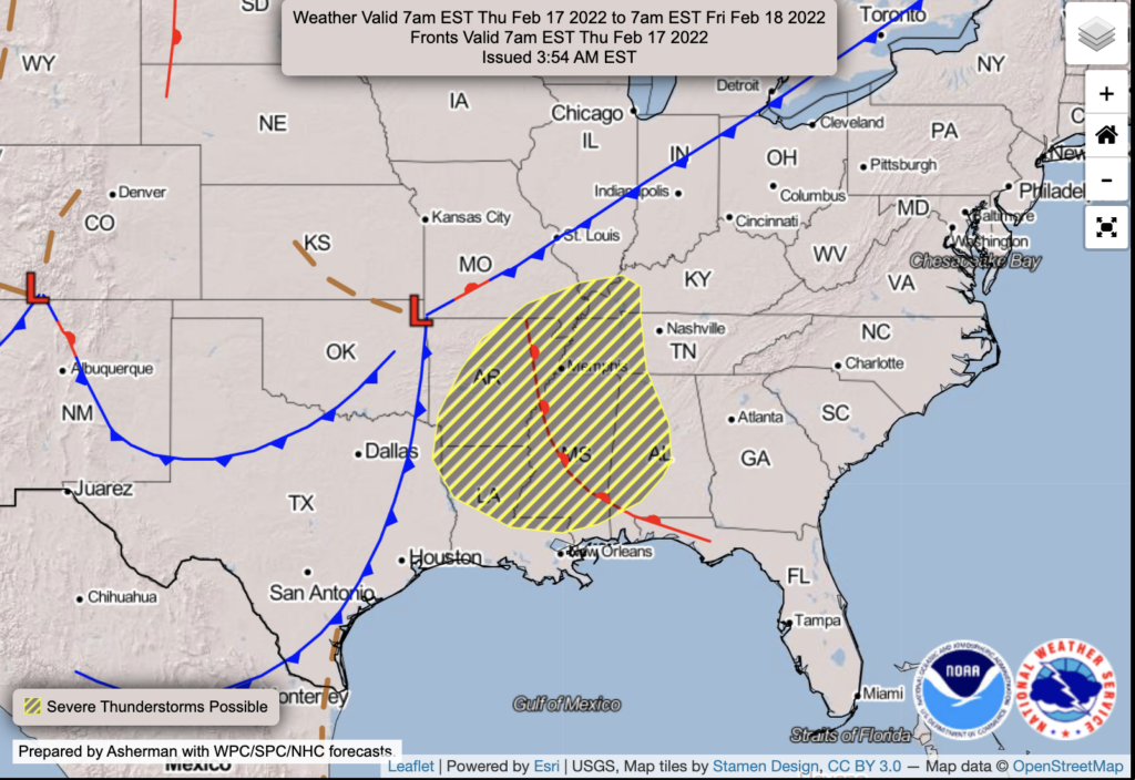
An area of low pressure is forecast to take a path from NE Oklahoma, through southern Missouri and into Illinois, passing NW of us. This will drag a warm front, then a cold front across our area. This setup is generally favorable for severe weather, which is why SPC has had an outlook on this one for several days now. It has “that look.”
But, it takes more than a look to generate the complex thing that is severe weather. The necessary ingredients may well be in place west of us. But, you’re here for hyperlocal coverage. So, let’s talk about us.
Fly In the Ointment – C.A.P.E.
I’m guilty here of oversimplifying. We’re watching C.A.P.E. and helicity (among other things).
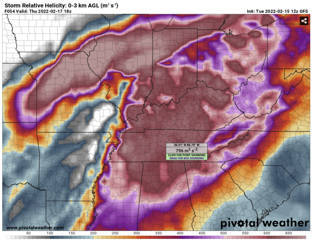
Helicity will be in place with this system. In fact, to use NWS Nashville’s verbaige…”
After 12z Thu, LL/MLJet enhance further and helicity/shear really goes very high-end.
NWS – Nashville Morning AFD, Feb 15, 2022
We’re talking helicity values (ability of the atmosphere to spin) around 800, according to the GFS model, which are…..um….high. However, these values aren’t unheard of with our storm systems this time of year.
C.A.P.E., though, is a different story. The atmosphere can have the ability to spin all day long, but if there’s not enough available energy to launch everything so to speak, severe weather will have a hard time staying together or developing at all.
Again, the same GFS. This time for C.A.P.E.
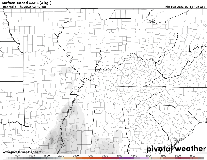
Quite a bit less impressive than the helicity.
Most Likely Scenario
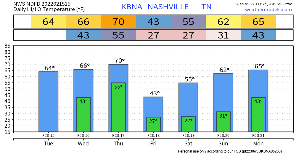
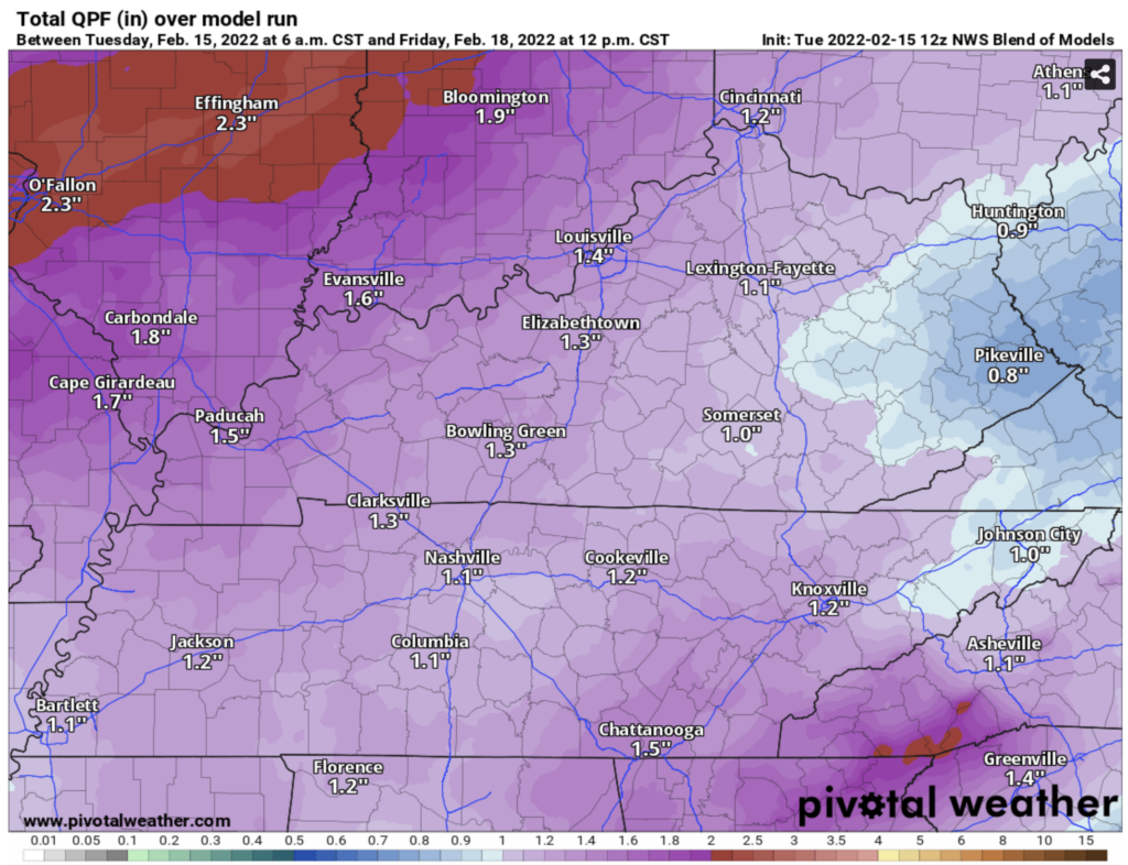
Rain looks to be a pretty sure bet. Looks like it could be pretty heavy at times, but nothing very concerning. Generally, about an inch of rain will be common, says the NWS Blend of Models.
Storms to our west will likely weaken as they move east if the current trend of low C.A.P.E. persists. If C.A.P.E. increases in future forecasts, our severe weather chances will also increase.
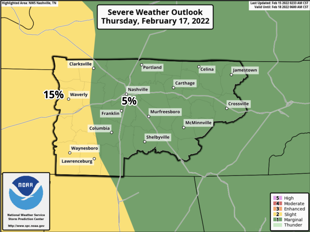
Currently, SPC thinks there is a 5% chance of seeing some form of severe weather within 25 miles of any point in our two counties. The higher 15% probability is to our west.
So, rain and thunderstorms look like a done deal. So do much cooler temperatures for Friday into the weekend. Severe weather is questionable. Future forecasts will be refined and also more specific. So, stay tuned.
Quick References:
Weather changes constantly.
Follow @NashSevereWx on Twitter for any changes to this forecast.
Live coverage during tornado and severe thunderstorm warnings:
Look good.
Support the mission.
We are 100% community supported. No ads. No subscription fees. Keep it free for everyone.
Categories: Forecast Blogs (Legacy)
You must be logged in to post a comment.