
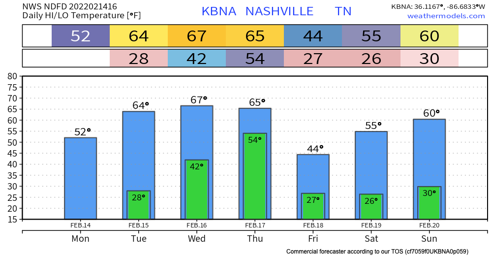
No rain is expected to interfere with any Valentine’s day plans.
Up until Thursday, the sun stays out keeping us dry. Temperatures rise into the mid 60’s by Wednesday.
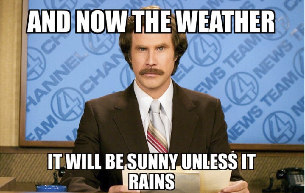
“Unless it Rains”
Thursday, low pressure sweeps north of Tennessee. A strong cold front will pass through our area Thursday evening bringing strong storms and maybe severe weather.
The SPC has half of Will Co in a severe weather outlook for Thursday. There is a 15% chance for severe thunderstorms 25 miles from any point within the yellow circle below.
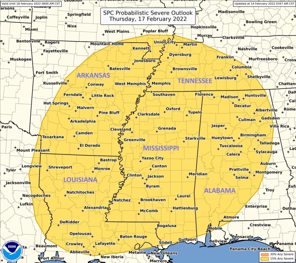
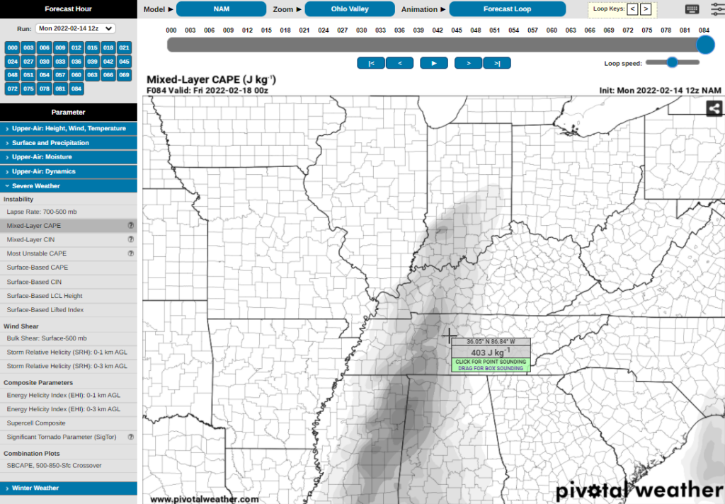
I say maybe severe weather Thursday. Although many of the key ingredients to cause severe weather should be in place, one of them is not: instability. The yellow circle above has moved south (and took Nashville out of it) because instability in this system is south of us. Showers throughout the day Thursday can also eat up the energy that the storms along the front need to produce anything significant.
What we do know is that Thursday will be pretty wet. Showers look to be light and on and off until Thursday afternoon-evening. Then as the cold front starts to approach, bringing heavier showers and downpours Thursday afternoon/evening. Our area could see 1-2″ of rain. Localized flooding is possible in the usual low spots, but we should be able to handle 1″ to 2″ if that’s all it is. Widespread flooding is not a concern as of now. Thursday night practice looks like a rainout.
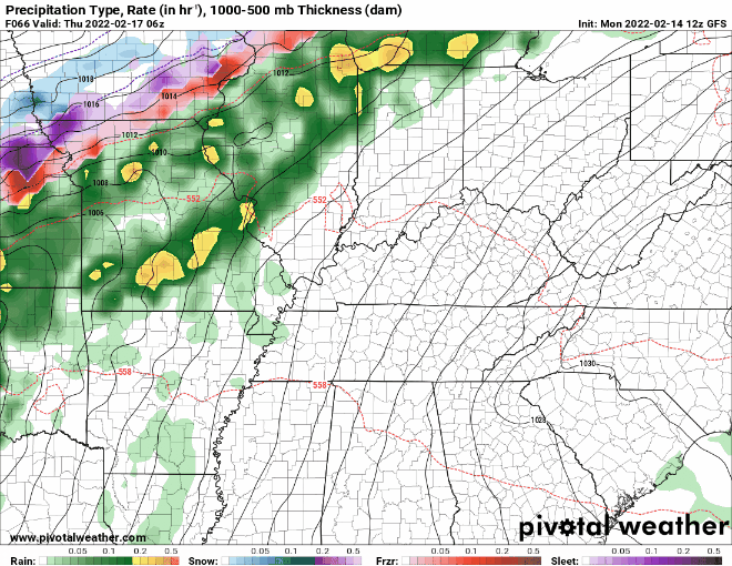
Right now although severe weather isn’t looking likely, stay weather aware and up to date on future blogs to see if this system changes. New data (like the 12z run of the NAM, below) has some instability coming into the area. We’ll have another good look at this system tomorrow.
Quick References:
Weather changes constantly.
Follow @NashSevereWx on Twitter for any changes to this forecast.
Live coverage during tornado and severe thunderstorm warnings:
Look good.
Support the mission.
We are 100% community supported. No ads. No subscription fees. Keep it free for everyone.
Categories: Forecast Blogs (Legacy)
You must be logged in to post a comment.